Friday, December 20, 2013

The first Christmas celebration in Utah?

Weber County's first Christmas observer also traveled up Weber Canyon and then from Peterson to "Ogden's Hole" in an expedition that began New Year's Day. He may have been near today's Trappers Loop Highway.                                                                                      Photo by Whitney Arave.


Who was the first white person (or persons) to celebrate Christmas in Weber County, if not all of Utah?
Was it:
A.  Miles Goodyear, in Ogden, 1845.
B.   Mormon settler James Brown and company, in Ogden, in 1847.
C.   John C. Fremont and/or Kit Carson in 1843.
D.  None of the above.
If you answered “D,” you would be correct.
Surprisingly, it was a mountain man and trapper, Osborne Russell, who celebrated the holiday, Dec. 25, first in Weber County in 1840.
Russell (1814-1892) was most famous as a political leader who later helped form the government of the State of Oregon.
  He kept a detailed journal of his nine years (1834-1843) in the Rocky Mountains and his account is a fascinating read, which predates John C. Fremont and Kit Carson’s visit in 1843 by almost 3 years.
He outlines his Christmas holiday as taking place near where the “Weaver” River (Weber River) empties into the Great Salt Lake. By that description, he most likely would have been in today's Hooper (or perhaps West Haven) for the holiday season.
 Russell spent the holidays in an Indian lodge, in the company of a French Man, his Native America wife and their child. In nearby accommodations were other Indians and children.
It was agreed on by the party to prepare a Christmas dinner …” Russell wrote in his journal.
He noted that his understanding of French and Indian language was helpful, as only three others knew English and that was a pretty sketchy proficiency.
At about 1 p.m., the group sat down to Christmas dinner, “in the lodge where I staid which was the most spacious being about 36 ft. in circumference at the base with a fire built in the center …” Russell wrote.
What did they eat?
   “The first dish that came on was a large tin pan 18 inches in diameter rounding full of Stewed Elk meat,” Russell wrote of the 1840 holiday feast.
The group had found a large group of elk, out west, by the lake, wintering in the thickets of wood and brush by the river.
“The next dish was similar to the first heaped up with boiled Deer meat (or as the whites would call it Venison a term not used in the Mountains),” Russell continued.
“ The 3d and 4th dishes were equal in size to the first containing a boiled flour pudding prepared with dried fruit accompanied by 4 quarts of sauce made of the juice of sour berries and sugar Then came the cakes followed by about six gallons of strong coffee already sweetened with tin cups and pans to drink out of large chips or pieces of Bark Supplying the places of plates,” Russell wrote in his journal.
He also explained that eating did not commence until the word was given by the landlady. Then, conversation was expected of all.
“The principal topic which was discussed was the political affairs of the Rocky Mountains The state of governments among the different tribes …” Russell wrote.
What about after dinner?
“Dinner being over the tobacco pipes were filled and lighted while the Squaws and children cleared away the remains of the feast to one side of the lodge where they held a Sociable tite a tite over the fragments. After the pipes were extinguished all agreed to have a frolic shooting at a mark which occupied the remainder of the day,” Russell ended his holiday account.
 He remained where he was until Jan. 1, 1841, at which time all the streams were iced over. So, he moved eastward.
 Russell wrote that he then followed the Weber River eastward and then when it forked, it went right into Weber Canyon.
“The route was very difficult and in many places difficult travelling over high points of rocks and around huge precipices on a trail just wide enough for a single horse to walk in …” Russell write of Weber Canyon.
 He likely camped in the Peterson area, where the snow was some 5 inches deep. It snowed another 8 inches that night. The next morning, he went north over rolling hills into Ogden’s Hole (today’s Ogden Valley), where the snow was 15 inches deep. He spotted a herd of 100 elk and shot one for food.
The next day, he returned to where he had spent Christmas and remained there for the rest of January.
There is much more to Russell’s early account of the Ogden area, including descriptions of Fremont and Antelope islands.

(Special thanks to Terry Bennett of Layton for suggesting this first Christmas holiday account).

Note: Russell’s journal accounts were left as they were written, abbreviations and grammar notwithstanding.
Also, the offensive word of today -- "squaw" -- was also not changed, but left as it was written ... for historical accuracy's sake and nothing else intended.

(-Written by Lynn Arave and originally published in the Ogden Standard-Examiner on Dec. 20, 2013.)

-NOTE: The author, Lynn Arave, is available to speak to groups, clubs, classes or other organizations about Utah history at no charge. He can be contacted by email at: lynnarave@comcast.net  


Friday, November 29, 2013

The unheralded Lewis Peak: Ogden’s friendliest mountain?


               Lewis Peak, northeast of Five Points.                                           Photo by Whitney Arave


By Lynn Arave

CALLING someone by their first name usually denotes familiarity. By that reckoning, Lewis Peak, an often unrecognized summit, located northeast of Ogden’s Five Points, ought to be the friendliest mountain in Weber County.
It’s a rare mountain you can be on a “first name” basis with.
Lewis Peak, 8,031 feet above sea level, was named for Lewis Warren Shurtliff, who was among the first known group of white settlers to scale the summit of the most prominent mountain, between the much more well-known Mount Ogden and Ben Lomond Peaks.
Shurtliff, then 16, of Weber County, climbed what would be known as Lewis Peak on June 6, 1852, with Ira N. Tiffany and Martin Harris. The three young men often hiked in the area to scout and help protect the settlers from unfriendly Indians. The three men also made a pole to mark the peak and placed some sort on flag atop it.
As the youngest of the three, the peak was named “Lewis,” in his honor, though it is very unusual for a geographical feature to be titled after a person’s first name. In fact, Lewis Peak is only one of a few Ogden Wasatch Front mountain peaks that is even named after a specific person.
Shurtliff’s “name” is also affixed to two other Weber County places. Strangely, his middle name, Warren, is who the communities of Warren and West Warren were named after. Makes you wonder more about who this unusual man was, who so inspired other pioneer residents to commemorate him using the first two of the three parts to his name.

                                               Lewis W. Shurtliff
   
Among his many accomplishments, Shurtliff eventually served as the Weber LDS Church Stake President; as a probate judge; as a Weber County Commissioner; as a state senator; as chairman of the Utah Irrigation Commission; and also helped start Ogden’s first trolley system – initially powered by mules.  
In addition, as the Weber Stake President, Shurtliff also helped organize the beginnings of Weber State University (originally named Weber Stake Academy) on Sept. 10, 1888.
Technically, Shurtliff was the University's first president.
(Today, a Lewis W. Shurtliff scholarship award is presented yearly to a qualifying Weber State University student.)
He died in 1922 at the age of 86.
(One his daughters, Louie Emily Shurtliff, was Joseph Fielding Smith’s first wife. She died in 1908, but he later became president of the LDS Church.)
Lewis Peak was officially designated as such on maps by 1912. Six employees of the Ogden Post Office hiked to Lewis Peak in June of 1912, according to a report in the Ogden Standard-Examiner. 

                          Lewis Peak, left side of picture.        Photo by Whitney Arave


Utilizing directions provided by Lewis Shurtliff himself (also the Ogden Postmaster from 1910-1914), they located the original pole, although only torn ribbons of the flag were left.
The Standard-Examiner also reported that in September of 1916, relatives of Shurtliff placed a metal flag pole and a copper plate with an inscription on the summit of Lewis Peak. They returned two years later and replaced the old flag with a new one, according to a later report in the Ogden Standard-Examiner.
Although Lewis Peak isn’t even one of the 30 highest summits in Weber County, it is located further westward than many other peaks in that area, is very rounded and thus has more prominence than just its height provides. There are at least four other unnamed peaks in the immediate area, taller than Lewis, with the highest being 8,136 feet, but the others are set back further to the east and thus not as prominent.
Lewis Shurtliff and company made their own bushwhacked trail to the summit in 1852, including a likely trip through the rugged canyons below. Today, a standard hiking path leads to the summit. Starting at the top of North Ogden Divide (elevation 6,184), this version of the Skyline trail goes up and southward 3.3 miles to a trail junction. The western path goes another 1.5 miles to Lewis Peak, a broad mound of rock. The U.S. Forest Service created the spur trail to Lewis Peak back in 1978.

Access to the area is also offered by a northern section of the Skyline Trail that begins from the southeast, near Pineview Reservoir, or by more rugged hikes up canyons to the west.
The view atop Lewis Peak is superb, since it juts out so far into the valley. Visible to the west are Coldwater, One Horse and Garner canyons en route to Lewis Peak. Just south of Lewis Peak is Jumpoff Canyon.
Because of its lower elevation, a hike to Lewis Peak is often accessible in May, far sooner than Ben Lomond Peak, which looms some 1,700 feet higher.
-Originally published by Lynn Arave in the Ogden Standard-Examiner, Nov. 29, 2013.

SOURCES: Ogden Standard Examiner, June 17, 1912; “Utah Place Names,” by John W. Van Cott; Findagrave.com


-NOTE: The author, Lynn Arave, is available to speak to groups, clubs, classes or other organizations about Utah history at no charge. He can be contacted by email at: lynnarave@comcast.net  


Wednesday, October 23, 2013

Southern Utah's Titanic Mountains: The Tushar Range


                                                                                                         Photos by Liz Arave Hafen

By Lynn Arave

They're by far the tallest mountain range in southwestern Utah, rising more than 12,000 feet above sea level. However, the Tushar Mountains remain relatively unknown.

''Under-appreciated and relatively uncrowded'' is how tourist officials describe these scenic, recreational gems, which are located east of Beaver -- about 210 miles south of Salt Lake City.
Some 30 miles long and up to 20 miles wide, the Tushars are part of the Fishlake National Forest.
Many Utah residents speed by to the west on I-15, and although the rugged shaped Belknap Peak may catch their eye briefly, most have no idea what mountain range they're looking at.
The light-colored Tushars are named after a Paiute Indian word, ''T-shar,'' meaning white. The range is believed to have been formed by intense volcanic activity below the ground that thrust upward some 5 million to 30 million years ago.
Access to the Tushars is easy. U-153, a scenic byway, is paved 19 miles up Beaver Canyon to Elk Meadows ski resort (elevation 10,000 feet). A dirt and gravel road continues another 21 miles to the east -- with some long and steep stretches. It connects with U.S. 89 at the town of Junction.
Another access road, although not paved, is Forest Service Road No. 126, out of Marysvale on the east side of the Tushars. It goes up Bullion Canyon about seven miles. More rugged roads and scenic backways also access the north side of the Tushars from I-70 and go to the old Kimberly mining area.
Kingpin of the Tushars is Delano Peak, 12,173 feet above sea level, a rounded summit that doesn't appear to be the tallest when looking at the range from I-15. As the highest peak in both Beaver and Piute counties, Delano is the 41st tallest named peak in Utah and the seventh highest outside the Uintas. The peak was named for Columbus Delano, U.S. secretary of the Interior in the 1870s.
Hiking to Delano Peak is a moderately strenuous, 13-mile round-trip trek that will require an average of six to seven hours. Since access roads go high into the mountains, it's just a 2,173-foot climb to the peak, probably making it the state's most easily accessed over-12,000-feet mountain. Regular hiking season is July to September.
The Wasatch Mountain Club ranks the Delano hike at a 7.7 in difficulty. In comparison, Ensign Peak holds a 1.5 rating, Bald Mountain in the Uintas is rated 3.3, Timpanogos Peak is rated 11, and Lone Peak in Salt Lake County is rated 14.8.
For pure scenic and pristine value, though, some hikers -- like Salt Lake's Winford ''Dub'' Bludworth -- prefer the Tushar's second-highest peak, the much more dramatic-looking Mount Belknap (it's 12,137 feet above sea level).
There are also some spectacular ATV trails through the Tushars. That's what attracted Bryan Burrell of Riverton to the area. He has a cabin on the east side of the mountains.
''This is a premier place for ATVs,'' he said. ''No one's disappointed who goes up there.''
Mountain bikers have also recently discovered the area, and intermediate to expert rides are available on the Kimberly road, the Big John Flat, the Puffer Lake Loop and the Skyline Trail.
Burrell is especially fond of the volcanic history of the area and also of Bullion Falls, an 80-foot water drop, named for the Bullion gold mine and town, where some 5,000 people once lived. There are also lots of colorful names in the Tushar Mountains: Horse Heaven, Grizzly Ridge, Robbers Roost, and Bellyache Canyon to name a few.
With a history of mining operations, mostly for gold and starting in 1888, names like Prospect, Gold Mountain, Grasshopper Mine, Deer Trail Mine, Glidder Mine, Sunday Mine and Copper Belt Peak also dot the mountainside of the Tushars.
There are six U.S. Forest Service recreation areas in the Tushars: Little Cottonwood, Ponderosa, Mahogany Cove, Kent's Lake, City Creek and Anderson-Meadow. There are also a few small bodies of water in the Tushars -- Puffer Lake, Kent's Lake, Blue Lake, LaBaron Lake and Willow Lake, plus a Boy Scout Camp.
Big Rock Candy Mountain, along U.S. 89, is a part of the northeast section of the Tushars.
Not without legends, talk of the Tushari, a mysterious, ancient Indian tribe was supposed to have inhabited the region. Also, Gorilla Ridge on the west slope of the Tushars and near Mount Baldy, was titled after a mine of the same name, and is believed by some to have Sasquatch sighting connections.
(-Written by Lynn Arave and originally published in the Deseret News.)
                                  The Tushar Mountains as seen from I-15 to the west.


-NOTE: The author, Lynn Arave, is available to speak to groups, clubs, classes or other organizations about Utah history at no charge. He can be contacted by email at: lynnarave@comcast.net  


Fingers of the Kolob: Often Overlooked View


By Lynn Arave

NEW HARMONY, Washington County, Utah — What a huge difference 0.4 of a mile can make.
Many Utahns have probably driven the five-mile Kolob Canyons scenic drive , just east of I-15, in a section of Zion National Park at exit No. 40. That's a signed turnoff and well-publicized.
However, did you know that a less than half-a-mile drive off I-15 west at exit No. 42 yields an incredible, but less often heralded view of "The Five Fingers of the Kolob" —also part of the Kolobs Canyon section of Zion National Park?


In the New Harmony area, west of I-15 are amazing views of the Kolob, not visible from the freeway, since it is too far east.
"One of the main attractions of New Harmony, and something it's famous for, is the Kolob Canyon Scenic Drive," states Juli Danis, a realtor in Southern Utah, on her Web site, www.julidanis.com
"If you drive into the town of New Harmony, and turn around and look towards the mountains on the east, you can see the magnificent view of the Kolob Fingers, truly one of the most magnificent sites you'll ever see. This is a well kept secret, as traveling down the I-15 freeway, they are not visible to the routine traveler," she continued.
There are some power lines that can get in the way of a photograph, but for any traveler headed to St. George, Las Vegas, or California, it is worth it to at least once take 5-10 minutes and exit the freeway west at exit No. 42 to see the Fingers of the Kolob and know what is there above you that you CANNOT see from the freeway.

(The three photos show the Fingers of the Kolob, from just west of I-15 at Exit No. 42. Photos by Elizabeth Arave Hafen.)


-NOTE: The author, Lynn Arave, is available to speak to groups, clubs, classes or other organizations about Utah history at no charge. He can be contacted by email at: lynnarave@comcast.net  


Tuesday, October 22, 2013

Hottest Day Ever in Salt Lake? 107.1 degrees on July 13, 2002

  Salt Lake City's hottest  air temperature ever recorded was 107.1 degrees on Saturday, July 13, 2002.

The previous time it came close to being this sizzling

was 106.6 degrees on July 26, 1960.

 "Mercury climbs to 107 to smash all records" was a Deseret 

News deadline back then.


"Hot, hotter, hottest" was the headline when that record was 

broken in 2002.

Despite that single day heat record, the summer of 2013 was 

the hottest overall on record. There were not a lot of 100 

unmatched.

According to the Salt Lake Office of the National Weather 

Service, the summer of 2013 had the most number of days -

-54 -- with a high temperature of 95 degrees F or more.

Wasatch Front Canyon Winds History: They Aren't East Winds Everywhere

                            The narrow mouth of Weber Canyon can produce strong wind gusts.


Hurricane force east canyon winds along the Wasatch Front are nothing new.
In fact, from 1959 to 1999, there were 26 such occurrences of damaging east winds.
So, they averaged about every 18 months for 4 decades and then disappeared for more than 12 1/2 years until Dec. 1, 2011.
The damage from these winds was mostly so extreme, because it had been more than a decade since the Wasatch Front had any such wind events and so the damage came all at once, mostly from overgrown trees.
Then, another such wind event struck on April 9, 2013. And, they struck again on April 30-May 1, 2016. The latest episodes of these horrific winds was Sept. 8-9, 2020; January 18, 2021 and March 14-17, 2024.
Still more canyon downslope winds came on May 10, 2024 -- perhaps the latest they've ever blown into the spring season.

 The "new" average for these winds is more in line with about every 3 1/2 years now.
The year 1988 featured a record three such east wind events. There were also two such hurricane force canyon wind events in 1964, 1973, 1983, 1986 and 1997.
April 2, 1973 featured some of the strongest, sustained canyon winds. Those winds picked up a pole vaulting porta-pit mat and carried across Weber State University's Wildcat stadium as if it was cardboard.
We forget that these winds are a periodic part of nature along the Wasatch Front.
Technically, they are "downslope winds."
Northern Utah's "canyon winds," or "east winds" are simply legendary. 
However, depending on where you live, these winds are not necessarily east winds.
Although I built my cedar fence strongest on the east side, that was pointless, since strong east winds have never hit my house.
In fact, the Dec. 1, 2011 winds that struck my property were straight from the north. (And they broke 4 posts along my fence's northern side.)
I asked Dan Pope, a from Utah weather expert on KTVX-TV then (now he's on Fox-13), to address the question on wind direction and why "east winds" aren't always east winds.
His explanation is intriguing and worth repeating, especially since no TV weathercaster has enough air time to provide this much detail.
Dan Pope's answer:
These ... winds were "mountain wave" induced. But, the topography does force the winds to veer with distance; and due to local hills, canyons and location they can change as they move away from the mountains. They also come in rolling as they slam the ground (spinning counter clockwise).
In North Salt Lake, I have always noticed a veering to the north, because the hills by and to the north of Eaglewood Golf Course, that force the eastward track around them to flow southward.
These hills are also are northeast-southeast oriented, and with City Creek Canyon on the other side, the winds likely skip over the flat area above Meridian Peak and are pushed away from the hills, protecting some of the upper Bench of North Salt Lake from the worst gusts, while Bountiful, Centerville, Farmington and areas northward are directly in line with the Wasatch Mountains, and the "wave" effect.
When we have these kinds of winds, there is usually a low pressure spinning to our south. The upper level winds come from the east or preferably the Northeast. And, at the surface, the pressure is much higher in Wyoming and lower in Utah. In a low pressure like this, sometimes a little warmer air is wrapped in above the mountain tops. This creates an inversion at 12,000 or 13,000 feet, and keeps any wind from rising--and creates a Venturi effect. 
Plus, the Uinta Mountains line up directly east of Bountiful and Davis County, so all wind get pushed eastward towards the Wasatch mountains from extreme Northern Salt Lake County and Davis County northward.
Rule of thumb is that winds will be 2 to 4 times higher than at mountain top as they "roller coaster" down the slopes; and they will hit beyond the base of the mountains 1/2 to 3 or 4 miles out towards the Great Salt Lake. Then they fan out, and can go in multiple directions.
To the south of Davis County, they fan to the south (a north wind) and northward the can even come in from the SE if a person lives more than 3 or 4 miles from the base of the Wasatch. But, more often than not, these winds veer to the south away from the Wasatch, because the surface pressure is lower to the south.
There are certain locations near the canyons and at the base of the Wasatch in Davis, and counties northward, where these winds can be severe right at the base. Bountiful, Centerville and Farmington, as well as NE Ogden, Brigham City and even Logan fall into this category.

--------------------------
EAST WINDS WERE A PIONEER PROBLEM TOO:

Strong east canyon winds have been known to buffet the Wasatch Front, particularly Davis County, ever since the Mormon pioneers arrived in the late 1840s.
"East winds have come from time to time (in Davis County) ever since the people can remember, doing much damage to trees and roofs," states the history book, "East of Antelope Island," published by the Daughters of the Utah Pioneers.The first recorded incident of strong east winds comes from a diary of Daniel A. Miller, one of the earliest settlers in Farmington.
He recorded that the very first day his family arrived in the area -- the fall of 1848 -- there was a heavy east wind.
Early settlers created inventive ways to try to secure their roofs from these winds, but nothing seemed foolproof. One early Kaysville resident, John R. Barnes, made the east walls of his home four bricks thick to ward off canyon wind damage.
Prominent settler George D. Watt made a special wind storm shelter for his family, but he still had his home's roof blown off.
A strong east wind in the summer of 1854 actually performed a miracle. The canyon winds saved the day by blowing hordes of invading grasshoppers away from Davis County crops and into the Great Salt Lake, where they perished.
Hurricane-force east winds struck at least twice in the early 1860s, and the roof on the East Bountiful LDS Church had to be replaced twice.
After one such east wind, the Tuttle brothers from Bountiful jokingly inquired on Antelope Island if any missing hats had been found.
The east winds were a very feared and dreaded occurrence, especially in Farmington. It was canyon winds and water shortages that plagued many early Davis settlers the most.
Perhaps the saddest east wind incident took place in February 1864 when Elizabeth Rigby of south Farmington and her 18-month-old son, John, froze to death after being pinned against a fence by hurricane force canyon winds. Husband John Rigby had left his family to travel to Salt Lake City for medicine. Upon returning, he not only discovered the two deaths, but the home's roof was also blown off and 200 sheep, six horses, 10 cows and four pigs perished because of downed buildings and the frigid winds.
During a Nov. 9, 1864, visit to Farmington with Wilford Woodruff when the canyon winds were blowing, LDS Church President Brigham Young rebuked the winds in the name of the Lord.
Woodruff's diary reports that east winds did decrease substantially for some years afterward, perhaps as long as the late 1890s.
When Matthew Cowley reviewed Woodruff's diary in 1909 before its publication, he noted:
"In late years these winds have occurred in some of their old-time severity."
Strong east winds struck Davis County twice during 1896 and two more times in 1898. A fierce canyon wind in 1906 took the roof off the 2-year-old West Bountiful LDS Chapel.

Sources: Dan Pope, meteorologist, "East of Antelope Island" book, by Daughters of Utah Pioneers; "Weather and Climate" book, by Dan Pope and Clayton Brough.

(-Written by Lynn Arave and published in the Deseret News, April 23, 1999.)

Monday, October 21, 2013

Utah's Worst-ever Winter: 1948-1949?

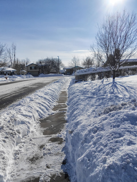
 The aftermath of a January 2013 heavy snowfall in Layton, just a  sampling of what happened all too often in the severe Utah winter of 1948-1949.


By Lynn Arave

RECALLING the infamous Utah winter of 1948-49
Think last month's cold spell, snow and inversions equal a hard winter?
Looking back to the frigid and snowy winter of 1948-49 makes December of 2013 look pretty tame.
Some old-timers, as well as historical records, indicate that the winter of 1948-49 -- some 65 years ago was simply awful -- likely the worst recorded winter period in northern Utah since the 1800s.
Take Ogden City for example: On January 26, 1949, Ogden shivered with its coldest ever recorded temperature -- 16 degrees below zero.
But low temperatures are only part of this chilling story. The winter of 1948-1949 had a frightful combination of  bone-chilling temperatures, heavy snowfall, howling winds and even inversions..
The National Weather Service ranks that winter as the No. 4 weather event for Utah during the 20th century.
Its description: "Utah's most severe winter since 1899 ... It was the coldest winter on record, with record amounts of seasonal snowfall ... Nearly a 25 percent loss in some livestock herds reported. Many fruit trees were killed. Wildlife struggled for existence. Tourist trade reached an all-time low, and 10 people died from exposure."
The Utah State Division of History refers to it as “1948’s Unforgettable Winter” and included reports from areas of the Wasatch Front where the snow piles and drifts were as high as the telephone wires and driving down the road was like traveling through a tunnel.
The more recent Utah winters of the mid-1980s and 1993 were infamous too, for heavy snowfalls, but they lacked subzero temperatures and howling winds.
For example, on Jan. 23 and Jan. 24, 1949, there were 23 inches of snow at the Salt Lake Airport, the third greatest amount on record. Then, on Jan. 25, the temperature dipped to 7 degrees below zero and never topped 8 degrees above zero for a high.
Anyone born before the start of World War II may be able to recall how terrible the winter was in 1948-49.
Checking the journal of Venice Flygare, of Ogden, my late Mother-in-Law, provides her description of that significant winter:
"It was a very hard winter, lots of snow," she wrote. "There was very seldom a snowplow that went along our street and no garbage pick up or mail delivery. There were many nights when we could park our car on 30th Street and walk the half block to our house (at 1328 Walcott Street)."
Another relative, Milas Erastus Wakefield, also wrote about that winter with a one-line entry: "1949 was a very hard winter, lots of snow and cold weather."
Brent K. Thurgood of Hooper, also recalled that awful winter:
"I remember it well, as I was 5 years old and living in Ogden at the time, in Bonneville Park, a government subdivision. The road to the North of our house was a narrow one way road but the snow plowed and blown off of it created a snow bank on both sides about 12-15 feet high."
He continued: "We had to dig a tunnel through to get to our house. I remember climbing to the top and sliding down with and without a sleigh. I also remember the black smog over Ogden, My house was on Quincy Ave. and you could see the black smoke and steam from the trains coming into and leaving the train depot. The black soot would fall on the snow each night. My mother hung our laundry out to dry and the clothes were covered with soot also."
Margaret Brough of Kaysville also recalled that icy winter with a lot of detail:
"I lived in West Jordan during that time and I was a Sophmore at Jordan High School," Brough recalled. "The Bingham Highway from Redwood Road up to the copper
mine was snowed in. We had a lot of snow and then the winds would blow snow drifts into the roads. The Bingham High way was closed for (it seems like) about 6 weeks. All the area between West Jordan and
bingham was mostly dry farms. The people did not have a way to get to the store for supplies or for feed for their animals. I remember someone took the body of a small airplane and built things that looked
like pontoons on the bottom and he would fly from house to house to get orders for food, and feed for the animals and deliver it. Airport #2 was in operation at the time and I am sure this guy operated out of there."
She continued: "We lived down a lane and one night as my father was coming home, the truck got stuck half way down the lane. My father walked home and by
morning the truck was completely covered. For weeks we would walk down the lane to catch the school bus and it seemed liked that truck was completely covered and you did not know where the truck was until spring. Suddenly the top of the truck became visible and it was still quite a few days before my father was able to get the truck home."
"When the bingham highway was opened it was done by a rotary plow. The plow would pile snow up on the snow that was already taller than the snow plow. We had a neigh bor who would take the bus to 7800 south and
redwood road and then he would walk a mile up the Bingham Highway to his house. The first night that the Bigham Highway was unplowed, he was walking on the top of the snow piled up by the side of the road.
(quite high) He was about 6' 2" and he bumped into the cross bar on the top of the light pole and knocked himself out. It was a few days after this happened that trucks began to haul some of the snow away.
(We needed to decrease the heights by the side of the road."
Now Brough said this startling fact:
"Jordan High School was closed down for three or four days right around the 20th of January until we could get the roads open for the buses to
operate. It was cold and the wind did blow a lot. I have pictures around our yard where the piles of snow was twice as tall as a 5' 2" girl would be standing. It was quite a fete. That was the coldest winter I have ever lived through."


--I also asked three 80-something-year-old seniors I recently saw at random about the winter of 1948-49. All three recalled it well. One said he hated the chest high school drifts and another said he went to Sacramento, Calif. for the holidays that winter and had extreme problems driving back into northern Utah. The third said he lived on the East Coast at the time, but recalls the news coverage of all the aerial food drops for livestock in the Rocky Mountains.
The Wasatch Front was stuck in a temperature inversion for long periods during that winter. In an era when burning coal was still the most common source of heating, air pollution levels must have been off the scale.
December of 1948 produced 39 inches of snow falling at the S.L. Airport. There were only seven days that month lacking snowfall. Plus, there were just eight snowless days in January 1949 and nine in February. To make it even worse, it snowed on 11 of the 31 days in March 1949.
December in Salt Lake City boasted two subzero temperature days; January had 13 and February four total. (Historically, the city averages only three days of zero degrees or below a year.) Ogden and points north of Salt Lake likely were as cold or colder than Salt Lake was.
Winds were also a curse that winter. With the extra cold temperatures, the snow was light and it didn't take much wind to create dangerous drifts.
On Feb. 7, 1949, 10 inches of snow were recorded at the Salt Lake Airport, followed by near hurricane-force winds. The blowing snow closed schools in the Davis and Weber school districts.
Milk and egg production dropped substantially. "Operation Haylift" used aircraft to drop food to struggling livestock in rural areas.
A photo collection at the University of Utah has this caption attached to a winter snowpile in central Utah —"The winter of 1948-49 was unforgettable. Snow was on the ground for 5 months. The snow which had been plowed to the sides of the road became so high that it had to be hauled off in trucks."
Coal supplies also ran low in Utah that winter, too. During portions of February that year, all roads north of Brigham City were closed.
Trains were even snowed in. A snowslide buried a train in Cache County and killed three railroad workers. In parts of Wyoming, drastic methods were used: Flame throwers cleared the Union Pacific tracks in February of 1949.
Idaho too had a severe winter that season.
Feb. 4-Feb. 11, 1949 was likely Idaho's worst ever winter blast. Three snowplows and their drivers were stranded overnight between Pocatello and American Falls.
Many road repairs were required in the spring.
So, maybe all those trite-sounding tales from seniors about trudging through deep snow to school in their youth were not all exaggerated after all.

Sources: Journals, "Utah's Weather and Climate" book, by Dan Pope and Clayton Brough; and the National Weather Service Web site.

(From an article by Lynn Arave in the Ogden Standard-Examiner, on Jan. 3, 2014.)


-NOTE: The author, Lynn Arave, is available to speak to groups, clubs, classes or other organizations about Utah history at no charge. He can be contacted by email at: lynnarave@comcast.net  


The Day the Sky Fell in Salt Lake City: April 5, 1876

       Arsenal Hill, site of the huge 1876 explosion, was located where today's DUP Museum stands.


By Lynn Arave

It was the LDS Church General Conference that started off with a bang.
 On April 5, 1876, 4:48 p.m., the powder magazines at Arsenal Hill (west of where today's state Capitol stands), exploded with a fury of 40 tons of gunpowder that Deseret News reports compared with the devil himself.
A trio of explosions rocked the city the afternoon before the semiannual four-day conference started. The Arsenal, the only building then on Salt Lake City's northwest bench, was leveled."Terrible disaster. Terrific explosion of forty tons of Giant, Hercules, blasting and other powder. Four persons killed instantly and others injured. Great damage to property" was the following day's headline in the Deseret News.
The raining debris covered a two-mile radius. The explosions were felt in shaking buildings as far north as Kaysville. Four different gunpowder magazines exploded, creating four separate bombs of debris.
Some people shouted "A volcano!" Others "An earthquake!" as an immense mass of flame shot heavenward. One reporter described the calamity as the former with "a column of smoke and debris as grand as Vesuvius ever belched forth."
Hundreds of people were lying on the ground, women and children screamed and many men turned pale, according to Deseret News reports. Some ran toward the explosion, others away. Many animals bolted away from wagons, frightened by the loud noise.
Two young men, identified as Frank Hill, 18, and Charles Richardson, 18, were near the building at the time of explosion. They had been tending cattle on the hill earlier in the day and were known to have been shooting a rifle at birds. They were killed instantly by the explosion. The men were suspected of causing the explosion when a burning paperwad from their shotgun ignited some loose gunpowder.
No specific blame for the explosion was ever laid, but a jury requested additional precautions for any other explosives kept in the city.
Vandals had previously shot through the Arsenal's main iron doors with guns for used for sport and target practice. The Arsenal building was made of rock, with a tin roof, but a thicker iron door was added after repeated vandalism.
Also killed were Mary Jane Van Natta, struck by a rock on the head as she was pumping water outside. James Raddon Jr., 5, died when he was struck in the chest by a rock while playing outside. Another woman was said to have died from fright after the explosion.
Broken glass created the biggest problem, with virtually all Main Street businesses and several nearby LDS meetinghouses hardly having an unbroken window left. The walls of the 20th Ward schoolhouse were badly damaged. There were no reports of damage to the Salt Lake Temple, under construction at the time, but it was likely only in the first story stage.
Several merchants were charged with selling glass at twice the usual price in the days after the explosion.
A large boulder went through the mayor's roof and two floors of his new home. A flying rock also took away part of the ear of a son of D.P. Kimball.
Several residents reported moving babies or children from rooms that were soon thereafter heavily hit by raining debris. Several dozen boys playing baseball to the west of the armory were knocked to the ground twice by the explosions and found shelter to avoid the biggest shower of debris.
President Brigham Young's flour mill, a half-mile away up City Creek, was destroyed, as were the covers for the city waterworks and the adjacent building near City Creek. One of President Young's daughters, siting near a window on South Temple, also suffered a head wound from shattering glass.
One Civil War veteran said after the explosion he saw less damage in Fredericksburg after a month of cannon bombardment there.
"The Prince of the Power of the Air had a roisterly time on Wednesday afternoon . . . Not many of our citizens, previously, had any realizing idea of the immense reserve force stored up in a few grains of charcoal, and nitre and sulphur . . . The explosion has been the main topic of conversation in the city ever since and will be more or less for future days to come. Years in the future, the time of it will be referenced to as an era, whence and with which the happenings of other events will be calculated and compared," the Deseret News reported two days after the explosion.
Other newspapers made the disaster sound even worse. For example, one other newspaper headline read: "Nearly every house in Salt Lake more or less wrecked." Other stories also spoke of 200-pound boulders, although the largest confirmed boulder of debris to hit downtown was 115 pounds - a rock that struck the Theatre Saloon on 100 South.
Still, the Deseret News reported every building within a 1.5- to 2-mile radius of the explosion sustained some sort of damage. But apparently no general conference talks made reference to the disaster, or at least nothing was recorded by conference reporters.
The Arsenal building was reduced to craters. It was privately owned by the DuPont Co. and had cost $26,000 to build. According to some sources, the Arsenal was at the top of Main Street, about two blocks north of Temple Square and approximately where today's Daughters of the Utah Pioneers Building stands at 300 N. Main. However, photographs taken in the Arsenal area after the explosion make it look more likely the building was at about 200 N. Main. The arsenal was never rebuilt.
The area surrounding Arsenal Hill in the 1860s and 1870s consisted of bare, open fields. The Arsenal Hill area was vacant, probably because not until the late 1880s was a year-round water supply secured for the area.
This, of course, was long before the area came to be known as Capitol Hill. The entire plateau between Ensign Peak and Temple Square was originally called Prospect Hill. Then, when the Arsenal was placed there - probably in the early 1860s - it became Arsenal Hill.

Not until Feb. 28, 1888, did Elder Heber J. Grant propose that the Salt Lake City municipality donate 20 acres of the former Arsenal Hill property for a future Utah State Capitol site. The actual donation took place on March 1. The Capitol building was slow in coming and wasn't started until 1913 and completed in 1915.
(-Written by Lynn Arave and originally published in the Deseret News, April 2, 1995.)
                                      The modern Salt Lake City.

-NOTE: The author, Lynn Arave, is available to speak to groups, clubs, classes or other organizations about Utah history at no charge. He can be contacted by email at: lynnarave@comcast.net