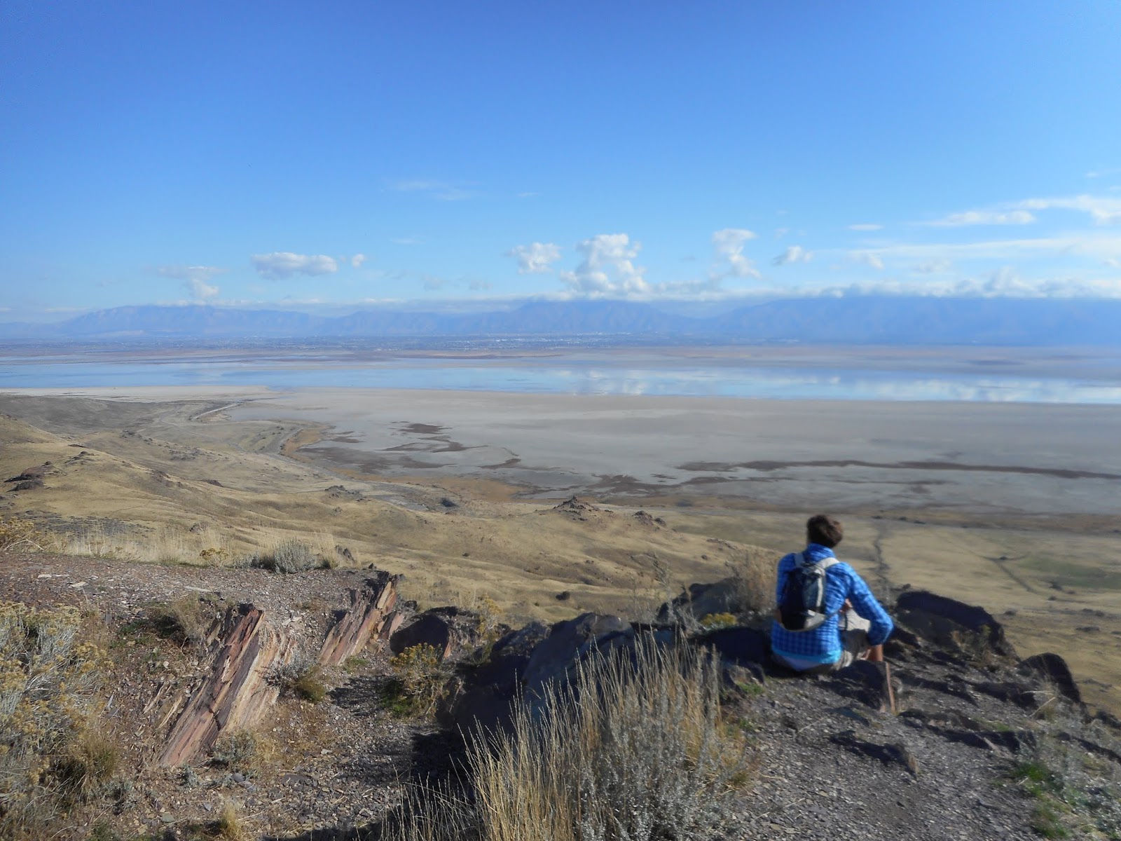
Wednesday, September 30, 2020

New Layton, Utah History book now available


There's a new Layton, Utah history book, that premiered on October 26, 2020, from Arcadia Publishing in its "Images of America" line.

The book is written by Lynn Arave, also author of this Mystery of Utah History blog.

With more than 170 photographs, this book would make a great gift for any new or long-time Layton resident, or someone who grew up in Layton City.

(There's also a new history blog to accompany this book at: https://laytonutahhistory.blogspot.com/)

--NOTE that the book was delayed by the publisher for 5 months, from May to October 2020, because of the Coroniavirus.

-IF you would like a copy of the new history book on Layton, Utah, you can order it from a variety of sources for $21.99, or less:

--on Amazon


https://www.amazon.com/s?k=9781467104968&i=stripbooks&linkCode=qs


--Or from Barnes and Noble at:

https://www.barnesandnoble.com/w/layton-lynn-arave/1135498880;jsessionid=BBCAF0636AA08D36361AFE15AF583EBC.prodny_store01-atgap01?ean=9781467104968


--Or from the publisher, Arcadia at:

https://www.arcadiapublishing.com/Products/9781467104968

IF you can't decide if you'd like to purchase a copy of the book, a free 31 page preview of the 127-page book is available from Google at:

https://www.google.com/books/edition/Layton/m0PZDwAAQBAJ?hl=en&gbpv=1&dq=%22lynn+Arave%22&printsec=frontcover

Thursday, September 3, 2020

An actual Howard Stark -- Not the fictional father of 'Iron Man' Tony Stark -- And the real one crashed his airplane in Utah

                                        The Monte Cristo Mountains, far background.  


THERE actually existed a real Howard Stark who was both a legendary pilot and an inventor -- and he died in the aftermath of a plane crash in northern Utah.
Mention Howard Stark to anyone today and they may instantly think of the fictional Howard Stark from the Marvel comics and movie universe, who was the late father of "Iron Man," alias Tony Stark.
A June 16, 1936 headline in the Salt Lake Tribune: "Search party follows lost U.S. flier's trail for five miles. Major Stark wandered down Lost Creek from plane after crack-up last January."
My gosh, there was a real Howard Stark who flew airplanes in their early decades!
Stark flew U.S. mail in airplanes. He was flying from Rock Springs, Wyoming to Salt Lake City on January 16, 1936, when all radio contact was lost. A winter storm apparently forced him to land on a remote Utah peak, Observatory Peak, 28 miles northeast of Devil's Slide and east of Huntsville, Utah, in a blizzard. His plane was not discovered until 5 months later, in June of 1936, but he was not there and presumed dead somewhere.
Another newspaper article on Stark in the Weekly Reflex of Jan. 23, 1936, stated that he was "a nationally known authority on blind flying."'


The Salt Lake Telegram newspaper of Sept. 22, 1939 carried the headline: "Aviator's body rests in S.L."

After more than 3 1/2 years, Stark's body was found by a sheepherder.
This story referred to Stark as the "ace blind flier of the department of commerce." He survived his plane crash, but not the winter conditions of trying to walk to civilization.
-If you conduct a Google search for "Howard Stark," you will find six full pages of results all on the fictional Howard Stark of Marvel comics and movies (including posts that speculate on Marvel bringing the character back to life).
Finally, at the top of page 7 of a Google search results is an article in Vintage Plane magazine from May of 2002 about this real life Howard Stark. Its headline is: "Howard Stark: The Pioneer Aviator of instrument flying."
This article, by John M. Miller, says that Stark was flying a Stinson Model S plane for the U.S. Department of Commerce, headed to the West Coast to give more instructors to other flyers about using instruments in airplanes.
Ironically, Stark had never been west before and his plane and equipment were not designed for the high altitude flying of Utah. The author believes he made an emergency landing in a snowstorm and froze to death trying to walk to safety in deep snow and minus 20 degree temperatures.
The author of the article stated that "Howard Stark is really the almost forgotten but true father of today's instrument flying … Howard Stark, Charles A. Lindbergh and Clyde Pangborn are my civilian pilot heroes ... Stark's 1-2-3 system has served as the basis for what we know now as partial-panel flying."
So, there you have it. A snapshot of the real Howard Stark. A first-class pilot and a civilian one, just like the fictional Howard Stark.
Note that the first mention of the fictional Howard Stark in Marvel comics was in the Iron Man comics of 1970. Iron Man made his first debut in 1963, along with Tony Stark. The father, Howard Stark, was added 7 seven years later and it is highly likely that the two Marvel comic writers who created Howard Stark were oblivious to the real one, since he is rarely, but unjustly mentioned in history. 

(-Originally published on August 18, 2020 in the Deseret News.)

Tuesday, July 14, 2020

When Hollywood disliked Southern Utah’s brightly colored terrain – And even got stranded in a slot canyon


             Some of the colored rocks, located northeast of Kanab, near Cottonwood Canyon.
                                                                                                            Photo by Ravell Call


SOUTHERN Utah is world famous for its brightly colored rocks. However, there was a time when Hollywood disliked the Kanab area's landscape.“Colored rocks of Utah plague film company” was an Oct. 6, 1940 headline in the Salt Lake Tribune.
The hues of Kanab area rock were simply too bright for the Technicolor filming process Hollywood was using at that time.
“Thousands of tourists visit Utah every year to gaze with wonder and delight at the brilliantly colored rocks dotting the landscape,” the story stated. “But these same rocks are a source of annoyance and expense to Twentieth Century-Fox now on location here for the filming of Zane Grey’s ‘Western Union.’”

What did Hollywood do?
“A crew of men had to be hired to ‘redecorate’ the rocks along Paris Creek, which cameramen said are too bright for technicolor filming,” the story reported.
The extra cost of the painting before filming was not reported, but was believed to be only a small part of the $100,000 (more than $1.8 million in today’s dollar value) that the film studio was expected to spend in the Kanab area for the movie.
And, that wasn’t the only problem Hollywood encountered in the area.
“While scouting for the Paria (Creek) location, Director (Fritz) Lang and his technicolor staff were marooned when a sudden rain filled the arroyos between Paria and Kanab, blocking their return. They spent the night waiting for the waters to recede while a rescue party tried in vain to reach them,” the Tribune story stated.
(This may have been the first public notice that Utah’s slot canyons can be dangerous during storms.)
The studio had 470 employees in town for the movie, as well as using about 300 Kanab residents for extras, cowpunchers and wranglers, etc.
Robert Young, Randolph Scott and Dean Jagger were among the stars in the “Western Union” movie. The Gap and Johnson Canyon were among the other filming locations.


-A similar scenario happened about 10 years later in 1950, when a headline in the Aug. 12 Ogden Standard-Examiner was, “Mountain ‘Flash Flood’ Maroons Hollywood Unit.”
A Hollywood crew of 64 members were stranded after a torrent seven feet deep filled Buckskin Creek, about 40 miles east of Kanab. A heavy rain and hail produced the flood and the crew was delayed about eight hours, until after midnight.
The crew, which included actors Robert Ryan and Walter Brennan, plus actress Claire Trevor, were hungry, but there were no injuries. The RKO movie “Best of the Bad Men” was being filmed.


 -MORE HISTORY: The Kolob Canyon Road is a scenic drive at the far western edge of Zion National Park. The first mention of a possible paved highway into this area was back in 1955.
The Parowan Times newspaper of May 26, 1955 carried the headline, “Highway into Zion Monument ‘possible.’”

The story stated that Zion Park Superintendent Paul R. Franke had visited the Kolob Terrace area and said a road would open up an area even more beautiful than Zion Canyon itself.
In pre-I-15 days, the prospective road was mentioned as leaving U-91 and entering the “finger” canyons of the Kolob Terrace through Taylor/Dry Creek. The road was built in the early to mid-1960s and opened on Sept. 30, 1967.
-There was a “ghost ship” on the Great Salt Lake in the late summer of 1887. The Salt Lake Herald of Sept. 4 that year published the headline, “A strange affair. Mysterious appearance of a Fisher Boat near Lake Park.”
A 12-foot-long rowboat was found unmanned, between “Church Island” (today’s Antelope Island) and Lake Park (forerunner to Lagoon on the shores of the GSL, west of Farmington). The boat was found drifting south, several miles from shore, full of provisions for an extended trip.

With some difficulty it was towed to shore at Farmington and included clothes, utensils and fishing supplies, but no food.
Where the ship came from was never determined and whether its owner met with an accident, or the boat just slipped out of reach was never publicly recorded.

                                                                           Goblin Valley.

-Goblin Valley is a well-known Utah State Park, established in 1964. However, the area was known by earlier titles. “Mushroom Valley” was its first name, given to it by its discoverer, Arthur Chaffin in 1949. (He had first spotted it in the 1920s, but didn’t return for decades.) According to the Richfield Reaper newspaper of Oct. 1, 1953, the area was also known by a different name – “Little Gnomeland.”


The article also referred to the formations as goblins, but expressed concern over how easily the shapes could be vandalized, with nearby U-24 being completed, though there was not yet a direct road to the valley itself.

(-Originally published in the Deseret News on July 14, 2020.)


Wednesday, June 24, 2020

A pair of never built roads in Bryce Canyon National Park: One in the bottom and the other a loop road


BRYCE
Canyon National Park had somewhat of a lackluster beginning, being in the shadows of the more highly esteemed sister park, Zion. From almost changing Bryce's name away from "Canyon" (since geologically it is NOT a canyon); to it almost became only a Utah State Park; to being administratively under Zion Park until 1956; Bryce has had some major "what ifs?"
And, here are two others to add to that list -- 1. In 1931 there was a failed proposal to create a loop road from Highway 89 through Red Canyon to Bryce and then back to Highway 89 at Long Valley Junction; 2. In 1951 there was a strong move to build a road on the floor of Bryce Canyon itself.
"Government plans new road to Bryce Canyon" was a March 28, 1931 headline in the Iron County Record newspaper of Cedar City.
This tentative road reached Rainbow Point (where the Bryce park highway ends southward today) and then would head due west to Highway 89 at the Long Valley Junction of U-14.
"The entire road would be about 27 miles long, with five miles being private lands and most of the balance in the Powell and Dixie national forests," the story stated.

                      Today's end of the road southward in Bryce Canyon.


The story also stated, "The new road would make it possible to visit Bryce via the present route through Red Canyon and then return over an entirely different route, eliminating all retracing. Most of the route would be at 8,000 ft. elevation and would add much to the pleasantness of the trip in hot summer months."

                   The parking lot turnaround at the end of 18 miles of road in Bryce Canyon.


Why didn't this road ever get built? Constructing the loop highway was contingent upon the State of Utah being able to cooperate and create five miles of road through the private lands. This apparently didn't happen, likely because of property acquisition issues. 
Yes, the more recent proposal in 1951 was to build a paved road below the rim.

The rugged terrain looking west from today's south end of the road in Bryce Canyon. But if a 1930s proposal had happened, Bryce Canyon National Park would have had a loop road and a highway would have descended below in this picture and connected with Long Valley Junction.


"Civic clubs will support move for road on floor of Bryce Canyon": was an August 30, 1951 headline in the Richfield Reaper newspaper of Utah.
Bryce Canyon put Panguitch, Utah on the national map, as the entrance, the last town before the now popular national park. So, the Associated Civics Clubs of Southern and Eastern Utah, along with the Panguitch Lions Club, held a meeting in town to discuss the idea of a road at the bottom of Bryce.
"The Club agreed to support a suggestion by State Representative John Johnson of Tropic to the effect that a road can be built on the floor of Bryce Canyon so that visitors can view the real scenic attractions of the area," the Richfield newspaper story stated.
It continued, "The main beauty of Bryce Canyon cannot be seen from the rim of the canyon."


                                                 Hikers on the Navajo Trail in Bryce.


                                    Imagine a paved road through the middle of this?

So, there you have it. Of course, the road was never built, but it leaves little to the imagination to envision a road going through the bottom of Bryce. Many, many natural features would have had to have been demolished to make room for such a road. Hiking would also not be a big activity as it is today in Bryce with such a road. Why hike, when you can drive down?


-In 1920, Bryce was just picking up steam with tourists. "Volunteers repair Bryce Canyon road" was a May 6 headline that year in the Salt Lake Telegram newspaper. A "road day club" had just been formed in Panguitch, with up to 47 men volunteering their time to smooth out the dirt road from Panguitch through Red Canyon and onto Bryce so that automobiles had better access.


                                                        The iconic tunnel in Red Rock Canyon.

-Initially, for more than a decade, the road to Bryce Canyon ended at the northwest rim of the amphitheater, probably near today's Sunrise Point. Walking or horse travel was the only way further south.
However, the Salt Lake Tribune of Dec. 6, 1929, reported that the National Park Service had allocated $13,700 to survey and begin to construct a road eight or more miles long southward along the rim of Bryce in the summer of 1930.
This road was "to afford visitors opportunity to view the canyon from many vantage points, instead of the one point now reached by the main highway," the Tribune story stated.
(At the time time, the Park Service allocated $280,000 to improve roads along the North Rim of the Grand Canyon, particularly from the Bright Angel Camp to Point Imperial and Cape Royal.)


                       There are some small cliffs along the Navajo Trail in Bryce.

-Finally, while Zion has been host to a lot more accidents than Zion, given its sheer cliffs and towering rocks, Bryce Canyon has also not been immune to accident from falls.
Some examples:
1. "Fall from Bryce Canyon cliff seriously injures Cedar girl" was a June 23, 1932 headline in the Beaver County News. The girl slipped off a cliff near Point Supreme and suffered three breaks in her pelvis bone and a broken arm. It took rescuers several hours to reach her.
2. "Girl has close call in Utah park accident" was a July 13, 1946 headline in the Logan Herald-Journal. The 14-year-old-girl from Buffalo, N.Y. slipped off a sandstone cliff in Bryce and went down 100 feet "before she clutched the edge of a projecting chunk of sandstone -- one of the many spires which have made the canyon famous," the story reported. She was rescued with ropes by a park ranger. The girl's physician father treated her many cuts and bruises, but nothing was broken.
3. The Ogden Standard-Examiner of April 22, 1954, reported that a 61-year-old woman tourist from Illinois died in a fall at the park on April 21 that year. She stepped over a log barrier at the Far View Scenic Point, lost her balance and plunged 90 feet to her death down a cliff. She died instantly.
4. A man died in cliff fall in Bryce in September of 2003.


  -Another milestone in Bryce National Park happened in November of 1936 when it began staying open in winter, to Inspiration Point. Years later, that led to snowmobiling and cross country skiing there.

-Originally published in the Deseret News on June 24, 2020.


Wednesday, May 13, 2020

When dynamite could have destroyed Lone Peak ...


COULD Lone Peak have been destroyed by a dynamite blast in 1937?
 “Will dynamite crash hilltop(?)” was the headline of an Associated Press story in the Ogden Standard-Examiner of August 19, 1937.
The story stated, “Lone Peak, lofty outcropping of the Wasatch range upon which a great airliner crashed last winter, is to be blasted at its tip into a tomb for the tragedy that claimed seven lives.”
On December 15, 1936, a Western Air Express Boeing 247 crashed just below Hardy Ridge on Lone Peak. Most of the aircraft was hurled over the ridge and dropped over a thousand feet into the basin below.
Lone Peak is an 11,253-foot above sea level summit in the Wasatch Mountains, located east of Draper. (However, strictly speaking, Hardy Ridge is located hundreds of yards south of Lone Peak, above Hardy Lake.)
The A.P. story stated that Western Air Express had secured permission from the U.S. Forest Service to dynamite the mountain top. This was in order to “bury the crash area which now attracts sight-seers and which, because of frequent rock slides, is considered a menace.”
The story stated that the seven bodies, luggage, mail and plane parts were all recovered after six months of searching, followed by two months of digging and removal work.
It does NOT appear that Lone Peak itself was ever dynamited. No reports of such a blast could be found in old newspapers or through Google searches.
However, at least one person who read this report said a book on the history of the plane crash does mention that dynamite was indeed used to cover up the crash site.
(The Lone Peak area includes a lot of unstable looking rock and so an explosion could have likely altered the appearance of the area somewhat.)
In any event, according to www.lostflights.com, Amelia Earhart herself participated in the search for the plane early on, but it wasn’t located until July of 1937 (the month Earhart disappeared).
(There have been four deaths on Lone Peak in the past 20 years. Two were from lightning and two were from falls off cliffs.)
-Notwithstanding the Lone Peak area’s disastrous plane crash, it has always been a popular hiking destination. “Teachers climb peak” was a Sept. 6, 1915 headline in the Salt Lake Telegram newspaper. The story said 15 principals and teachers from the Jordan School District climbed the peak on Labor Day weekend. They faced a heavy wind and snowstorm half-way up the mountain.
-The American Fork Citizen newspaper of Sept. 8, 1923 stated that six men climbed Lone Peak, also on Labor Day weekend. They camped overnight and had a large fire that could be seen from all over the area.
-“Wasatch Mountain Club hikers ascend Lone Peak” was an Aug. 4, 1925 headline in the Salt Lake Telegram. A party of 14 took three days to complete the hike.
-“Hikers climb peak to set new record” was a Telegram headline on Oct. 3, 1938. Wasatch Mountain Club members, Odell Pedersen, W.C. Kamp, Orson Spencer and Keith Anderson all climbed the peak in 3 hours and 58 minutes, one of the speediest times ever.
-Three members of the Wasatch Mountain Club scaled Lone Peak from the east side, that includes a 700-foot-high wall of granite. They did it in July of 1958, according to The Midvale Sentinel newspaper.

                                         Malan's Peak is east of Mount Ogden Park.

-ANOTHER HISTORICAL TIDBIT: This probably wouldn’t be safe in today’s drought conditions, but in the late 1930s, Weber State College students would hike to Malan’s Peak and Malan’s Basin each September and have a block “W” fire.
(Malan’s Peak is east of 32nd Street in Ogden.)
Some 90 students made the first-ever such hike in 1937, according to the Standard-Examiner of Sept. 20 that year.
In 1938, approximately 150students made the hike. They left the college campus at 6:30 p.m., drove to Taylor Canyon and reached the Basin about 9 p.m. and returned about 1 a.m.
“A flaming W on the mountain was lit at seven-thirty,” the Standard-Examiner of Sept. 10, 1938 reported.
This annual hike eventually stopped, but was restarted in 1988, though the fire tradition ceased.


                                                   Taylor Arave poses on Malan's Peak.


-All material was originally published in the Deseret News on May 13, 2020.

Saturday, April 11, 2020

A look at early ship wrecks on the briny and unpredictable Great Salt Lake


                                   The Great Salt Lake southwest of Antelope Island. 


THERE seems to have been plenty of boaters on the Great Salt Lake in Utah’s earliest decades who shipwrecked, or nearly so – and a significant number of them ended up stranded temporarily on Fremont or Antelope islands.
Perhaps the lack of weather forecasting, sparse communication and underestimating the punch of the GSL’s briny-laden waves all contributed to the disasters.
The first of these involves two near-wrecks by the Lake’s first-known white explorers, the John C. Fremont party, which included mountain man Kit Carson, who conducted a U.S. Government survey there. On Sept. 9, 1843, Fremont and his four of his men paddled a poorly made inflatable rubber boat to Fremont Island. However, half-way there a strong wind began to blow and white caps appeared on the lake’s surface. They had great difficulty in reaching the Isle, especially as air in the boat leaked out.
After their survey, they returned to the mainland, but faced a big incoming storm.
Carson’s diary stated they had not gone more than a league, when an incoming storm threatened them and the boat was leaking air. Fremont urged them to "pull for their lives," Carson noted, that "if we did not reach shore before the storm, we would surely all perish." Pulling at the oars with all their might, they barely made it. "Within an hour, the waters had risen eight or ten feet," Carson wrote.

                                                 Christopher Layton.
-Christopher Layton, a prominent early Layton pioneer, is the namesake for today’s Layton City. One of Mr. Layton’s lesser-known experiences was a shipwreck in the Great Salt Lake. In April of 1872, a small steamship, the Kate Connor, owned by Layton, ran ashore off Antelope Island (then known as “Church Island”) and became stranded.
The Salt Lake Tribune had reported on May 2, 1872, that the accident happened during a big storm. There were about 10 people on board the craft and it was carrying cedar posts at the time.
The fierce spring storm almost swamped the boat and the passengers scurried to safety on Antelope Island. Eventually, a sailboat was used to transport them back to the mainland.

                                                A section of the map at Hooper City Hall.

Next the wrecks get personal for myself. A large pioneer map of the Hooper area, on the wall at the Hooper, Utah City Offices (drawn and produced by the late Hooper historian, John M. Belnap), lists Nelson Arave (one of my great grandfathers) as having wrecked a boat on Fremont Island in the Great Salt Lake in 1874. Three years later, in 1877, there’s a reference in The Latter-day Saints' Millennial Star (Volume 39, p. 223) that states Nelson Arave had built two large boats to transport cedar posts and wood from Promontory (Point) to Hooper. Presumably, it was one of those two boats that wrecked on the isle.

                                      Nelson Arave

-Four years after Nelson Arave’s wreck on Fremont Island, one of his friends, Charles Smaltz, wrecked his large boat too on Fremont Island, in 1878.
-The Salt Lake Tribune of May 18, 1875 reported that the City of Corrine Steamboat (150 feet long and three decks high) had carried 80 passengers on a recent GSL excursion. However, a big storm struck and at one point the fear was the boat would capsize or sink. It didn’t, but the boat was eventually anchored about 200 yards off shore of Antelope Island to ride out the storm.
This was “one of the roughest voyages ever experienced on the Salt Lake,” according to the Tribune story.
The Salt Lake Herald in an April 21, 1882 story stated of the dismal history of boating in the GSL: “The fate of these steamers makes it clear that the people of Salt Lake City are not of a sea-going turn …” The story also described the lake as “capacious.”
-Blanch Wenner, who lived on Fremont Island with her parents from 1886-1891, told the Salt Lake Telegram on June 17, 1939, that it sometime took several days on a sailboat to reach the Island in bad weather – and sometimes required a stay on Antelope Island first.
-The Salt Lake Tribune of Sept. 21, 1913 mentions a lawsuit over the wreck of the boat “Argo,” that was used to transport sheep to Fremont Island and yet was destroyed in a storm in 1912.
-Finally, 15 Hooper boys took a 35-foot boat to Fremont Island in 1924 and were stranded overnight when the boat’s motor wouldn’t start. They used signal fires to alert relatives, but eventually got the motor running and returned to the mainland (-From the Ogden Standard-Examiner of Feb. 25, 1924.)
And, even the 1930s weren't always safe on the lake. Hazel Cunningham of Salt Lake City had a quest for GSL marathon swimming and this effort also highlighted the finicky lake's dangerous side. "Four rescued as boat sinks in lake storm" was a June 12, 1936 headline in the Salt Lake Telegram.

Her first attempt at a record swim was met with disaster as a sudden lake storm overturned the boat following along. A Salt Lake Tribune sportswriter and three of Cunningham's friends spent 4 hours in rough water with her before being rescued. The boat tipped over about three miles from Saltair beach. (It was just over a month later when Cunningham successfully made her record swim from Saltair to Antelope Island in fair weather.)
-There were, of course, a number of boat wrecks on the GSL after these. Bottom line is, the Great Salt Lake is not to be underestimated – even today.

             The Arave family on a tour boat near Fremont Island in the early 1990s.


-This story was originally published in the Deseret News on April 8, 2020.

Wednesday, March 25, 2020

A pair of antique advertisements: One from Ogden in 1959; And one from Parowan in 1933

HERE are 2 classic ads from past decades in Utah:
A KLO radio ad from the Ogden Standard-Examiner of Oct. 2, 1959.

-------------------------------------------------------------------------------


An ad in the Parowan, Utah Times newspaper of July 21, 1933.


Monday, February 3, 2020

1907: When Davis County farmers had too much water

A rain storm in 2015 left deep puddles of water in Layton City, near Hill Field Road and Main Street.


"Farmers in Davis face hard problem. Heavy rains have saturated lands with too much water. Draining is of no avail" was a March 13, 1907 headline in the Inter-Mountain Republican newspaper.
The story reported that many Bountiful residents had moved to the north of Davis County for the open spaces and larger farmland available. However, recent wet seasons have caused them to wonder if they made a mistake in moving.
At one point, this was one of the driest areas in Davis County, but now saturated soil is making farming delayed and difficult.
This wet soil first became apparent in the spring of 1904. Where it used to require a 40-foot drill downward to access water, now it is on the surface in the spring season.

-The wet seasons also helped grass grow tall and wild near the mouth of Weber Canyon and caused some large grass fires on July 23, 1907, according to the Ogden Daily Standard of that date. Some wheat fields were destroyed and it took an army of 200 men fighting the fires to preserve some threatened homes.


Road to Francis Peak completed in 1938; The 1940 proposal to run the road all the way to Parley's Canyon

                                                A sign at the top of Farmington Canyon.

THE 5-mile dirt road from the top of Farmington Canyon to Francis Peak was NOT built in the late 1950s when the Francis Peak radar station was constructed. It was built more than 20 years earlier by the CCC (Civilian Conservation Corps) and was completed in 1938.
According to the Davis County Clipper of Sept. 2, 1938, men of the CCC Company No. 940 constructed the five mile road in a two year project. It started as 12-feet wide and the U.S. Forest Service widened it to 22 feet.

                                  The junction at the top of Farmington Canyon.


"It will open up the scenic beauty around Francis Peak," the Clipper story stated.
The initial purpose of the road was to support erosion control. That's because the Farmington area suffered devastating floods in the 1920s, from overgrazing and also sudden cloud bursts.

                         An upper section of the road through Farmington Canyon.


                                              The northern radar dome atop Francis Peak.

-That same year, the Salt Lake Telegram newspaper heralded the completion of the entire mountain road, with the headline, "Farmington and Bountiful connected by scenic loop" was an Aug. 31, 1938 headline in the Telegram. This 17 mile stretch was also constructed by the CCC. (The side road north of Francis Peak was a connecting route.)
The road, today's "Skyline Drive," was begun in 1933 by the CCC for erosion control and access. The steepest portion of the road is through Farmington Canyon and that section is 7.5 miles long.
In order to avoid drilling through rock, the Canyon road included two bridges.
The Bountiful Peak Campground and Picnic Area is about one mile south of the top of Farmington Canyon. That facility was dedicated on Aug. 22, 1941, according to the Clipper of Oct. 15, 1941.

                          Note the switchbacks up the north side of Farmington Canyon.

-It didn't happen, but in 1940, plans were proposed to connect the Davis County mountain road with Emigration Canyon. The Salt Lake Telegram of March 27, 1940, reported the proposal by the U.S. Forest Service. Likely, the United State's entrance into World War II at the end of 1941 doomed that ambitious plan.
However, that tentative road was surveyed as 29 miles long and run along the edge of City Creek and end at Little Mountain in Emigration Canyon. (Originally, the road was to go all the way to Parley's Canyon.)

                             A view from Layton City toward Francis Peak.


How about 'Dern' Air Force Base, instead of Hill AFB? Plus, Utah's version of Kitty Hawk flying

                        Hill Air Force Base, as seen from the Layton foothills.

WHAT IF?
It could have been that Hill Air Force Base (celebrating its 80th anniversary in 2020) had a different name.
The original Utah proposal was to name the base "Dern Field," after Utah's sixth governor, George Henry Dern (who served from 1925-1933).
Dern was later the U.S. Secretary of War under President Franklin Roosevelt from 1933 until his death, in 1936.
According to the Davis County Clipper of Jan. 24, 1990, it was U.S. Representative J.W. (James William) Robinson, a Democrat from Utah, who made the suggestion to name the air base after Dern.
This honor wasn’t just to honor the late Governor/Secretary Dern for his high political offices. According to the Ogden Standard-Examiner of Feb. 4, 1940, Dern had “made an inspection” in 1935 of the potential air base land in northern Utah and “became very sympathetic towards its potential possibilities.”
“Secretary Dern’s efforts were responsible in a large measure for renewed interest in this project,” The Standard-Examiner further reported.
This led to the War Department securing options on 4,135 acres of land in the area where the Ogden Chamber of Commerce was promoting as ideal for a future air base and ordnance depot site.
Although most Utahns likely agreed it was a good idea to honor Dern with the base name, it apparently did not square with current Army Air Force policy. 
According to the 1990 Clipper story, Army General H.H. Arnold responded to Robinson's naming proposal that the base "would probably be named after an army flier who performed distinguished flying service in Utah, or whose death occurred in that vicinity."
Notwithstanding, the Hill Top Times newspaper of Jan. 1, 1946 stated, “War Department General Order No. 9 names site OAD ‘Hill Field’ in honor of Major Ployer P. Hill.”
(“Hill Field” was the base’s original name and it was retitled, “Hill Air Force Base” on Feb. 5, 1948.)
Major Ployer "Pete" Hill was killed while piloting the experimental Boeing B-17 ("Model 299") bomber at Wright Field, Ohio on Oct. 30, 1935.
However, Ployer Hill had no ties to Utah and Wright Field was more than 1,600 miles from today's Hill Air Force Base.
(Strangely, the crash was caused because the crew forgot to remove the pins from the flaps on the plane before takeoff. This "why?" mystery has led to a lot of speculation, including if the crew had been drinking before takeoff? ... But almost 9 decades later, there's no way to ever solve this mystery.)
The fact that the sandy area where today's Hill Air Force Base is actually located on a "Hill,” elevated from much of the surrounding area, has made the title more appropriate over the decades.
Yes, there is no indication of displeasure with the base’s name, or any known move to rename it. In fact, during its early years, Hill Field paid tribute to the daring test pilot on the anniversary of his death. “Field recalls tragic death of Major Hill. Army Base pays tribute to officer who died seven years ago,” was an Oct. 29, 1942, headline in the Standard-Examiner.
In addition, the base’s naming finally had its late arriving Utah connection in the 1960s. The Standard-Examiner of Nov. 7, 1965 reported that Major Hill’s only son, also named Ployer P. Hill, served a tour at Hill AFB as a major, from 1964-1966, prior to a combat mission in Vietnam.
(The younger Major Hill died on Jan. 21, 2008 at the age of 83 in Florida.)
Yes, “Dern Air Force Base” doesn’t sound right after more than 80 years. It could have been, but the Hill name is both appropriate and deserving today.

-MORE HISTORY: The famous Wright Brothers flight at Kitty Hawk, North Carolina in 1903 had a big effect on one Utah resident -- even some eight years later.
"Ogden aviator comes to grief" was an Oct. 19, 1911 headline in the Salt Lake Telegram newspaper.
"Fired by the accounts of the glider experiments of the Wright Brothers in North Carolina, Ray Irwin, 14 years old, constructed a biplane glider with a wingspan of 26 feet ..." the Telegram reported.
The young man, with the help of others, took off from the sandridge and glided some 300 feet and across the Weber River until it plunged to the earth and crashed in the sagebrush. Irwin escaped with minor injuries.
The Salt Lake Herald Republican newspaper of Oct. 19, 1911 hailed Irwin as "Ogden's first aviator." That newspaper said Irwin sprained his left leg on impact and that crash broke the framework of his glider. He apparently had some 300 spectators of his short flight.


(-Originally published on September 19, 2020 in the Deseret News.)


Wednesday, January 15, 2020

Visiting the North Rim of the Grand Canyon in 1896


VISITING the North Rim of the Grand Canyon in the late 19th Century was truly an adventure. Unlike the South Rim, which a railroad accessed it, the North Rim was still a wilderness.
"Kanab to the Kaibab. An expedition to the Grand Canyon" was a June 28, 1896 headline in the Salt Lake Tribune.
"Kanab is the outfitting point for an expedition from the north to the Grand Canyon of the Colorado," the newspaper reported. "The essentials comprise a water  keg of not less than five gallons' capacity for a party of three, plenty of blankets and a food supply for at least a week."
The journey from Kanab to Point Sublime viewpoint of the Grand Canyon required 75 miles of wagon travel and another 13 miles by trail, after the wagon road ends. The story stated that the final 13 miles are best taken by those who are familiar with the area, as the path is very faint and confusing.
("Point Sublime" was apparently the original North Rim viewpoint used by early visitors. However, it is about 5 miles west of today's North Rim lodge and center.)


Visiting the North Rim of the Grand Canyon today is a 90-minute drive from Kanab, or about 79 miles of paved road.


Tuesday, January 14, 2020

When Cache Valley fed 200 Native Americans all winter in 1860

                                    The Logan Temple, an icon in Cache Valley today.
THE winter of 1860 was a cold and snowy season and one where the residents of Cache Valley took care of some 200 Native Americans.
According to the Deseret News of March 21, 1860: "The people in that (Cache) Valley have been greatly annoyed with Indians during the winter and they have had to feed about two hundred of them most of the time since last fall, which has been a heavy tax, but it had to be borne, as there was no alternative but to fee them or do worse," the News reported.
The roads that winter from Ogden to the Box Elder County line were good, but from there on to Cache Valley were bad, an almost impassible.

Back when Davis County was all about agriculture


SOME 120 years ago, agriculture was what Davis County was best known for. A story in the Salt Lake Herald Republican on Jan. 1, 1899 touted Davis County as a narrow strip of land, but one that was very fertile.
With two railroad lines traversing the county, it was seen often by many travelers, but few know how many crops were harvested there.
"Davis County is essentially an agricultural district," the story stated. "And in the wonderful variety of its products it is unsurpassed."
Bountiful and Centerville in particular were touted as breadbaskets for the people of Salt Lake County. There were all canning factories and dairies in Davis County.
A Herald Republican story on Dec. 31, 1899 stated that Davis County was rich in "wealth, products, resources and energy."

Utah College track and field results from a century ago; And a horse riding record

                           The University of Utah stadium.

THERE'S no question that performances in track and field have improved over a century ago.
-Here are some winning times and distance from an indoor track meet between the University of Utah men and the Deseret Gymnasium team, and held at the Deseret Gym on April 6, 1918 (and results published in the Salt Lake Tribune of April 7, 1918):
35-yard dash: 3 and 4/5 seconds
Mile run (14.5 laps in the gym,) : 4:57
Running high jump: 5 feet 8 inches
Standing high jump: 4 feet 10 inches
Pole vault: 10 feet 6 inches
-Here are the results of an all-comers Utah college and high school track meet, held May 10, 1920 at Ogden's Lorin Farr Park:
100 yard dash: 10.0
220 yard dash: 22.0
440 yard dash: 53.0
880-yard run: 2:04.6
Mile run: 4:49.4
Three mile run: 18:40.1
High jump: 6 feet 2 inches
Long jump: 20 feet 1/2 inch
Pole vault: 11 feet

-The Salt Lake Tribune of Oct. 13, 1895 outlined a different racing record in Utah -- for horse riding.
"New Century Record. S.P. Durant makes the run in 7:32" was the newspaper headline. Durant of Salt Lake City rode his horse 100 miles in seven hours and 32 minutes. His ride was continuous, without any stopping for food, water or rest.


Monday, January 13, 2020

Bryce Canyon 'stirs Ogdenites' in 1920


THE Ogden Standard-Examiner of July 14, 1920 published the account of an Ogden family visiting South Utah and the majesty of Bruce Canyon was at the top of their list.
According to the Standard-Examiner, the Joseph Chez family agreed with a fellow tourist they met that Bryce was as spectacular as the famed Alps in Switzerland. They described Bryce "as an awe inspiring spectacle."
The only drawback to Bryce at the time, was that it could pretty much only be viewed from the rim above, as the only trail downward was very sketchy.
There was "a steep and somewhat uncertain trail into its depths," the Chez family reported to the Standard.


Weber State football results from nearly a century ago

                                         Weber State University's current mascot, in a parade.

"WILDCATS whitewash Montana in opening gride game: Weberites run loco against Dillonites," was an Oct. 17, 1926 headline in the Ogden Standard-Examiner.
  Weber won that game 67-0 against Montana State, as fullback Ray Price was the outstanding Wildcat player, with two touchdowns and all of Weber's PATs. Montana was favored in the game and had a heavier team, but failed to deliver any offense or defense.
Back in the 1920s, Weber State played its home games at Lori Farr Park.

Thursday, January 9, 2020

Condos and homes on Fremont Island?

                 Fremont Island is not much of an island these days, with a low Great Salt Lake.

ARE condos in the future for Fremont Island in the Great Salt Lake?
They WERE a distinct possibility.
(See 2 updates below ...)

In 2018, "Diesel Brother" Dave Sparks headed a financial group which purchased the Island from the Richards Family of Salt Lake, who had owned Fremont since the 1960s, or earlier.
When the Diesel Brother and group bought the Island, they stated on Facebook:
 "We have big, aggressive plans to open the island up for visitors from all around the world to come experience a piece of the Wild West. I hope that all of you can someday join us for an island adventure including summer concerts, offroad racing, horseback riding, camping, exploring, shooting, etc!"

No mention of condos on the island in that proclamation, but they likely have some specific plans to open up Fremont to limited public usage, or their investment yields nothing.
The Island's owners planned a January 11, 2020 bus trip to the Isle to apparently kickstart their development plans.

                   The start of the sandbar leading to Fremont Island.

If condos, or any housing (like a hotel for visitors) were to be added there, access would be a key dilemma. With a low level of the Great Salt Lake, the Diesel Brother group has a souped up bus, with giant oversized tires, called "The Freedom Bus," which can easily traverse the famous sandbar to Fremont Island, that is found off the causeway to Antelope Island.
Yet, the bus only provides limited access to the Island. And, if another causeway-- like the one leading to Antelope Island -- were built to Fremont, that would likely cost millions of dollars.
Drinking water, sewage and electricity would be other essentials there. 
For Antelope Island, the power lines are buried along the causeway to the Island. Where would Fremont's power lines go?
The shortest access would be from Promontory Point South, across Great Salt Lake water, or from Hooper westward. Taking at least power and water lines to the Isle would again be very expensive projects.
There are some small brackish type of water wells on Fremont, but whether they can produce adequate water is unclear.


             The Kit Carson Cross on the north end of Fremont Island.

Hooper City incorporated Fremont Island into its boundaries when it incorporated in the year 2000. Any developments on the Island would have to be approved by the City.
Fremont is home to the Kit Carson, Cross, likely the oldest Catholic or Christian relic in Utah. It also has some graves and the foundation to an old 19th Century home.
Sheep, cattle and horses have all grazed on Fremont Island over the decades. Wild Shetland ponies also roamed the Island until the 1990s.

                                     The Wenner Family graves on Fremont Island.


When the Richards Family obtained Fremont Island, they had dreams of its becoming the Utah version of Alcatraz Island, a prison.
(That's because a Salt Lake grave robber, Jean Bapiste, was exiled there.)
When a prison seemed unlikely there, the Richards Family hoped Fremont could be a state park, like Antelope Island is. That never happened either.

UPDATE: As of November 2020, a non-profit group, Palladium Foundation of Salt Lake has purchased Fremont Island, with the intent of preserving it as open, undeveloped land. No housing or condos! (However, before the purchase, 10,000 to 12,000 homes were planned for Fremont, though water supply and access were obvious roadblocks for any large scale development.)

ANOTHER UPDATE: As of December 2020, Fremont Island is now owned by the State of Utah, after more than 150 years of various private owners.


--All photographs above by Lynn Arave, who has visited Fremont Island four times, once by canoe, once by boat, and twice on foot.