Showing posts with label Davis County. Show all posts

Thursday, February 11, 2021

Back when Davis County was temporarily ‘lost’ and Sandy was terrorized


DAVIS County was “lost” temporarily in May of 1892.
“County mark lost” was a May 13, 1892 headline in the Davis County Clipper. On May 6 of that year, “the stone that indicates the division line between Salt Lake and Davis counties was pulled up and moved into the middle of the wagon road,” the Clipper reported.
On May 9. Davis County road supervisor John Parkins heard about the vandalism and he headed south from Farmington to the border line, hoping to reset the block. However, he found that the block was no longer in sight.
“But after a three-hour search succeeded in finding it under some weeds on the inside of the stone wall on the lower side of the road, about four or five hundred yards north of where it stood,” the Clipper stated.
He surmised that the large stone had been taken on cart to that distant location. He also found two cigarettes at the scene and noticed that the wagon had done a U-turn to head back to Salt Lake County after dropping off the stone.
The stone was replaced and Davis County was back to normal.
-“Terrorizes citizens of Sandy” was a March 2, 1893 headline in the Clipper.
“A few days ago a crowd of Salt Lake toughs, thugs and jailbirds, headed by Hyrum Cassady, who had recently escaped from the city prison, descended upon the peaceful village of Sandy and began stealing right and left,” the Clipper stated.
Their thefts were quiet at first, but after they procured a keg of beer, they became reckless.
“Three of them went into the co-op. store and stole two pair of pants and it was decided to make a general raid on the town that night,” the newspaper reported.
One of the thugs’ own betrayed them and warned some citizens of their plans. That man was beaten and driven out of town.
“By this time it was rumored that the gang intended to set fire to buildings and the little town was wild with excitement. The citizens organized, and after quite a battle, succeeded in arresting five of the fellows, who were locked in a freight car,” the Clipper account stated.
The Sheriff was then sent for and he and his officers captured another three or four of the men. They were now holding the whole gang, but these thugs set fire to the railcar and cut a big hole in the side of it.
The eight criminals were finally contained and when brought to court, the leader was sentenced to six months in jail and a $15 fine. The other seven men received lesser sentences, ranging down to just two months in jail.
Some considered this the toughest gang ever arrested in one roundup in the area.
-“Tramps and grasshoppers” was an Aug. 10, 1893 Clipper editorial by Jed Brown of Bountiful. He maintained that the Bountiful area had never before had so many idle men or tramps walking around.
“They steal our vegetables and fruits and have feasts on our hard earnings,” Brown stated. “We should surely have an officer closer than we have to look after our interests.”

                                                      Buffalo on Antelope Island.

-The Clipper newspaper also had an item in its Aug. 3, 1892 edition on “How buffaloes were slaughtered.”
During an annual migration for food, buffalo herds were simply unstoppable and if an animal fell, it was trampled to death by the bison behind.
So, lazy hunters eventually realized that they didn’t have to always just shoot buffalo. All they had to do was frighten a herd in the direction of a ravine, “where if the front ranks halted they would be pushed over by the thousands.”
The article, taken from “Our Animal Friends” publication, concluded with “It was reckless, wholesale slaughter of noble animals and accounts partly for the scarcity of the buffalo in later years.”


1914: When South Hooper, Clinton and South Weber sought to join Weber County


DAVIS County is by far the smallest of Utah's 29 counties. However, there was a failed proposal in 1914 that sought to put South Hooper, Clinton and South Weber into Weber County.
According to the Weekly Reflex newspaper of Kaysville on Jan. 29, 1914, petitions were circulating to make this proposal a reality.
"The principal reason given for the proposal change is the fact that all the residents of the three precincts named regard Ogden as their trading point and they therefore desire to transact all of their business there," the newspaper story stated.
At the time, this land was considered when one of the richest agricultural sections in the area. Also, West Point was not yet a named community, it primarily being called "South Hooper" at the time.


A portion of South Hooper and all of South Weber had actually at one time been located in Weber County, not Davis.
According to Utah historian Glen M. Leonard in the book, "A History of Davis County," an ecclesiastical disagreement resulted in the southeastern boundary of Davis County moving about one mile north of where it originally was established.
The county line moved south to the Weber River at the east end of Davis County. This meant that the Weber town of Uintah (previously called “East Weber”) was created to define what settlement remained on the north side of the Weber River.
The new Davis County town had also already favored the name “South Weber,” even though it was now in a different county, but at least it was indeed on the south side of the Weber River.
Jump ahead to 1877 and a related boundary change was made. 
(Perhaps someone looked at a map of Davis or Weber County and saw the unusual zag in the county line... created in the 1855 change.)
 This time instead of keeping the twist in Davis County’s border beyond South Weber, created by the 1855 change, the county line out west was now moved north about a mile to parallel the change made 22 years earlier in the South Weber section. This now made the Davis-Weber boundary line fairly straight from leaving the Weber River until it reached the marshes of the Great Salt Lake.
(Besides a crooked boundary, one other factor in favor of moving more Weber County land into Davis County -- by moving the Davis line northward on its west side -- was that Davis County was clearly still the state's smallest county of all. Legislators in 1877 may have felt the tiny county could use a little more land.)
The most significant effect this related boundary change created was that Hooper, originally known as “Muskrat Springs” and established in 1852, was now split.
This created “South Hooper” on the Davis County side and it was originally huge, going all the way south to today’s 1700 South (Antelope Drive), before the days of a West Point, Clinton and Syracuse. Over the decades as those three cities were established, “South Hooper” shrunk dramatically and only the section of unincorporated Davis County there is today was left. 
The South Hooper name also faded as the rural area only stretched from West Point at about 5000 West and State Road 37 (“Pig Corner”) about a mile north to the county line.
Yet, today some of these rural residents still consider themselves “Hooperites,” even though they reside in a different county.

Monday, February 3, 2020

1900: When you could walk to Antelope Island; Plus, when a sandbar helped build a causeway


YOU could walk to Antelope Island in the year 1990, thanks to a low level of the Great Salt Lake. Yes, lakeside resorts were struggling in mud to keep patrons happy, but access to the former "Church Island" was easier.
"To Island by land. Trip can be made practically dry shod. Road of Salt and Sand" was a Sept. 24, 1900 headline in the Salt Lake Tribune.
"Great Salt Lake has been known as the 'Dead Sea of America.' If it is not dead, it certainly gives every evidence being in the throes of dissolution," the Tribune stated.
The four-mile stretch from the eastern shore of the Great Salt Lake to Antelope Island was a glistening stretch of sand that year. And, some sand had been used to create a small bar to reach the isle, without a boat.
The Tribune reported that most were using horses and wagons to cross the lakebed to the Island. One man said it required just 35 minutes to cross from the former Jeremy Salt Works to reach Antelope.


                                                 The eastern bay of Antelope Island.

Further north, there were more uneven and muddy conditions and even some small pools of stagnant water.
The receding lake also does not create a pretty scene, the Tribune reported.
"The space left dry by the receding waters is anything but inviting in its appearance. Here and there are decaying hulks of rowboats and sailboats, several of which were once in use at Garfield beach years ago and there is also a vast quantity of other wreckage," the Tribune story stated.
The Tribune also mentioned a special tree, now a landmark, from which hunters surprised and killed a "ferocious buffalo," a few years ago who roamed the Island. 
Little amounts of wheat had been raised on Antelope Island in 1900, because of the dry climate. However, the isle had apparently had some successful farming performed on it in previous years.


                The causeway as viewed from the northeast tip of Antelope Island to the mainland.

-JUMP FORWARD almost seventy years and the newly opened official causeway road  from Syracuse to Antelope Island was in use. And, surprisingly, it was sand from the natural sandbar that runs to Fremont Island that helped construct that original causeway. (It washed out multiple times from the 1970s and into the mid-1980s.)


The sandbar (left side of photograph) from Fremont Island (foreground) to the causeway road. Antelope Island is in the distance on the right side of the picture.

"Gravel for the roadbed was obtained through a trade between the county and state," the Davis County Clipper of April 28, 1967 reported. "The State brought out 200 loads of gravel to the sire in return for an equal amount of salted sand scooped from a sandbar which leads to Fremont Island and connects to the new road."
At the time, in 1967, the road was still a dirt one and was not paved until the early 1970s.


                The sandbar to Fremont Island, as seen from the Antelope Island Causeway.

-THAT SAME SANDBAR to Fremont Island has also been a boating hazard at times. The Clipper of Jan. 22, 1987 reported that four men were stranded for 14 hours in the Great Salt Lake after running aground on the sandbar.
The men were headed to the privately owned Fremont Island to hunt sheep when they became stranded, just west of Howard Slough. They were spotted by helicopter and another boat was launched to rescue them. Whether the men had permission to hunt on the private island was unknown.

Tuesday, January 14, 2020

Back when Davis County was all about agriculture


SOME 120 years ago, agriculture was what Davis County was best known for. A story in the Salt Lake Herald Republican on Jan. 1, 1899 touted Davis County as a narrow strip of land, but one that was very fertile.
With two railroad lines traversing the county, it was seen often by many travelers, but few know how many crops were harvested there.
"Davis County is essentially an agricultural district," the story stated. "And in the wonderful variety of its products it is unsurpassed."
Bountiful and Centerville in particular were touted as breadbaskets for the people of Salt Lake County. There were all canning factories and dairies in Davis County.
A Herald Republican story on Dec. 31, 1899 stated that Davis County was rich in "wealth, products, resources and energy."

Thursday, June 21, 2018

1892: When Davis County could have lost 2 miles


NORTH Salt Lake City could have been a lot smaller than it is today. That's because in 1892 there was a push at the State's territorial legislature to move the Salt Lake-Davis County line about two miles further north.
This proposed action was because a new stockyards, about 400 acres in size, had just opened at the extreme south end of Davis County and Salt Lake City was envious to have that asset within its own boundaries.
"Keep Davis County intact" was a January 10, 1892 headline in the Salt Lake Herald newspaper. This article noted that such a move would injury Davis County and that it was already by far the smallest county in Utah.
Fortunately, no such boundary change ever took place.
The City of North Salt Lake didn't originate until 1946 and so during the proposal in 1892, all the land there was still unincorporated Davis County property.

Thursday, January 26, 2017

Antelope Island in 1882 -- No Buffalo and Different Geographical Names


                            The Frary Peak summit, highest point, looking south on Antelope Island.


By Lynn Arave

IMAGINE Antelope Island in the Great Salt Lake with no buffalo, only wild horses and cattle, plus with only boat access and even some different names in use. Plus, there’s also the tale of a mysterious early settler on the Island.
-Miles Goodyear wasn’t the only white settler who lived in Northern Utah when the Mormon Pioneers arrived in 1847. There was another, far lesser known man.
Daddy Stump was living on Antelope Island when the Mormon Pioneers started exploring the Isle in 1848. That’s also the first mention of the man.

                     A pair of dead trees serve as sentinels on the east side of the Isle.


Stump, believed to be a mountain man and perhaps also known as a bear killer, had built a small cabin and had a small orchard of peaches on Antelope Island.
The LDS Improvement Era Magazine from 1907 mentions Stump twice in its volume 10 contents. First, he is called an old mountain man. Secondly, several Mormon Pioneers reported that Stump’s rustic camp was located in a little canyon near a spring of water on the south end of the Island. Stump is referred to as an “old trapper.”
The somewhat mysterious Stump was not mentioned by government explorer John C. Fremont and crew during their expedition of the Island in 1843. Thus, Stump may have only been in Utah a few years before the Pioneers.
A history of Fielding Garr (first Mormon settler on Antelope Island in 1849) on WikiTree.com quotes a visit to Daddy Stump’s camp by Brigham Young on Antelope Island:
“In 1856 Brigham Young visited Antelope island. ‘The time was pleasantly spent in driving over the Island and in visiting places of interest-bathing, boating and inspecting their horses and sheep. Old Daddy Stump's mountain home was visited. They drove their carriage as near to it as possible and walked the remainder of the way. Everything was found just as the old man had left it …”


                                  The central east side of Antelope Island.
Some sources indicate that Stump, a solitary man, may have left Antelope Island by 1849, after the Fielding Garr Ranch was established there by the Mormon Pioneers.
It is also generally accepted that he is believed to have disappeared six years later, in 1856 – with the assumption that he was killed by Indians that year in Cache Valley.
The book, “History of Utah,” by Orson F. Whitney, also very briefly mentions Stump as taking cattle to Cache Valley and that most of his herd died there (presumably from a harsh winter). Whitney mentions that others also lost most of their cattle there too that same winter.


                 Fourth-graders playing in the Great Salt Lake at Antelope Island.


Today, Stump is forgotten by most history books – except for perhaps a mention in a single line. His only remaining legacy is that a ridge on the south end of Antelope Island is honored with his name and that Antelope Island State Park periodically hosts a seasonal hike, called the “Daddy Stump History Tour.”
-The Salt Lake Herald newspaper of July 30, 1882 carried a report on a group of Salt Lake residents who spent a week vacationing on Antelope Island that summer.
The story stated that the group had to board the "yacht Maud" to reach the island, which had a dual name back then, also being often called "Church Island," since The Church of Jesus Christ of Latter-day Saints held ownership of it then.
In fact, at one time in the 19th Century, the LDS Church had some 70,000 sheep grazing on the Island.


                          Buffalo in an early spring on Antelope Island.


And, even on the island itself, a reference was made to "Alma Peak," a point on the island that obviously eventually gained a different permanent title. (Alma was the name of a prophet in the Book of Mormon.)
"There surely is something in the air on the island, which makes the flintiest heart soften ..." the article reported on an almost magical quality to the place.
The group of Salt Lake residents spent their week horseback riding all over the island; reading, sun bathing, swimming in the Great Salt Lake -- and even singing at night.
"But someday in the near future, it will become one of Utah's attractions," the article proclaimed of Antelope Island.

                           A solitary buffalo on Antelope Island.

-Buffalo first came to Antelope Island in 1923 for a movie set.
-Some 87 years after the Salt Lake Herald story on Antelope Island, in 1969, the State of Utah opened a portion of Antelope Island (the north end) as a state park after a seven-mile causeway was constructed across the Great Salt Lake to the Island. In 1981, the State of Utah purchased the entire island for a state park.


       The landscape on the west side of Antelope Island is even more rugged than the east side.

Monday, June 27, 2016

Layton’s ‘Snow Horse’ gallops into view during most spring seasons


By Lynn Arave

ALMOST every spring, a white shape seemingly trots into view of the Layton area along the Wasatch Mountain side.
The “Snow Horse” is a pioneer landmark and has been noticed in the area most years around the end of May/early June for more than 165 years.
A pioneer legend states that if any part of the snow horse is still visible by the Fourth of July, there'll be plenty of water in the valley throughout the summer. Another variation of that legend is that tender crops should not be planted until the snow horse is clearly spotted, because it's a sign there will be no more frost.
A copy of the photograph of the snow horse that hangs inside Layton City's municipal offices, at 437 North Wasatch Drive.

A more modern variation is that some parents don’t let their children wear shorts, or play in outside water each year until the Snow Horse has been spotted, a confirmation that warm weather has arrived.
The “Snow Horse is located at about 8,500 feet above sea level on the appropriately named Snow Horse Ridge, just east of the Layton-Kaysville border.  Deep ravines along the mountainside, where snow accumulates and remains longer than the surrounding area is what creates the unusual shape. Most years the horse’s legs became thinner and thinner as the snow melts.
                   There was a headless snow horse in the spring of 2013.
This Snow Horse was a “no show” in 2021, 2015 and 2007, because of the meager snowfall then. It arrived the third week of April in 2026, as there was such sparse snowfall -- and it had never been seen that early before. 

Some believe they can also spot a smaller colt-like shape following the horse. Others claim it is a bat-like figure that sometimes appears too.
Layton City Hall contains a photograph of a typical Snow Horse. Snow Horse Elementary School in Kaysville is named after this seasonal landmark, though it is ironically not visible that far south at the school itself.
-There are also other so-called mountain shapes sometimes reputed to be sometimes spotted in the North Davis-Weber County area. Some profess to see a 7 shape on the north face of the mouth of Farmington Canyon.  A banjo shape can sometimes be spotted in the spring from the Hooper-Clinton area around the mouth of Weber Canyon. Also, some claim to see a Scotsman's smiling face on Ben Lomond Peak, north of Ogden, each spring.
-A prime location for viewing the “Snow Horse” is around Layton High School, or near Gentile Street in Layton. However, if you know where to look, the figure can even be spotted from as far north and west as Hooper.
-To best see the “Snow Horse,” count two major peaks going north (left) from the Francis Peak radar towers. Then, on that second peak, look down a long slope and there's where the Snow Horse resides.

(-Written by Lynn Arave and originally published in the Ogden Standard-Examiner.)


Thursday, April 23, 2015

When I-15 almost took a different path in Davis and Weber counties

                            Looking down on a section of Highway 89 in Layton in 2015.


By Lynn Arave

Imagine a mountain hugging Interstate-15 in North Davis County and Southern Weber County.
I-15 from Farmington to Ogden almost went a different route – Highway 89, instead of today’s western route, near Highway 91.
The Ogden Chamber of Commerce had pushed hard for the Highway 89 freeway option. After all, that offered the most direct access to Ogden City and Weber State College.
However, an independent study revealed that it would be far more costly to build I-15 along the Highway 89 corridor. Also, the western route option offered more direct access to the military installations in the Top of Utah.
And, once a Highway 89 aligned freeway reached Ogden, where would it go northward from there, without impacting large sections of homes and businesses?
According to Glen M. Leonard in his book, “A History of Davis County,” The Federal Interstate Highway Act of 1956 expanded federal subsidies for major state highways and meant Washington paid 95 percent of the costs of such superhighways. So, it wasn’t “if” freeways would be built in Utah, it was just “when.”
Leonard’s book states that increased traffic between Salt Lake City and Ogden is why the Utah State Road Commission chose a six-mile section in south Davis County to be Utah's first highway built to interstate standards.
“In a ceremony in North Salt Lake in January 1958, Governor George D. Clyde launched the project by driving a bulldozer into Amasa Howard's ninety-year-old dairy barn to clear a route for the new $7.3-million segment,” Leonard wrote. “Utah's first section of six-lane divided interstate highway reached north to Pages Lane and was completed in 1962.”
However, original plans did not include any interchanges between Farmington and Bountiful. Centerville had to lobby to eventually gain its own freeway access.
Bids for constructing I-15 in the Ogden area opened in 1963, split into several segments.
After three years work, I-15 from south Layton to Ogden opened on Nov. 23, 1966. A huge advantage with this section meant that Main Street (Highway 91) would no longer be so congested with commuters during shift changes at Hill Air Force Base.

                              I-15 in Layton.

The I-15 route north of Layton often followed the abandoned Bamberger Railroad route.
On Dec. 12, 1976, the section of I-15 from the Box Elder-Weber County line to Perry was completed after more than four years of work. This meant I-15 was now continuous from Layton to southern Box Elder County.
However, the Lagoon to Layton section of the interstate was the last section finished in the Ogden area.
The widening and resurfacing of the existing section of Highway 91 from Layton to Lagoon was not open until 1977 through a $10 million project. This finally meant uninterrupted freeway travel existed between Juab County on the south and Box Elder County on the north. Future projects would expand the freeway both north and south.
Leonard also noted that I-15 in Davis County produced a housing boom too.
“The communities along the freeway's route rightly envisioned a new incentive for growth,” Leonard wrote. “Interstate 15 made the greatest difference in the Centerville, Farmington, and Kaysville areas, which had lagged behind other parts of the county because of their distance from both Ogden and Salt Lake City.”
He continued: “Also, as in the Syracuse region, a stable agricultural population existed in the central core. Small subdivisions began appearing in these central cities about the time the interstate began reaching into the county from the south. Suburban sprawl brought the first, small subdivision to Syracuse in that same decade.”
Utahns probably take I-15 for granted today, but inter-city travel in the Top of Utah wasn’t nearly as quick or convenient before the freeway came along.

(-Originally published on-line and in print in the Ogden Standard-Examiner, by Lynn Arave, on April 23-24, 2015.)


-NOTE: The author, Lynn Arave, is available to speak to groups, clubs, classes or other organizations about Utah history at no charge. He can be contacted by email at: lynnarave@comcast.net


Thursday, January 15, 2015

A 1914 proposal to disband Davis County


WHAT if Davis County didn’t exist today?
Just over a century ago, there was a strong proposal to do away with it.
“Davis County may be wiped off the map” was a May 7, 1914 headline in the Ogden Standard-Examiner.
“G.W. Palmer of Farmington threw a small bomb into the state board of education meeting  yesterday afternoon by asserting that Davis County should be split in two, half added to Salt Lake County and half to Weber County,” the report stated.
“Geographically there is no excuse for the county and socially it is no county,” Palmer argued “Half of the residents  look to Salt Lake as their principal city and the other half to Ogden.”
Many at the meeting said they were too loyal to Davis County to permit any such arrangement. Palmer argued that this was “false patriotism” and that his proposal was a logical move.
Part of the controversy also centered around whether the small high schools in Bountiful, Kaysville and Syracuse should continue, or establish one large, strong county high school instead.
-In other historical tidbits:
-“No boxing in the town of Hooper” was an Aug. 10, 1910 Standard headline.
Weber County Sheriff Wilson had canceled the August 15th twenty-round boxing match scheduled between Joe Harbertson and Kid Williams. He said that was not only because so many Hooper residents opposed it, but also because its existence would mean that Weber County communities would be claiming prize fights too.
Also, “every boy in the county that felt he was ‘scientific with the gloves’ would be putting in his time training for a boxing contest.”
J.D. Hooper was the local chairman of the committee who opposed the boxing match on the “grounds the morals of the community were in danger.”
Notwithstanding, a previous boxing match had been held in Hooper on July 24th of that year, though residents felt that illustrated the dangers of the sport.
-“State Highway to be constructed to Hooper” was a June 1, 1917 Standard headline.
This road was constructed from West Ogden through Kanesville. The report stated the present highway to Hooper was in poor condition.
“… With heavy travel from this populous farming district, southwest of Ogden, there is need for the road being built at once,” the Standard reported.
The same story also stated that the other great highway need in Weber County was a road through Liberty to the top of the divide, to connect Weber and Cache counties.

(-Originally published on-line and in print in the Ogden Standard-Examiner on January 14-15, 2015 by Lynn Arave.)

-NOTE: The author, Lynn Arave, is available to speak to groups, clubs, classes or other organizations about Utah history at no charge. He can be contacted by email at: lynnarave@comcast.net  


Friday, February 21, 2014

When Weber County threatened to carve up Davis County …


 “Davis County’s rough roads” was a July 27, 1911 headline in the Standard-Examiner.
The increasing use of the automobile was demanding smoother, better roads. The article said that Ogden and Salt Lake were taking good care of their highways, but that Davis County’s routes were almost impassible.
“If Davis County continues to remain indifferent to the demands of better roads and the necessity for a good highway between Ogden and Salt Lake, the county (should) be divided by annexation to Weber and Salt Lake counties,” was the outcry of some key Weber County residents.
The article also claimed that Davis County’s main highway to Salt Lake was “rougher than a newly made road through a growth of heavy sagebrush.”
A few years after that proposal to do away with Davis County entirely was made, a variation also came out:  That Salt Lake County would take a strip of Davis County that was two miles wide. According to a May 18, 1914 Standard article, this meant that the county line would move northward to the southern boundary of Bountiful City.
“There are only about thirty voters and property owners in this section and it is said a majority of these have signed the petition,” the Standard story stated. In that era, St. Joseph’s Road House, was about the only thing of note in the area.
(North Salt Lake City was not created until 1946. If this had been accepted, it would have meant that North Salt Lake City, if it still would have been created, would have actually been in Salt Lake County, as its name seems to convey.)
Strangely, the northern part of Davis County had an even more significant proposal for it. The same petition asked that Clinton, South Hooper and South Weber all be given to Weber County, to create a large and uniform Hooper area in a single county.
None of these proposals ever happened and it is likely a good thing, as Davis County was already, by far, the smallest county of Utah’s 29 counties.
--Here are a few other random, but intriguing snippets from Northern Utah history in the early 20th Century:
-“Day-dreaming Salt Lakers” was an April 9, 1901 Standard-Examiner headline. Residents of Salt Lake were still trying to induce the Southern Pacific Railroad to move the proposed Lucin Railroad Cutoff to their territory, in the south end of the Great Salt Lake.  All this, despite the engineering and plans already made for the Lucin route. (Of course the route never changed.)
-Besides problems with speeders in automobiles in the early 20th Century, there were other challenges too. “Autos without the state number are stopped” was a July 19, 1915 headline in the Standard.
The story stated that W. Adams from Layton rode his motorcycle up Ogden Canyon the day prior and he was arrested, because the machine was not registered. He received a $5 fine. Others with unregistered vehicles were also fined.


-“Farmer digs up Indian skulls” was a Feb. 17, 1912 headline in the Standard. John Byington of Hooper caused considerable excitement while plowing his field and finding four Indian skeletons. Rumors of murder abounded, but authorities believed them to be Indians, buried there at least 50 years ago. Byington’s mother said her late husband had also found Indian remains in that same area 29 years earlier. However, those remains were better preserved and wrapped in buffalo robes. Bows and arrows were also found in the same area.

-NOTE: The author, Lynn Arave, is available to speak to groups, clubs, classes or other organizations about Utah history at no charge. He can be contacted by email at: lynnarave@comcast.net  


Friday, October 18, 2013

When Straight Roads Aren't Straight in Utah

            The north end of 4500 West in West Point: notice the jag after the intersection.

                   Another look at the uneven intersection at 1800 North and 4500 West.

By Lynn Arave

Have you ever wondered why some roads don't line up?
When is a straight road not a straight road?
When it’s 4500 West Street (also State Road 110) in West Point, Utah.
Anyone who’s traveled this north-south corridor in northwestern Davis County knows it has a large bend in it on its south end, to the west, near 700 South and the Syracuse border.
They may also know it does not line up directly with a continuing segment of 4500 West in the northern edge of West Point, that travels north of 1800 North (State Road 37) into Hooper City. To continue further northward on 4500 West, a jag to the west of about 150 feet is required.

        At the south end of 4500 West Street is this bend that realigns it back to normal.


Another look at the 4500 West curve on is west end.


However, it is also clear that the extreme south and north ends of 4500 West line up, if they could be connected. It is only that long, middle segment, about three miles long, that is out of alignment and likely closer to being 4400 West.
How did this important corridor end up being mismatched?
“It has been that way since pioneer times, way back 100-plus years ago,” Max B. Elliott, Davis County Surveyor, said. “It is the road by usage,” he said of the section that’s out of alignment.
He speculated that some homesteads were in the way of having a straight road and over time that simply became the legal right of way as there was likely too much property to displace.
“There are other roads like that,” Elliott said of 4500 West, though it is the one most visible in its misalignment.
Howard Stoddard, 86, former West Point Mayor, said he didn’t know why the road was crooked.
“It has been that way all of my life,” he said.
Val Hinze, who has lived on 4500 West for more than 35 years, said while he has been keenly aware of the misalignment of part of the road, he too has never heard any cause mentioned.
Today, 4500 West is the most western north-south corridor in Davis County. Lacking any traffic signals or stop signs, it also remains the lone, free-flowing road on Davis County’s west side.
Although the exact cause of the crooked road can’t be identified, a further look at a history of that road and adjoining highways, contains some interesting information.
The 4500 West Street was first designated as a state road, U-195, in 1935, connecting U-37 with U-108 (today’s Antelope Drive).
Back in 1935, U-37 (1800 North or the “Clinton Road”) ended at 4500 West. It wasn’t until 1945 that the road officially looped into Hooper and past “Pig Corner” at its bend.
And, before Hill Air Force Base was established, 1800 North (U-37) used to go all the way east, up and over a sandy hill into Weber Canyon. So, it is more than a coincidence that this road lines up with the mouth of the canyon.
Elliott said the lack of direct access to Weber Canyon would have been cut off by Hill Field in the early 1940s.
The 4500 West Street was dropped as a state route for a time starting in 1947, but when it became a state thoroughfare again, it was renamed U-110, being 3.5 miles long, and at an elevation of 4,230 feet.
U-107, or 300 North Street, was improved and officially designated as a state road in 1931, and offered eastern access off 4500 West.

(-Originally written by Lynn Arave and published in the Syracuse Islander, March 13, 2013.)

Monday, October 14, 2013

The Stormy History of The Antelope Island Causeway


THE popular Causeway to Antelope Island slices across the mineral-laden Great Salt Lake like a seven-plus-mile ribbon of asphalt, gravel and rock.
However, we take this wide, smooth highway for granted -- and yet the fickle Great Salt Lake hasn't always permitted the causeway to reside there -- it has been washed out in the past and could also suffer the same fate in the future.
Like the Great Salt Lake, the causeway has stormy history of ups and downs. The rising lake in the early 1980s soon wiped out and covered the roadway. Here are some highlights:
-1964: Much of the road base for the causeway is built early in the year, but the base itself is constructed only 6.25 miles out into the lake, since a 1.25-mile-wide sand bar allows access to the island because of the lake's low level at the time. But the rising lake cuts off part of the roughed-in road to the island by fall.
-1968: In the spring, the causeway is completed as a 7.5-mile dirt road and unofficially opened to the public for a brief time - until the lake washes away a portion of the road a few weeks later. By October, construction on a 70-foot bridge at the causeway's west end is completed, while most of the dead-end causeway remains open 24 hours a day until November, when a control gate is placed on the road's east end (and locked during off-hours) to curb vandalism.
-1969: The causeway to Antelope Island officially opens on Jan. 5, 1969. By Feb. 1, high waves force closure of the road and begin to erode it. By late February, a 3,000-foot section of the road is under water. The road remains awash but safe later in the spring, and $100,000 is spent to repair and strengthen the road. (About 124,000 tourists cross the causeway in its first year.)


-1970: Winds and high water threaten the causeway again in the spring. The road is raised 2.5 feet along a two-mile section susceptible to washouts. The dirt road is again soon passable, though bumpy, for the year's 198,000 tourists.
-1972: In late January, 14 cars become stuck in mud on the wet road and it is closed again. A month later, the road is reopened and repaired.
-1973: The road receives its annual spring dunking and is again awash in several places. The lake's spring level reaches 4,200.30 feet. In the fall, high winds wash out a 100-foot section of the road.
-1974: Unexpected wave damage temporarily halts causeway reconstruction intent on raising the road bed 4 to 5 feet.
1975: The causeway hastily reopens in April and then closes again "in the blink of an eye" as construction continues to raise and widen the road. On Oct. 11, the causeway reopens after being closed for nearly two years straight. (It has actually been six years since it was open for any real length of time.)
-1976: The road is closed during February for bridge work. In March, the lake attacks the causeway again, but the road remains undamaged for a change. The road closes on weekdays starting in August until October so it can be completed as a two-lane paved highway.
-1977: The causeway is blamed for increased odors around the lake and also for drastic changes in lake salinity.
-1978: More than 400,000 visitors cross the causeway en route to Antelope Island.
-1979: A $1 per car fee, the first such admission cost ever, is charged at the east end of the causeway.
-1983: The rising lake and spring winds threaten the causeway. By June, portions of the causeway's pavement width have been reduced from 44 to 15 feet. For the first time in seven years of uninterrupted service, the causeway is closed. By fall, the lake level is only about 2 feet below the road.
-1984: The causeway is still closed and now under almost 2 feet of water.
-1985: A ferry system with rubber rafts allows some visitors to cross the lake parallel to the causeway and visit Antelope Island.
-1986: The ferry service ends because of a lack of fresh water on the island. Most of the causeway is almost 5 feet under the lake.
-1989-1991: Some of the causeway, left intact, despite erosion, now rises above the briny waters of the Great Salt Lake and becomes its own tourist stop, as visitors long to return to Antelope Island. By 1991, the Utah Parks services posts no trespassing signs along the eroded causeway to ensure safety.
-By the mid-1990s, the waters of the Great Salt Lake have receded and Davis County decides to rebuild the roadway. This time, they make the causeway significantly higher/wider than before -- and despite windstorms and waves, it has now approaching a 20-year span of uninterrupted travel to the lake's largest island.
------------------------------

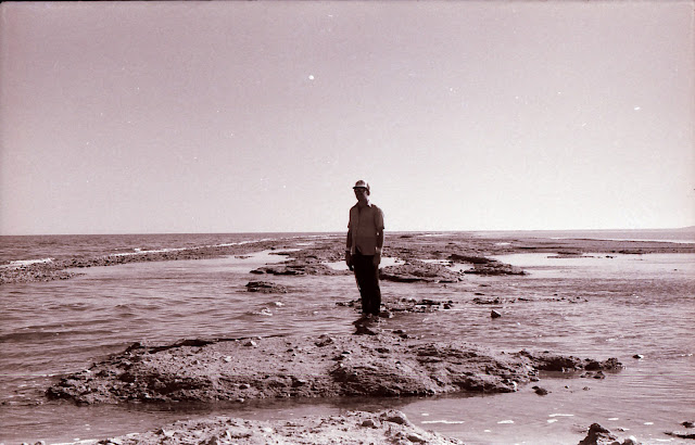
        Lynn Arave in 1991 on what was left of the washed out causeway to Antelope Island.

Lynn Arave's report on the Syracuse/Antelope Island causeway in the spring of 1991, before it was rebuilt:
I was able to take a hike along the battered Syracuse causeway to Antelope Island before a no trespassing sign was posted there.
Deep gravel and sand make any travel on the old roadway difficult. Mountain bikes get bogged down more often than not by the loose terrain, and even walkers struggle with traction.
Even at a brisk walking pace of about 3.5 mph, it takes just over an hour to reach the severed end of the causeway. Still, since all but 400 yards of the old causeway was under water only a year ago, the additional 6,600 yards that have risen since add to the attraction and help compensate for the work of a nearly eight-mile roundtrip walk.
The pungent lake smell doesn't dissipate either, like it used to, after the first quarter-mile. Because of puddles and lake damage, the rotting smell is now widespread along the causeway.
Most of the asphalt portions of the road have eroded and can be spotted in the lake as pulverized, fist-size chunks, attesting to the power of water, wind and waves to undermine and destroy a hard asphalt road. Somehow there are some paved sections (complete with painted lines) as long as 100 feet that are almost completely intact, up to three miles out from the mainland. Generally speaking, though, the causeway surface gets rougher and wetter the further out you go.
The old power cable that supplied electricity to a causeway street light system and to Antelope Island is also exposed and occasionally visible along the way.
It's a long, sometimes boring walk to where the road is severed, but the allure of Antelope Island increases every day the causeway remains out of service
I found that the old road was indeed solid up to 3.5 miles out, where there's a big breach in a curved portion of the road. At the time, it was possible to continue another 600 yards out, but winter storms have obviously now covered that section with water.
At 3.8 miles out I encountered a breach that was about 3 feet deep. End of trip. No wading or swimming for me. The causeway appeared to continue, intermittently, above and below water, for an additional 2.5 miles, but that still leaves about 1.5 miles of almost completely open water before Antelope Island.

SOURCES: Personal journal, various Utah newspaper reports.

(-Updated from reports by Lynn Arave in the Deseret News.)