Showing posts with label Great Salt Lake. Show all posts

Tuesday, April 22, 2025

When the Canyon Winds spooked cattle and drove them into the Great Salt Lake


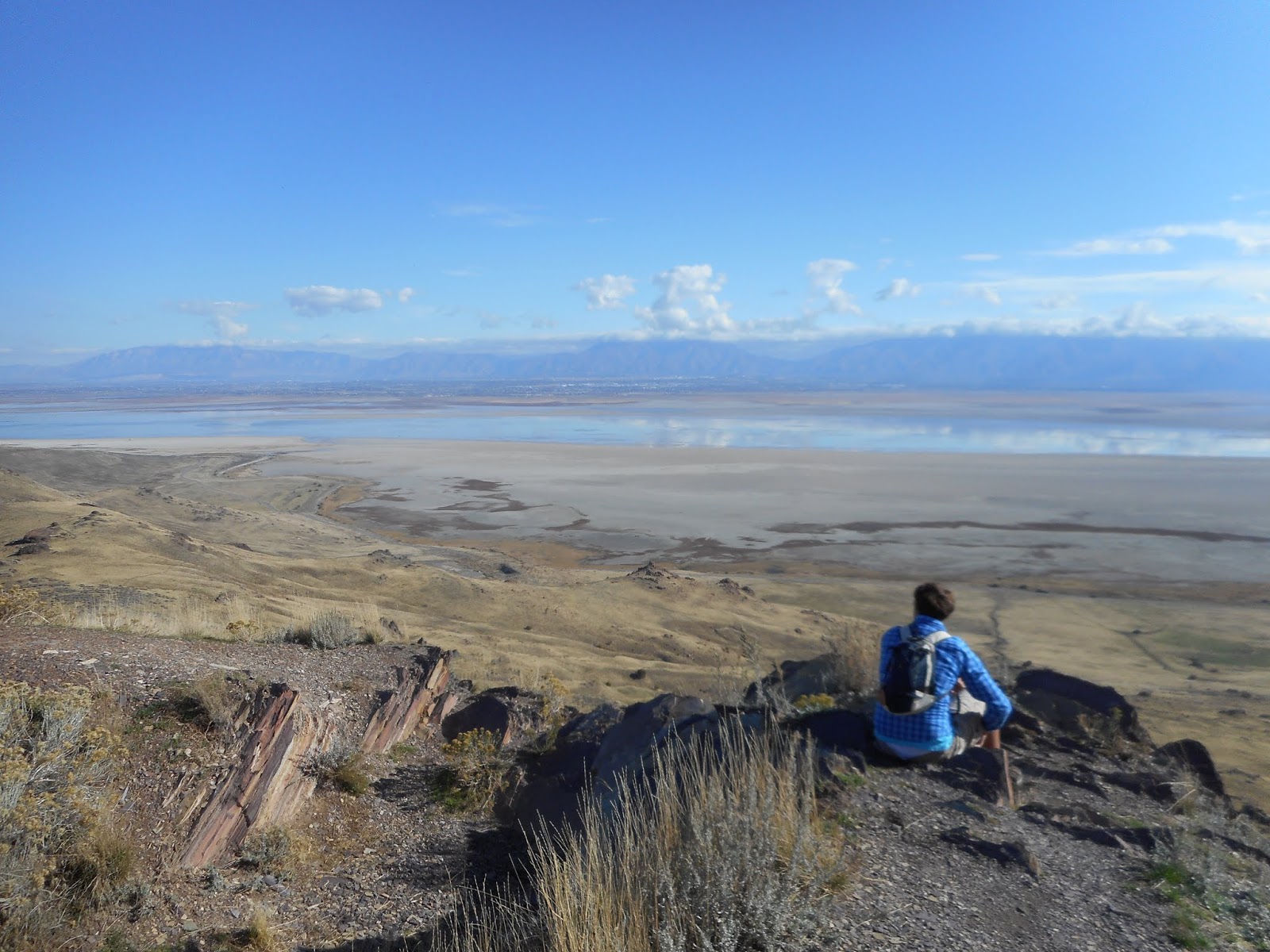
     The view from Fremont Island, looking north to Little Mountain and the Great Salt Lake.

THE gusting canyon winds that sometimes blow east out of the Wasatch Mountains do more than plague men. They can also drive cattle crazy.
The Davis County Clipper newspaper of April 20, 1900 reported on a cattle stampede into the Great Salt Lake, driven by horriffic winds.
On April 8 that year, the Chadwick Brothers were herding cattle in the area of Little Mountain, west of Ogden's 12th Street and Slaterville. A severe winds and hail storm arose and cause the cattle bunch up ner a spring of water.
"All at once they made a rush in the direction of the lake traveling with the wind ..." the story stated. All the efforts of the herders could not stop the animals and the assistance of others in the area could also not halt them. The cattle went into deep lake water and had to swim.
The ranchers lost 49 head of cattle in the lake.
"Old timers say that in early days the east wind drove cattle from Farmington over the lake to Antelope Island but of late years no such storms have been experienced," The Clipper reported.


Back when the Great Salt Lake was its own ‘county’ and more history


                      The Great Salt Lake and Causeway to Antelope Island.

UTAH'S boundaries by county have evolved considerably over the decades.
For example, according to the Deseret News of July 27, 1989, it wasn't until 1880 that the waters of the Great Salt Lake were divided and proportioned out to five different counties – Tooele, Salt Lake, Davis, Weber and Box Elder counties.
Before that, and despite what early county maps show, the lake didn't specifically belong to any particular county or counties, and the dividing lines of counties ended at the lake's shores.
Essentially, before 1880, the GSL was sort of its own ‘county’.
However, according to the Davis County Clipper of Feb. 12, 1909, a key problem before 1880 was that Salt Lake County acted like the entire Great Salt Lake was within its boundaries.
The Clipper article stated that during an interview with a Bishop Barton of Kaysville revealed that he was a member of the territorial legislature in 1880 and that he drafted the bill to divide the GSL among the five counties.
“Prior to that,” Barton said, “The whole lake belonged to Salt Lake County. That division gave us (Davis County) Church Island (today’s Antelope Island.”
Barton also indicated that the lake division extended Salt Lake City’s limits more than 1,000 yards northward to include the hot springs.

MORE HISTORY:

-“Keep away from Ogden. Lake wrecked surveyors afraid of the newspaper reporters” was a Feb. 19, 1900 headline in the Deseret Evening News (and reprinted from the Davis County Clipper).
A crew of 23 from California were surveying the Great Salt Lake for the future Lucin railroad cutoff. One day their small steam powered boat approached Fremont Island (then often called “Millers Island) and they ran into an ice flow about ½ mile off shore, which disabled their boat.
They packed into row boats and tried to tow the main boat to shore, but evening darkness came and so they tied the larger boat off shore. During the night the ice cut the ropes and the boat drifted 10 miles away into shallow water.
The story stated, “The men were afraid to go to Ogden for fear the newspaper reporters would get a hold of their experience and make fun of them.”

                     The natural sandbar to Fremont Island.

-Not just boats traversed the Great Salt Lake. “Utahns claim first trip by team across lake to Fremont Island” was an Aug. 22, 1934 headline in the Salt Lake Telegram.
With the lake lowering in elevation, L.P. Rose, an airways mechanic and Frank Stoddard of Hooper drove a team of horses 14 miles over salt flats and briny water from the Davis County mainland to Fremont Island.

                                 Fremont Island.

The wagon’s wheels sunk up to eight inches in the first three miles of salt flats and then were underwater up to 22 inches in the brine.
The men noticed huge clusters of salt crystal during their ride. They made the trip to Fremont Island to replace the acetylene gas in a blinker light system there.
-“Calendars prove nothing in Utah” Was a June 17, 1939 headline in the Salt Lake Telegram.
The story stated how for only the fifth time in the 20th Century, snow fell in Salt Lake City during June.
“Citizens shivered as the mercury took a nosedive at 39 degrees, only seven above freezing, following abnormally high temperatures early in the week,” the story stated. Four days prior, the S.L. temperature had climbed to 96 degrees.
The foothills were white with snow. Snow had only fallen in June to date previously in the Century in the years of 1902, 1906, 1914 and 1937. And, it had only fallen once in June in the 19th Century, since weather records were kept, starting in 1885.

                            Pineview Dam today.           Photo by Whitney Arave

-Pineview Reservoir was completed in June of 1937 and not one month later, the new dam had claimed its first fatality. “Ogden woman drowns in car dive,” was a July 15, 1937 Salt Lake Telegram headline. Edith Lightfoot, 28, drowned, when she sunk while another of the three passengers tried to tow her to shore. (The other three occupants of the vehicle could all swim and they all survived the accident.)
The vehicle had mistakenly followed the old, abandoned road, that led directly into the reservoir and without any barriers.


Thursday, February 11, 2021

When the Great Salt Lake was proposed as a National Park; Plus, more history

                      A view of the Great Salt Lake from Buffalo Point on Antelope Island.                                                                                                       -Photo by Roger Arave

THE Great Salt Lake is one of Utah's most well-known assets. However, few seem to be aware that in 1960 the briny body of water was proposed as a national park.
Of course, that status was never awarded, but Utah Senator Frank Moss did seek it, according to the Weekly Reflex newspaper of March 24, 1960.
Moss explained in the newspaper article that he never wanted the entire lake to be a national park, just a portion of the lake's shore.
He realized even in 1960, that industrial uses were impairing the lake and that developments also threatened it. While he didn't want to restrict any of the economic value of the lake, he was open to studying fresh water bay possibilities and more.

-MORE HISTORY: "Six stranded on Antelope Island get back safely," was an Oct. 27, 1932 headline in the Weekly Reflex newspaper. The men, Nephi Ross, Earl Stoddard, Paul and Francis Fowers -- all from Hooper, plus Frank and Charles Stoddard from West Point.
The men took a motor boat from the West Point Gun Club in hopes of rescuing a boat that was beached off the edge of Antelope Island a week earlier. That task was too difficult and their food supply ran out. They spent a night on the Isle and lit a fire to show relatives they were OK.
A Utah Pacific Airways plane was chartered and flew over Antelope Island in search of the. The pilot never found them, just a herd of about 25 buffalo.
The men finally freed the boat, but a storm preventing them from leaving the island until later in the day.


                                                                  Pineview Dam.                           Photo by Whitney Arave


-FACTS about a proposed Pineview Reservoir: 
Cost: $3 million.
Shoreline: 17.5 miles
Maximum depth: 56 feet in front of the dam.
Highways to Huntsville and Eden rerouted on the sides.
Source: Ogden Standard Examiner of Sept. 28, 1934.

-THERE was an obscure development while constructing Pineview Reservoir: For more than 40 years, the Utah Power and Light Company operated a small reservoir below Wheeler Canyon and found west of the new Pineview Dam. This old reservoir had to be drained and discarded and the old highway rerouted through it.
In addition trucks with water tanks hauled fish away as the reservoir was drained.
The Standard-Examiner of Oct. 7, 1934 chronicled some of this prep work and that a Civilian Conservation Corps camp was being erected near Huntsville.

-WHEN the Utah State Prison in Sugarhouse was slated for replacement, it eventually ended up in Draper, near Point of the Mountain. Another explored possibility was Antelope Island. However, another proposal is much more obscure -- west of Bountiful, near the Great Salt Lake.
According to the Weekly Reflex newspaper of Jan. 24, 1929, Salt Lake County was pushing for the prison to be moved northwest of the Cudahy Packing Plant (near today's Cudahy Lane).
A key problem with that proposal was that the Utah State Constitution required that the prison be located in Salt Lake County. So, Davis County would have to give the land to Salt Lake County for that to have ever happened. This proposal never took place and since Davis County is by far the smallest county of the 29 in Utah, it turned out well.

Thursday, October 15, 2020

Back when dumping raw sewage into the Great Salt Lake was the norm

                          A diminished Farmington Bay as viewed from Antelope Island.

UNTIL the 1960s, dumping raw sewage into the Great Salt Lake was a continual and normal practice along the Wasatch Front.
While the Great Salt Lake was one of Utah's best known attractions, it had been a cesspool for decades.
Davis County leaders finally realized in the late 1950s, that this was not a good environmental practice. "North Davis' sewer treatment plant made ready to operate," was a headline in the Weekly Reflex newspaper of Oct. 2, 1958.

                    The North Davis Sewer District facilities, located west of Syracuse.

This facility cost $1.3 million and featured a high rate filter that was the first of its kind in Utah. The plant was designed so that its water emissions were not harmful to any animal.
Central Davis and South Davis County also developed their own similar sewage plants soon after.
"Construction moves ahead on sewer" was an Oct. 6, 1960 headline in the Reflex, as the Central District in west Kaysville proceeded to build a sewer treatment plant.
However, it was Salt Lake City who stalled on creating a sewage treatment plant.
"Outmoded sewage system mocks modern S.L. pride" was a Jan. 29, 1958 headline in both the Deseret News and the Salt Lake Telegram newspapers.  "Salt Lake prides itself on being a modern city," the story stated. "It is a modern city without a modern sewage system. It is modern city which inflicts raw sewage upon its neighbors to the north and which closes large areas to development because of lack of sewage facilities."
The story reported that there were four badly needed sewer projects in northern Salt Lake County -- a modern sewage treatment plant; a sewer line on Redwood Road; a sewage line on 300 East; and an airport sewer extension.

                  Farmington Bay is to the right (south) of the causeway to Antelope Island.

Yet, even more than three years later, these problems were not solved and Davis County in particular was the most upset. "Davis rakes disposal plant plan" was a March 14, 1962 headline in the Salt Lake Tribune. Salt Lake City was then considering a plan to put a new sewage treatment plant at the southern end of Davis County, just beyond the city limits of North Salt Lake City.  
North Salt Lake City leaders wanted at the least, for such a facility to be west of Redwood Road if it was going to be in Davis County.
"Davis County set the pattern in location of disposal plants by placing them in areas which would not distract from any present facilities," North Salt Lake Mayor Clay Allred said.
Finally, in late 1965, Salt Lake cleaned up its sewage emissions.
"'Cesspool' abandoned after 25 years" was a Sept. 14, 1965 headline in the Salt Lake Tribune. The story stated that the "biggest open-ended cesspool in the country" was now gone. The Tribune had declared that superlative 25 years earlier.
In the fall of 1963, Salt Lake began work on a sewage plant and  it was at the northern edge of Salt Lake County. The end result was described as a first-class plant that cost $8 million and was under the proposed budget.
Notwithstanding those environmental strides, the Deseret News report on April 20, 2002, that "Farmington Bay is a sewage treatment pond." Three sewage treatment plants dump their treated wastewater directly into the bay and several other plants in S.L. County dump their wastewater into the Jordan River, which also dumps into the same bay too. The concern then was all the nutrients this adds to the lake and that the salinity is low because the Antelope Island Causeway has but one opening to mix the bay's water with the rest of the GSL.
An earlier Deseret News story on June 12, 1994 had reported that some geologists feared there were "Fedit masses of pickled sewage" in layers under the Farmington Bay portion of the Great Salt Lake. That's because before sewage treatment plants, the briny waters might have preserved the raw sewage in layers of settlement.
-MORE HISTORY: A Dec. 10, 1959 story in the Weekly Reflex newspaper of Kaysville reported on a lesser known phenomenon in the Great Salt Lake -- that there are freshwater springs in the middle of the lake. That's apparently one of the places where the aquifer releases some its stored water.
Back then, in the 1950s, the Great Salt Lake's ecosystem not was well-known. Thus, this Reflex article stated that a main goal was the Weber Basin Water Conservancy District was "to take all the water before it gets in the Great Salt Lake." It is now believed that this water diversion is a major reason for the lake's low elevation in recent years.

(-Originally published in the Deseret News on Oct. 13, 2020.)


Saturday, April 11, 2020

A look at early ship wrecks on the briny and unpredictable Great Salt Lake


                                   The Great Salt Lake southwest of Antelope Island. 


THERE seems to have been plenty of boaters on the Great Salt Lake in Utah’s earliest decades who shipwrecked, or nearly so – and a significant number of them ended up stranded temporarily on Fremont or Antelope islands.
Perhaps the lack of weather forecasting, sparse communication and underestimating the punch of the GSL’s briny-laden waves all contributed to the disasters.
The first of these involves two near-wrecks by the Lake’s first-known white explorers, the John C. Fremont party, which included mountain man Kit Carson, who conducted a U.S. Government survey there. On Sept. 9, 1843, Fremont and his four of his men paddled a poorly made inflatable rubber boat to Fremont Island. However, half-way there a strong wind began to blow and white caps appeared on the lake’s surface. They had great difficulty in reaching the Isle, especially as air in the boat leaked out.
After their survey, they returned to the mainland, but faced a big incoming storm.
Carson’s diary stated they had not gone more than a league, when an incoming storm threatened them and the boat was leaking air. Fremont urged them to "pull for their lives," Carson noted, that "if we did not reach shore before the storm, we would surely all perish." Pulling at the oars with all their might, they barely made it. "Within an hour, the waters had risen eight or ten feet," Carson wrote.

                                                 Christopher Layton.
-Christopher Layton, a prominent early Layton pioneer, is the namesake for today’s Layton City. One of Mr. Layton’s lesser-known experiences was a shipwreck in the Great Salt Lake. In April of 1872, a small steamship, the Kate Connor, owned by Layton, ran ashore off Antelope Island (then known as “Church Island”) and became stranded.
The Salt Lake Tribune had reported on May 2, 1872, that the accident happened during a big storm. There were about 10 people on board the craft and it was carrying cedar posts at the time.
The fierce spring storm almost swamped the boat and the passengers scurried to safety on Antelope Island. Eventually, a sailboat was used to transport them back to the mainland.

                                                A section of the map at Hooper City Hall.

Next the wrecks get personal for myself. A large pioneer map of the Hooper area, on the wall at the Hooper, Utah City Offices (drawn and produced by the late Hooper historian, John M. Belnap), lists Nelson Arave (one of my great grandfathers) as having wrecked a boat on Fremont Island in the Great Salt Lake in 1874. Three years later, in 1877, there’s a reference in The Latter-day Saints' Millennial Star (Volume 39, p. 223) that states Nelson Arave had built two large boats to transport cedar posts and wood from Promontory (Point) to Hooper. Presumably, it was one of those two boats that wrecked on the isle.

                                      Nelson Arave

-Four years after Nelson Arave’s wreck on Fremont Island, one of his friends, Charles Smaltz, wrecked his large boat too on Fremont Island, in 1878.
-The Salt Lake Tribune of May 18, 1875 reported that the City of Corrine Steamboat (150 feet long and three decks high) had carried 80 passengers on a recent GSL excursion. However, a big storm struck and at one point the fear was the boat would capsize or sink. It didn’t, but the boat was eventually anchored about 200 yards off shore of Antelope Island to ride out the storm.
This was “one of the roughest voyages ever experienced on the Salt Lake,” according to the Tribune story.
The Salt Lake Herald in an April 21, 1882 story stated of the dismal history of boating in the GSL: “The fate of these steamers makes it clear that the people of Salt Lake City are not of a sea-going turn …” The story also described the lake as “capacious.”
-Blanch Wenner, who lived on Fremont Island with her parents from 1886-1891, told the Salt Lake Telegram on June 17, 1939, that it sometime took several days on a sailboat to reach the Island in bad weather – and sometimes required a stay on Antelope Island first.
-The Salt Lake Tribune of Sept. 21, 1913 mentions a lawsuit over the wreck of the boat “Argo,” that was used to transport sheep to Fremont Island and yet was destroyed in a storm in 1912.
-Finally, 15 Hooper boys took a 35-foot boat to Fremont Island in 1924 and were stranded overnight when the boat’s motor wouldn’t start. They used signal fires to alert relatives, but eventually got the motor running and returned to the mainland (-From the Ogden Standard-Examiner of Feb. 25, 1924.)
And, even the 1930s weren't always safe on the lake. Hazel Cunningham of Salt Lake City had a quest for GSL marathon swimming and this effort also highlighted the finicky lake's dangerous side. "Four rescued as boat sinks in lake storm" was a June 12, 1936 headline in the Salt Lake Telegram.

Her first attempt at a record swim was met with disaster as a sudden lake storm overturned the boat following along. A Salt Lake Tribune sportswriter and three of Cunningham's friends spent 4 hours in rough water with her before being rescued. The boat tipped over about three miles from Saltair beach. (It was just over a month later when Cunningham successfully made her record swim from Saltair to Antelope Island in fair weather.)
-There were, of course, a number of boat wrecks on the GSL after these. Bottom line is, the Great Salt Lake is not to be underestimated – even today.

             The Arave family on a tour boat near Fremont Island in the early 1990s.


-This story was originally published in the Deseret News on April 8, 2020.

Thursday, January 9, 2020

Condos and homes on Fremont Island?

                 Fremont Island is not much of an island these days, with a low Great Salt Lake.

ARE condos in the future for Fremont Island in the Great Salt Lake?
They WERE a distinct possibility.
(See 2 updates below ...)

In 2018, "Diesel Brother" Dave Sparks headed a financial group which purchased the Island from the Richards Family of Salt Lake, who had owned Fremont since the 1960s, or earlier.
When the Diesel Brother and group bought the Island, they stated on Facebook:
 "We have big, aggressive plans to open the island up for visitors from all around the world to come experience a piece of the Wild West. I hope that all of you can someday join us for an island adventure including summer concerts, offroad racing, horseback riding, camping, exploring, shooting, etc!"

No mention of condos on the island in that proclamation, but they likely have some specific plans to open up Fremont to limited public usage, or their investment yields nothing.
The Island's owners planned a January 11, 2020 bus trip to the Isle to apparently kickstart their development plans.

                   The start of the sandbar leading to Fremont Island.

If condos, or any housing (like a hotel for visitors) were to be added there, access would be a key dilemma. With a low level of the Great Salt Lake, the Diesel Brother group has a souped up bus, with giant oversized tires, called "The Freedom Bus," which can easily traverse the famous sandbar to Fremont Island, that is found off the causeway to Antelope Island.
Yet, the bus only provides limited access to the Island. And, if another causeway-- like the one leading to Antelope Island -- were built to Fremont, that would likely cost millions of dollars.
Drinking water, sewage and electricity would be other essentials there. 
For Antelope Island, the power lines are buried along the causeway to the Island. Where would Fremont's power lines go?
The shortest access would be from Promontory Point South, across Great Salt Lake water, or from Hooper westward. Taking at least power and water lines to the Isle would again be very expensive projects.
There are some small brackish type of water wells on Fremont, but whether they can produce adequate water is unclear.


             The Kit Carson Cross on the north end of Fremont Island.

Hooper City incorporated Fremont Island into its boundaries when it incorporated in the year 2000. Any developments on the Island would have to be approved by the City.
Fremont is home to the Kit Carson, Cross, likely the oldest Catholic or Christian relic in Utah. It also has some graves and the foundation to an old 19th Century home.
Sheep, cattle and horses have all grazed on Fremont Island over the decades. Wild Shetland ponies also roamed the Island until the 1990s.

                                     The Wenner Family graves on Fremont Island.


When the Richards Family obtained Fremont Island, they had dreams of its becoming the Utah version of Alcatraz Island, a prison.
(That's because a Salt Lake grave robber, Jean Bapiste, was exiled there.)
When a prison seemed unlikely there, the Richards Family hoped Fremont could be a state park, like Antelope Island is. That never happened either.

UPDATE: As of November 2020, a non-profit group, Palladium Foundation of Salt Lake has purchased Fremont Island, with the intent of preserving it as open, undeveloped land. No housing or condos! (However, before the purchase, 10,000 to 12,000 homes were planned for Fremont, though water supply and access were obvious roadblocks for any large scale development.)

ANOTHER UPDATE: As of December 2020, Fremont Island is now owned by the State of Utah, after more than 150 years of various private owners.


--All photographs above by Lynn Arave, who has visited Fremont Island four times, once by canoe, once by boat, and twice on foot.


Tuesday, August 13, 2019

When the Snake River was proposed to be the shrinking Great Salt Lake's lasting salvation


                         A dried up and exposed portion of the Great Salt Lake bed.

THE Great Salt Lake is declining. Between droughts and less river water reaching the lake, its level is nearing a historic low.
Ironically, in the early 20th Century, this possibility was not only recognized, a solution was offered.
“Water for the lake. Marcus E. Jones has a plan to present. Would use Snake River …” was a Dec. 27, 1903 headline in the Salt Lake Tribune.
Jones, a civil and mining engineer and geologist, proposed creating a canal that would bring the flood waters from the Snake River and its tributaries to the Great Salt Lake and Utah. He said this would restore the GSL to its former normal levels and excess water from the canal could be used in other ways, as needed.


                            The Snake River at Jackson Dam.

He estimated the cost then for such a canal to be $2 million (That more than $50 million in today’s dollar value).
His plan was to take the water out of the Snake River at St. Anthony and take the canal through Red Rock Pass at the north end of the Cache Valley. There the canal could dump into the Bear River, or a canal could shadow the river to the Wasatch Front. He said there is always excess Snake water – especially during the months of April, May and June.
Jones’ vision involved more than just raising the Great Salt Lake level. His own studies concluded that the rainfall in the Salt Lake Valley is greater when the GSL is higher.
Of course, this canal never happened.


                          Mesa Falls, along the Snake River.

Some two decades later, newspaper headlines were prophetic on the lake. “America’s famous ‘Dead Sea’ soon to be dry land.” That was a Feb. 3, 1924 headline in the Ogden Standard-Examiner.
 “Within a century the Great Salt Lake, in Utah, will have dried up,” the story stated. It then likened the GSL’s reduction to that of its predecessor, Lake Bonneville.
The GSL fell 10 feet, from 1900-1915, until some exceptional wet years had recently gained most of that loss back.


    A tumbleweed sits along where once the GSL water was more than a dozen feet deep. 

“Were it to disappear, Salt Lake City would lose its principal attraction,” the story stated.
Left would be an immense sink, a giant salty plain, impossible to use for anything constructive.

 An exposed piece of wood along the sandbar to Fremont Island, before it was removed by 2005.


-During the same time period, Antelope Island was no longer and isle. “To Island by land. Trip can be made practically dry shod. Road of salt and sand,” was a Sept. 24, 1900 headline in the Salt Lake Tribune.
The story continued: “Great Salt Lake has been known as the ‘Dead Sea of America.’ If it is not dead, it certainly gives every evidence of being in the throes of dissolution.
The story stated how there was nothing but four miles of glistening salt between what used to be the eastern shoreline of the lake and Antelope Island. A Tribune representative made the trip to the Island by wagon and horses in 35 minutes, “without urging the horses to any great extent.”
One man told the Tribune that he wagered he could travel by land from the ranch house on the south end of Antelope Island to Saltair, 10 miles away, “with perfect safety.”
Cattle were reported as still doing well on Antelope Island, though not much wheat has been raised there, due to extra dry conditions.
Further north, the water conditions of the Great Salt Lake were reported as more favorable. Still, the hunks of decaying boats and other wreckage along the former lakebed were reported as not being very inviting in appearance.

(-Originally published in the Deseret News on August 13, 2019.)


Tuesday, June 25, 2019

Back when marathon swimming races flourished in the Great Salt Lake


“FLOATING like a cork” in the Great Salt Lake was a very popular pastime in Northern Utah, from when the first pioneers arrived until the early 20th Century. And, by the 1920s, a new rage in the briny lake arose – long distance swimming.
“Annual marathon furnishes a thrill” was an August 25, 1920 headline in the Salt Lake Telegram newspaper.
This “first” annual race (authorized by the Amateur Athletic Union) started at Antelope Island and ended at Saltair. Alvin Nelson won the 6.75-mile race in two hours and 40 minutes. McKeith Burt finished just five seconds behind, as runner-up.
(Note that Nelson had won a similar inaugural GSL race a year prior, as an amateur, in 1919, but it was not organized under the auspices of the AAU.)
Thirteen swimmers started the 1920 race, but five had to be fished from the lake in the first four miles.
However, seventh place was taken by Frank Nelson, just age 13 – and he swam the last half of the race without goggles.

Looking south from the highest point on Antelope Island to the Oquirrh Mountains and part of the lake where marathon swim races used to be held.

-The Telegram of Aug. 7, 1921 clarified that the August Antelope Island to Saltair race was for amateurs only. It also stated that “Professor” C.S. Leaf held the pro record for that same course at 2 hours and 28 minutes (or 12 minutes faster than the amateur record), set on Aug. 19, 1919.
-The Ogden Standard-Examiner of Jan. 20, 1927 promoted the idea of having a 31-mile marathon swim race around the Great Salt Lake, that would capture the interest of the world. There’s no evidence this race ever became a reality, But, the intent was for the Salt Lake and Ogden chambers of commerce to funnel some of the $100,000 combined money they used annually to promote Utah and add some into this professional race and its prize funds.
The story also noted how there’s no fear of shark attack’s in Utah’s lake and the salt-laden water would offer more of a buoyant rest for swimmers.
-The Telegram of July 6, 1930 explained how the Antelope Island to Saltair swimming race had been an intermittent event, since its early years. For example, the race was held in 1930, but wasn’t held in 1928 or 1929.
-“Orson Spencer sets mark for Antelope Swim. Annual paddling marathon most successful in history” was a Dec. 31, 1931 Telegram headline. The newspaper reported almost five months after the event that Spencer had set a course record of 2:25.41, breaking Professor Leaf’s pro record – and Charles Welch, Jr., was just 17 seconds behind as runner-up.

                                           The west side of Antelope Island.

-One shortcoming in early Great Salt Lake swimming races was the lack of female entrants. “Feminine entrants lacking from 1931 Saltair Marathon” was a July 22, 1931 Telegram headline. Mary Gibbs, a Salt Lake tennis player, had initially entered the race, but later withdrew.
-By 1932, the GSL swimming race had attracted 40 participants. “Replete with tradition and color, the annual Antelope Island swim marathon on the Great Salt Lake will enter its fourteenth year of existence when paddlers begin the battle of the brine …” Reporter Wendell J. Ashton stated in a June 29, 1932 Telegram story.
However, the story stated that Mrs. Billie Droubay was the only woman entrant and an unofficial finisher in the 1931 lake swim, “finishing two hours after officials had left the finishing scene.”
The top finishers in the 1930s races won medals.
-The Telegram of Aug. 1, 1933 stated that year’s GSL swim was set for August 2 and that three women were entered. Results of that race were apparently never published.
-The Telegram of July 6, 1936 reported that Miss Hazel Cunningham of Salt Lake, swam from Saltair to Black Rock, a distance of five miles, in three hours and nine minutes. – And that was the last report of such a 1930s lake swim.

Cunningham's quest for GSL marathon swimming also highlighted the finicky lake's dangerous side. "Four rescued as boat sinks in lake storm" was a June 12, 1936 headline in the Salt Lake Telegram.
Her first attempt at a record swim was met with disaster as a sudden lake storm overturned the boat following along. A Salt Lake Tribune sportswriter and three of Cunningham's friends spent 4 hours in rough water with her before being rescued. The boat tipped over about three miles from Saltair beach.

     Fourth-graders from Layton's Vae View Elementary School wading in the Great Salt Lake.

-Why did these 20th Century GSL lake races suddenly stop? Probably at least partially because the Great Salt Lake’s level dropped significantly. All during the heyday of briny races in the 1920s, the lake level stayed above 4,202 feet above sea level. (4,200 feet is often considered the lake’s average elevation.)
According to the U.S. Geological Survey, by 1935, the lake level was down to approximately 4,196 feet and by 1940, it had dropped to about 4,195 feet. These low lake levels would have made a swim from Antelope Island to Saltair an impossibility, as dry or very shallow lakebed would be the norm. The lake level rebounded some by 1950, but then by the 1960s it had dropped to the lowest level since the Pioneers had arrived.


This metal post was landlocked in the former Great Salt Lake in 2004, when low lake levels exposed it. Twenty years earlier it would have been underwater.


(-This story was originally published in the Deseret News on June 24, 2019.)


Wednesday, August 22, 2018

The new normal: A high and dry Spiral Jetty -- But still worth a visit


The Spiral Jetty, with Great Salt Lake water sitting hundreds of yards away, to the west.


THE new normal for the Spiral Jetty, in a northeast corner of the Great Salt Lake at Rozel Point, is a piece of rock art that's high and dry.
The GSL is not so "great" anymore and its shore was sitting some 600 yards away from the Spiral Jetty in August of 2018.
So, why would someone drive 50 minutes, one-way on a washboardy gravel road from the Golden Spike Historic Site to visit a waterless relic?
The peace, quiet and solitude here is deafening and yet appealing. 


                     The Spiral Jetty from above the parking lot.

Other than some pesky flies zipping around, this desert place seems lifeless of animals. But with just myself and my son, Taylor, there during our 90-minute visit, we weren't disappointed.


                    The center of the Jetty, high and dry in the summer of 2018.

During my only other visit there in about 2003, the lake's water lapped partially around the Jetty. Your shoes did get a little wet walking on top of it.
When Robert Smithson of New Jersey directed the creation of the Jetty in April of 1970, the GSL level was 4,195.15 feet above sea level. During my visit, it was down to 4,192.3 -- almost 3 feet lower. That may not seem like much, but in a shallow lake, it represent a significant amount.
During out visit, it was hard to believe that in 1986, the lake reached an all-time high of 4,211,85 feet. That likely means that the top of the Jetty itself was covered by about 15 feet of salty water.


                                    Bushes now growth in the sand atop the Jetty itself.

A surprising find was that there were several bushes now growing atop the Jetty itself. Without the thick salt water present to prevent growth, there will likely be more such bushes appearing future years. Sandy soil is also accumulating atop to Jetty, partially obscuring its unique blackness on the salt flat.
Also, just a dozen yards west of the Jetty there is a thick salty plain, leftover from the receding lake.
Obviously in the spring, or following a storm, the Jetty could be temporarily wet.


                                              The salty plain, west of the Jetty.

And, in the bushes below the parking lot above the Jetty is a 100-foot-tall wooden pole sitting among the rocks. If some storm decades ago heaved the pole up to its present location, it must have been quite the violent act of nature.


                              The old pole, near the Spiral Jetty.

Smithson paid thousands of dollars to have more than 6,000 tons of black basalt rock -- very common in the area -- moved and cemented to create the Jetty. It is a counterclockwise coil, some 1,500 feet long and about 15 feet wide. (Some of the rocks are secured at the bottom by concrete, which will likely lengthen its lifespan.)
Smithson, after about 5 days of work, had his artwork redone in another several days. He apparently loved this remote area and chose it in particular for his unusual creation.
A $9,000 art grant financed some of his hired work. (That's more than $59,000 in 2019 dollar values.)
This isn't the typical type of artwork, as in a museum. This is a hands-on/foots on, giant piece of art that is best appreciated by interacting with it. If you've driven that bumpy road to reach the Jetty, the final touch is to walk the 100 yards down a rock slope to experience the Jetty up close and personal by walking atop it.
(If you can't physically do that, you can still savor it from the nearby parking lot.)


                                The new monument, near the Jetty.

In 2014, an Eagle Scout project, added a nice monument on the hillside, east of the parking lot.


                                       The plaque on the monument.


To reach the Spiral Jetty, take the I-15 exit at Brigham City to Corinne and the Golden Spike National Historic Site and head west. The Jetty is some 50 miles from Brigham City.
Be prepared that just past the Golden Spike headquarters the road turns to gravel. Although the road is now well-signed, it is very washboardy in places and for the last 1.5 miles (near a large corral), the road is dominated by terrible such ruts and requires a passenger car to slow down to 10 mph at times to not shake apart. Also, be sure to slow down for the several cattleguards along the route. Trucks are the best vehicle for this bumpy road and they can also likely travel at the fastest speed too.

                   Note the many "washboardy type ruts in the road to the Jetty.

Also, respect the privately owned grazing land and do not trespass there on either side of the road.
Although a sign along the road states it is 15.7 miles to the Jetty on the gravel road, it seems more like 19 long, long miles. The road ends at the parking lot above the Jetty.
The nearest gas station in the area is in Corinne. The only water and restrooms are at the Golden Spike Headquarters -- and only when the site is open.
Note too, that cell phone coverage is also unreliable in the area, west of Corinne. Anyone experiencing an emergency in the Jetty area would have to scale to tallest  hill in the area and hope to receive a signal ...


Monday, July 10, 2017

One of the first drownings in the Great Salt Lake

            Davis County 4th graders play in the Great Salt Lake at Antelope Island.


YES, you can drown in the briny, buoyant waters of the Great Salt Lake.
Although the GSL's waters are 3 to 5 times saltier than the ocean and you can't sink -- but "float like the cork" there, you can drown in the water.
Inhaling the water can choke and gag you and the briny water can fill your lungs and stop your breathing.
One of the FIRST, if not the first recorded drownings in the Great Salt Lake happened on Sunday, August 6, 1882.
According to the Ogden Herald newspaper of Aug. 7, 1882, J.D. Farmer, a well-known Salt Lake City businessman, drowned near the Black Rock resort, on the lake's south end. Although his body could not be initially found, his clothing was discovered in one of the bath houses. He could not be located when the day's final train was ready to return to Salt Lake City. People searched for his body, but it was not found until more than four years later.
The Salt Lake Herald newspaper of Oct. 13, 1886 reported than his body was finally found about eight miles west of Garfield, along the shoreline there. The skeleton's size apparently matched Farmer's height.
The Great Salt Lake has an average depth of 14 feet and pockets of it can be about 36 feet deep, depending on lake elevation. 


                     A youth floats like at cork in the Great Salt Lake.

-Although no one can be certain if the first drowning in the Great Salt Lake wasn't the Salt Lake grave robber, John Baptiste, whom Brigham Young exiled to Fremont Island in the spring of 1862. This since he was never found after an escape from the isle, the Salt Lake Herald Newspaper of Nov. 14, 1895 published an account of the robber where "fact and fiction mixed." 
This report was originally published in the Chicago Chronicle newspaper and was simply, "a wild, weird story." It states that Baptiste was exiled on "Church Island" (Antelope Island), when the fact is the location was Fremont Island.
This Chicago story, a forerunner of fake news, spins Church Island as haunted and avoided because Baptiste has turned into a wild man, hairy, old and dangerous. It even acts like the Great Salt Lake is extremely dangerous with many boats sunk and people drowned.
A work of fiction in the 1890s, it would make for a dismal TV movie plot today.