A sign at the top of Farmington Canyon.
THE 5-mile dirt road from the top of Farmington Canyon to Francis Peak was NOT built in the late 1950s when the Francis Peak radar station was constructed. It was built more than 20 years earlier by the CCC (Civilian Conservation Corps) and was completed in 1938.
According to the Davis County Clipper of Sept. 2, 1938, men of the CCC Company No. 940 constructed the five mile road in a two year project. It started as 12-feet wide and the U.S. Forest Service widened it to 22 feet.
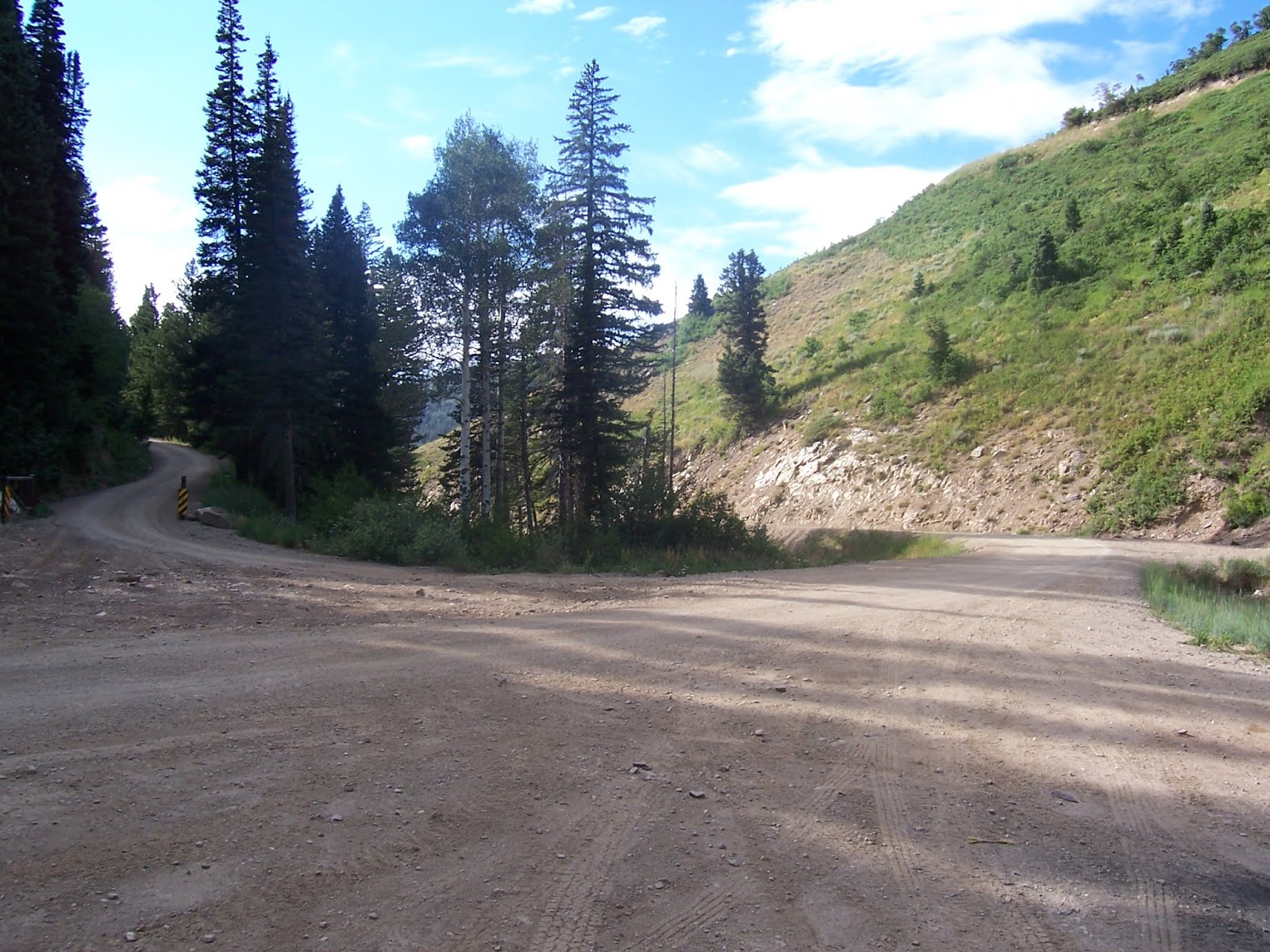
The junction at the top of Farmington Canyon.
"It will open up the scenic beauty around Francis Peak," the Clipper story stated.
The initial purpose of the road was to support erosion control. That's because the Farmington area suffered devastating floods in the 1920s, from overgrazing and also sudden cloud bursts.
An upper section of the road through Farmington Canyon.
The northern radar dome atop Francis Peak.
-That same year, the Salt Lake Telegram newspaper heralded the completion of the entire mountain road, with the headline, "Farmington and Bountiful connected by scenic loop" was an Aug. 31, 1938 headline in the Telegram. This 17 mile stretch was also constructed by the CCC. (The side road north of Francis Peak was a connecting route.)
The road, today's "Skyline Drive," was begun in 1933 by the CCC for erosion control and access. The steepest portion of the road is through Farmington Canyon and that section is 7.5 miles long.
In order to avoid drilling through rock, the Canyon road included two bridges.
The Bountiful Peak Campground and Picnic Area is about one mile south of the top of Farmington Canyon. That facility was dedicated on Aug. 22, 1941, according to the Clipper of Oct. 15, 1941.
Note the switchbacks up the north side of Farmington Canyon.
-It didn't happen, but in 1940, plans were proposed to connect the Davis County mountain road with Emigration Canyon. The Salt Lake Telegram of March 27, 1940, reported the proposal by the U.S. Forest Service. Likely, the United State's entrance into World War II at the end of 1941 doomed that ambitious plan.
However, that tentative road was surveyed as 29 miles long and run along the edge of City Creek and end at Little Mountain in Emigration Canyon. (Originally, the road was to go all the way to Parley's Canyon.)
A view from Layton City toward Francis Peak.
Showing posts with label Skyline Drive. Show all posts
Monday, February 3, 2020
Wednesday, December 6, 2017
1937: When the Skyline Drive, between Farnington and Bountiful, opened
THE Skyline Drive/backway mountain dirt road, between Farmington and Bountiful, Utah, first opened on August 29, 1937.
"Connecting last link and route of new mountain highway" was an Aug. 31, 1937 headline in the Davis County Clipper newspaper.
For the first time on Aug. 29 that year, an automobile traversed the entire 27-mile stretch between the two cities.
James E. Gurr, supervisor of the Wasatch National Forest and J.P. Martin, regional engineer for the Forest Service in Ogden were the first two to travel the road.
The road was built by CCC crews and transient labor, over five years, from 1933-1937. Besides the scenic nature of the road, it also gives firefighters easy access to the area.
The Farmington Canyon portion was stated in the story as the most difficult. Drilling was required through solid rock to create thjat 7.5-mile portion of the road -- most of it "on a precipitous and rocky hillside." Two bridges over Farmington Creek were also required there.
The road tops out at 9,150-foot above sea level in the Bountiful Peak area.
Farmington Canyon can be blocked by snow well into summer.
The road was also built because of the flooding problems in the area during the 1920-1930s time period. Erosion control dykes were also established, to better control runoff.
-The Sunset Picnic/Campground area in Farmington Canyon was dedicated on May 23, 1939 by the U.S. Forest Service. Located six miles up the Canyon, the area was previously the Farmington junction camp, used to camp road workers.
The FAA's portion of the road to Francis Peak.
-According to the Davis County Clipper of Dec. 6, 1968, a section of road off the Skyline Drive was planned to go down into the Morgan area, on the east side of the Wasatch Mountains. However, that was never built.
It was also hoped that there could be a ski resort established on Farmington Flats. That never materialized either.
-An aerial tramway was also planned up Shepard Canyon to Francis Peak in the 1970s. Although there was little opposition to this plan (Davis County Clipper Aug. 5, 1977), it also never happened.
Original funding was $1.1 million for the tram and it would have been able to carry up four men and 3,000 total pounds. The tram ride would have taken but seven minutes, as compared with 1.5 miles to drive the dirt road to the Radar Domes. It would have featured 12 towers up the mountainside, to the 9,500-foot elevation summit.
The tramway was considered very cost effective, as compared to keeping the dirt road passable all winter. In fact, the study showed the tram would have paid for itself in eight years, since the Francis Peak station is manned year-round.
The tramway plan's environmental study got bogged down in its own federal red tape and its construction costs skyrocketed and mean the project never happened.
The junction up Farmington Canyon, where the road splits, north to Francis Peak or south to Bountiful Peak.
-All photos by Roger Arave.
Subscribe to:
Posts (Atom)


