UTAH HISTORY
can be confusing, especially when there are many different names for the same
things – and when historic names are modernized – then contemporary history searchers are bewildered as to what
is being referenced.
As an
example, take the so-called “Pioneer Trail,” in Hooper, Weber County.
In essence, this “Pioneer” trail is more properly
named in most history books by one of these 4 titles: The Old Emigrant Trail,
Bluff Road, Old Traveled Road, or the Salt Lake Cutoff.
It was only in the lone history of Hooper book,
“History of Hooper, Utah Land of Beautiful Sunsets,” by John M. Belnap
(published in 1976 and available free in an on-line version on Family Search,
by using an LDS Church log-in) as the so-called “Pioneer Road.”
That pioneer title has apparently caught on in Hooper City, itself over the decades, and although Belnap’s book is certainly unique and very accurate otherwise, the “Pioneer Trail” title is not. It may sound simpler, more fitting and conform well to the general “Mormon Pioneer” term, it has obviously led to much confusion and bewilderment.
(Obviously, LDS Church leaders in Hooper ran with the confusing title and hence the “Pioneer Trail Stake” name in Hooper for one of its stake's titles – and LDS Church headquarters also must have approved the name, probably since the path was indeed a “Pioneer” trail. There is also a Pioneer Trail Ward in Hooper as well.)
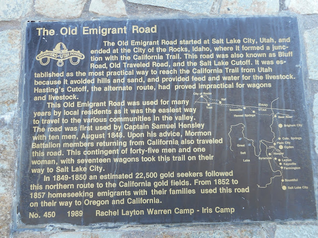
By accessing Belnap’s Hooper history, he accurately states in page 18 of his book, that the trail (with some of my extra historical information added) started in Salt Lake City. It headed northward, through Bountiful, Woods Cross and Centerville, likely following near today’s I-15 corridor. When Farmington was reached, the trail veered northwest into Kaysville and Layton – then going straight west on what is today’s “Gentile Street."
There is even evidence of a way station at
the far west end of Gentile Street, in today’s Syracuse City. (That also likely ties into how the "Gentile" name became attached to the road, since mostly non-LDS Church members used it early on.) The trail went
west, because that avoided hills and very sandy areas around Roy and Hill AFB,
plus there were more water sources and grasses for animals to eat.
The Syracuse Emigrant Road marker/monument.
There is a large historical marker, by the Daughters of Utah Pioneers, in northwest Syracuse, commemorating the “Old Emigrant”/”Pioneer Trail,” next to an LDS Chapel on Bluff Road, at 3700 South. From Syracuse on, the trail followed what is known today as the Bluff,” in northwest Davis County.
It passed by today’s
Jensen Nature Park, the Syracuse Arts Academy and Schneiter’s Bluff Golf
Course, to name a few modern waypoints. (In fact, there is a 6-mile, paved
trail, named the Old Emigration Trail, that goes below the Bluff in Syracuse
and West Point.
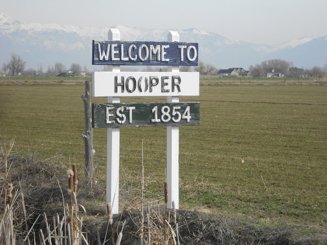
When the trail reached today’s Hooper, it was often just east of main Hooper Canal, or the eastern side of Hooper. There is firm evidence that “Muskrat Springs,” the actual water source, was also a resting spot along the trail too,
The trail then continued into West Weber and Plain
City, before veering northeast and reaching the old Utah Hot Springs, at the
border of Box Eler County. At the City Rocks in southern Idaho, some 125 miles
distant, the trail met the California Trail. The trail was more than 200 miles
long, because unlike today’s I-84 route, it avoided the steep mountains
northeast of Tremonton and veered more toward today’s Grouse Creek area and
specifically went by the future town of Yost.
This trail was used by thousands of travelers from the
late 1840s, until 1869, for about two decades, when the transcontinental
railroad made it mostly obsolete. Better roads also being built over the
decades also called for most of the trail to be abandoned, except in urban
areas.
(In defense of the “Pioneer Trail” LDS Stake name, it
does sound better than being called say, the “Emigrant Trail Stake,” which
would also be confusing as it would appear
to relate to Emigration Canyon in the Salt Lake area, rather than in
Weber County … but the “Pioneer Trail Stake” name does come with its own
confusing historical accent – though perhaps there was no better title than
“Pioneer Trail Stake” in this specific case.)
References:
“History of Hooper, Utah Land of Beautiful
Sunsets,” self-published by John M. Belnap, 1976, p.18.
Daughters of Utah Pioneers historical
marker, at 3700 South Bluff Road, in Syracuse.
“Images of America Layton Utah,” by Lynn
Arave, Arcadia Publishing, 2020.
https://walkrideusa.com/states/utah/individual-trails/old-emigration-trail-utah


