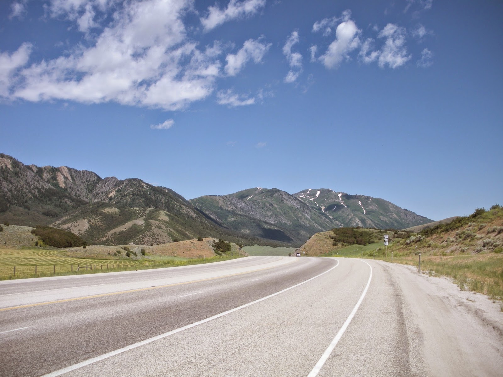
Today's Sardine Summit, looking north, along Highway 89.
By Lynn Arave
THOUSANDS of people a day motor along at 55 mph on the
four-lane Highway 89/91 through what is almost always referred to as Sardine
Canyon, the main passageway between Brigham City and Cache Valley/Logan. How
that fishy moniker has been affixed to a mountainous area devoid of any truly
narrow geography, or fishing areas begs an investigation of history.
That’s especially the case, since today’s highway does
not even travel through the original Sardine Canyon of pioneer times. So, first,
a true geographical sketch of the area is in order.
Although place names can eventually become what the
general populace keeps calling something, today’s “Sardine Canyon” is not the
original Sardine Canyon of pioneer times.
Technically speaking, Highway 89/91, an approximate
18-mile stretch from Box Elder to Cache County, traverses three separate
canyons – none of them named Sardine by official U.S. Geological Survey
designation, or State of Utah highway maps.
1. The
highway departs Brigham City and travels east and north through Box Elder
Canyon to the community of Mantua.
2. Next, traveling steeply uphill is Dry Canyon,
ending at Sardine Summit (5,899 foot elevation).
3. After a steep downhill segment to Dry Lake,
Wellsville Canyon completes the trilogy of canyons into Cache Valley.
It is today’s populace and news media who favor calling
all three canyons by the one “Sardine Canyon” name that overshadows any
geography lesson or official maps.
The road alignment through the area has
changed significantly over the decades. The first Mormon settlers on the way to
Cache County in the fall of 1856 likely traveled about the same route to
Sardine Summit and to about Dry Lake as we do today. However, then – presumably
because of water sources and a more gradual route – headed directly east to
Sardine Spring. Then, they followed the original Sardine Canyon northeast into
Cache Valley and near today’s Hyrum Reservoir and Mount Sterling Cemetery. That was the original path
into Cache Valley.
The first real road in the area went through the side canyon that begins
just north of Sardine Summit, following part of the original pioneer route, but
then headed east along today’s Mt. Pisgah Road and into McMurdle Hollow and then
into the community of Hyrum.
The first
newspaper mention of the “Sardine Canyon” name, that could be located, was from
Logan in the fall of 1880. A map from Sept. 4, 1878 in the Cache County
Surveyor’s Office, also uses the name Sardine Canyon. (In 1878, there was a
side route possible through Wellsville Canyon, instead of Sardine, but that was
only considered a secondary route at the time.
A 1915 newspaper
article described the experience of driving a Studebaker “light six” model
through the northern section of the route south into Box Elder County. Mr. L.E.
Dresbach drove the automobile, loaded with five people. It was previously
“regarded as impossible” to make such a trip in an automobile.
“To Paradise and
then west over the Sardine Canyon road practically in high gear and at the rate
of 25 miles per hour until the top of the cutoff was reached,” it was reported
in the newspaper.
A previous version of the old road to Logan, into the true Sardine Canyon.
Later, in the 1920s, the next version of road
started about 1,000 feet north of
the original pioneer route. This road wound around the ridge east of Dry Lake.
It is still visible while driving along U.S. 89/91 today. The road, the first
alignment to be paved through the area, eventually intersected the original
Sardine Canyon. Portions of this road are still paved, but weather is eroding
away the asphalt and sections have been removed.
According to
newspaper reports, the second version of the route to Cache Valley opened in
September of 1924, was 24-feet wide and had a maximum grade of 6 percent. It
cost $200,000 to construct this nine-mile section of road, between Mantua and
Wellsville.
This road was
also a landmark for the west, marking the completion of the last link of a
highway from Grand Canyon National Park, to Zion National Park and north to
Yellowstone National Park.
One of the old side roads off Highway 89 today.
Furthermore, the
road with its compact dirt composition and lower grades, was open in winter
much more often than the original highway through the area. This meant Cache
Valley was not isolated for months during the snow season, but more like weeks.
“Hundreds of
‘autoists’ who already traveled over the new road are high in their praise” of
the new gravel/hard dirt road, the newspaper reported.
By the following
month, the county believed it had solved the snow blockage problem in Sardine
Canyon by constructing a special cabin for a winter patrolman who would live
there in the winter and have a ‘two-ton tractor” to plow the snow.
Despite all the
initial praise for the second “Sardine” alignment, there were serious travel
problems in later years. For example, in January of 1949, this road was closed
for a full month. The winter of 1948-49 was northern Utah’s combined
snowiest/coldest winter season on record.
(Even today’s modern “Sardine Canyon” route
can be plagued by snow and ice. In fact, Sardine Canyon often makes the news,
because of periodic winter accidents reported there.)
The third and final alignment is today's road, built in the 1950s and
opened in 1960. It was constructed in part, because of the shortcomings that
the previous road’s closures experienced in the winter of 1949. It traverses
down from Sardine Summit on a straight shot to Dry Lake and offers a much
shorter and smoother route to Cache Valley than its two predecessors, exiting the
canyon into Wellsville.
By the early 21st
Century, this highway had been widened from two lanes to four.
Now, having
established the three variations in the roads through the area, the examination
can now return to the original query of the name origin of Sardine Canyon and
its three possible origins:
1. In the fall of 1856 the first settlers on the way
to Cache Valley stopped near a spring 1.5 miles east of what is now known as
Dry Lake today. It is here that one of the legends claim these pioneers ate a
sardine can lunch here and hence the name of the greater area almost 160 years
later. Furthermore, some variations of this legend claim that these settlers
left the sardine can, or cans by the trail near Sardine Spring and so later
travelers spotted them and the name was born.
However, did cans of
sardines exist in 1856? Could they have traveled west?
“I think it’s possible,” the
webmaster of www.sardineking.com,
out of California, stated of cans of sardines existing in Utah in 1856. “I
can’t think of why a settler would not have wanted to bring a case of sardines
with them if they were traveling by horse and wagon. Canned sardines keep very
well.”
Furthermore, it was
indicated that while tin cans were around in 1856, sardines were not canned in
the USA until after that year. So, they would have had to have come from Europe
and would thus be much more rare, than a few decades later.
(Also, “what if” the pioneers had eaten a different sort of lunch in
the area? How does "Tuna Canyon,"
or "Steak Canyon" sound?)
Still, the railroad didn’t
reach Utah until 14 years later in 1869. And so, all of the Mormon pioneers
prior to the iron horse had to walk, horse and wagon or handcart some 1,300
miles to Salt Lake City. Thus, if a pioneer possessed one more cans or sardines
and brought them along, would they have kept them unopened and uneaten for all
1,300 miles and even weeks or months after before a future 80-plus mile trek
from Salt Lake to the Cache Valley? They might have saved them in reserve, or
as a delicacy for as long as possible, though it seems that after several hard
winters during the Mormon pioneers’ early years, all the canned sardines would
have been used.
2. Did the first pioneer settlers headed for Cache
County believe one of the canyons in the area between Brigham City and Logan
was particularly tight or narrow and hence the sardine name?
Certainly
today’s U.S. 89/91 highway alignment offers no unusually narrow sections. In
fact, that’s the main reason why many have pondered where the sardine name came
from, given the lack of geological support.
However, while the original Sardine Canyon is
narrower than today’s version, it does not appear ‘sardine’ narrow.
An
approximate 1910 photograph of the original Sardine Canyon is contained in the
on-line archives of Utah State University. This picture shows how the stream
dominates the canyon at the time, though the canyon itself is not particularly
narrow, lacking steep walls.
3. Did the presence of tiny, sardine-like fish
spotted in a stream along the original Sardine Canyon inspire the canyon’s
name?
Several
professors of aquatic ecology at Utah State University lended support to this
claim.
“I have heard anecdotally
that they (Cache Valley’s first settlers) saw whitefish (“Prosopium
williamsoni”), which could resemble a sardine to the general public and which
were likely abundant in these areas (and still are in the Logan River),”
Phaedra Budy, professor and Aqautic Research Ecologist in the Department of
Ecology Center, Watershed Sciences, at Utah State University, stated.
Charles P. Hawkins, another
professor in that Department at USU, agrees, especially if the water source is
perennial, so that it can support naturally occurring fish.
The first pioneers might have passed by as many
as three different springs in Sardine Canyon –
Sardine Spring (which was the source of year-round water and spawned a stream;
“The Pothole Spring” further east; and Hall Spring, a little further north. In
addition, South Grove Spring is located about 1,200 feet north of Sardine
Spring and feeds into Sardine Canyon.
Also, since at least 1960,
there has been a manmade ditch draining Sardine Spring, with some underground
piping. The original Sardine Canyon was homesteaded by James and Margaret
Bradshaw in the late 1800s. They had a camp with milk cows and made butter near
Sardine Spring. The land there is now owned by The Church of Jesus Christ of
Latter-day Saints and is part of the Wellsville Stake welfare farm grazing
area.
So, overall, legends No. 1
and No. 3 – appear to be the most plausible. In fact, could it be that the
pioneer lunch of sardines, their discarded cans along the trail, plus later glimpses
of small, sardine-size fish in streams to the east of today’s modern highway, all
have combined to cement the Sardine Canyon name? That’s the most likely
conclusion.
Also, it should be noted
that only one other officially named “Sardine Canyon” exists in the United
States. Strangely, it is also in northern Utah, located as a side canyon on the
south side of Ogden Canyon, just southeast of today’s Alaskan Inn (formerly the
site of the Hermitage).
This other Sardine Canyon is
extremely narrow and since its beginning is elevated several dozen feet above
the canyon’s paved highway, it is likely often not noticed by travelers. Since
no other sardine canyon name exists in the U.S., could these two canyons be
connected somehow? After all, what are the odds that both would end up in Utah
and be only some 30 air miles apart?
John W. Van Cott, who
authored “Utah Place Names,” cross
referenced the name origin of Sardine Peak to Sardine Canyon in Cache County, Why he did this is unknown. (Van Cott died in
2006.) Sardine Park (elevation 7,485 feet) connects to the other Sardine Canyon
in Weber County, There are also two other sardine-nicknamed places in that Weber
County area, Just north of Snow Basin Resort –“Little Sardine Peak” (elevation
5,970) if often referenced. Also, “Sardine Hill” (elevation 5,461) is nearby. Today,
this Weber County “sardine” area has its own high popularity, with a popular
mountain biking loop through the area.
SOURCES:
“Utah Place Names”; U.S. Geological Survey,
“Mount Pisgah, Utah” quadrangle map; Standard-Examiner Archives; Deseret News
Archives; Logan Daily Herald Archives; Logan Leader Archives; Box Elder News
Archives; Utah State History Archives.
(-Originally published in the Ogden Standard-Examiner, by Lynn Arave online and in print, on May 19-20, 2015.
-NOTE: The
author, Lynn Arave, is available to speak to groups, clubs, classes or other organizations
about Utah history at no charge. He can be contacted by email at:
lynnarave@comcast.net