Tuesday, August 20, 2013

Utah Geography 101 Quiz


OK, so you know Utah's nickname is the Beehive State and that it was the 45th state to enter the Union.
But how much do you know about Utah's vast and varied geography? Its mountains, lakes and deserts?
Here's a pop quiz on Utah geography (with a little history mixed in).


Part I
(Each correct answer is worth three points)
1. Where did the name for Kings Peak, Utah's tallest summit, originate?
2. What is the second-tallest summit in the state?
3. What is the tallest summit in the Wasatch Mountains?
4. What is the state's tallest mountain outside the Uintas?
5. Salt Lake County's tallest mountain is?
6. What Utah city has the highest elevation?
7. What Utah city has the lowest elevation?
8. Downtown Salt Lake City's elevation, within 200 feet, is what?
9. What paved road has the highest elevation?
10. The steepest paved state road in Utah is?
11. What is the state's lowest point?
12. What is Weber County's tallest summit?
13. Peter Sinks, near Logan Canyon, recorded Utah's coldest temperature. What area recorded the second-coldest?
14. Delicate Arch may be Utah's most famous, but what is the largest?
15. What county is South Weber in?
16. Utah's tallest year-round waterfall is?
17. The sheerest cliff in Utah is?
18. The Wah Wah Mountains straddle three counties. Name one.
19. A town named, in a backward way, for Utah's geographic center is?
20. Bryce Canyon National Park isn't a canyon at all. What is it?


Part II
(Each correct answer is worth two points)
1. Based on vertical rise (the elevation difference from city floor to a nearby mountain top), the Utah town with the greatest elevation difference is:
a. St. George
b. Moab
c. Nephi
d. Salt Lake City
2. Salt Lake City was originally called:
a. Lake City
b. Salt City
c. Great Salt Lake City
d. Deseret
3. Deseret means:
a. desert
b. honey bee
c. promised land
d. Mormon
4. What area received the most precipitation in a single water year?
a. Logan Canyon
b. Kings Peak
c. Little Cottonwood Canyon
d. Provo Canyon
5. What location received the least amount of precipitation in a single water year?
a. St. George
b. Delta
c. Callao
d. Wendover
6. What town had the lowest-recorded temperature?
a. Logan
b. Woodruff
c. Randolph
d. Alta
7. What city had the highest-recorded temperature?
a. Hanksville
b. St. George
c. Salt Lake City
d. Moab
8. The deepest known cave in Utah is:
a. Danger Cave
b. Logan Cave
c. Cache Cave
d. Neff's Cave
9. The oldest living thing in Utah is:
a. The Limber pine
b. The Jardine juniper
c. The Ashley Joshua
d. The Ute Stump
10. The Utah lake with the highest elevation is:
a. Upper Red Castle Lake
b. Mirror Lake
c. Moon Lake
d. Granddaddy Lake
11. "Wahsatch" is located in what county?
a. Wasatch
b. Summit
c. Morgan
d. Rich
12. The main river that cuts through Zion National Park is:
a. Sevier
b. Paria
c. Virgin
d. Kolob
13. Utah's largest county by land area is:
a. Box Elder
b. San Juan
c. Tooele
d. Millard
14. Utah's smallest county by land area is:
a. Davis
b. Weber
c. Morgan
d. Daggett
15. Utah's total area in square miles (rounded off to the nearest thousand) is:
a. 85,000
b. 100,000
c. 50,000
d. 95,000
16. Davis County's highest point is:
a. Francis Peak
b. Bountiful Peak
c. Thurston Peak
d. Layton Peak
17. The deepest spot in the Great Salt Lake (at an average 4,200-foot lake elevation) is:
a. 25-30 feet deep
b. 30-35 feet deep
c. 35-40 feet deep
d. 40-45 feet deep
18. Bear Lake's average maximum depth (when the lake is full) is:
a. 90-100 feet
b. 150-160 feet
c. 190-210 feet
d. 220-250 feet
19. Utah's state borders are not defined by straight lines. Utah's most crooked border is:
a. Its north border
b. Its south border
c. Its west border
d. The lower half of its east border
20. The "Subway" is located in which Utah national park?
a. Bryce Canyon
b. Zion
c. Capitol Reef
d. Arches


-----------------------------------------------------


ANSWERS
Answers to Part I
1. Kings Peak was named for Clarence King, a geologist and surveyor in the Uinta Mountains from 1868-1871.
2. South Kings Peak. The peak is less than a mile from Kings Peak and is 14 feet shorter. (South Kings was believed to be Utah's highest until 1966.)
3. Mount Nebo. (The mountain's northernmost peak — it has three — stands at 11,928 feet above sea level.)
4. Mount Peale in the La Sal Mountains southeast of Moab measures 12,721 feet above sea level.
5. The western summit of the American Fork Twin Peaks (above the Snowbird tram) is 11,489 feet above sea level. (The eastern summit of American Fork Twin Peaks tops out at 11,433 feet above sea level.)
6. Brian Head (9,600 feet above sea level).
7. St. George (2,880 feet above sea level).

                                    Pencil drawing by Steve Arave.

8. The Salt Lake Temple sits at 4,340 feet above sea level.
9. The Mirror Lake Highway (U-150) crosses Bald Mountain Pass at the 10,759-foot elevation.

10. U-143, from Parowan to Cedar Breaks National Monument has a 13 percent maximum grade.
11. Beaver Dam Wash, southwest of St. George (2,350 feet above sea level).
12. Willard Peak, on the Box Elder County line (9,764 feet above sea level).
13. The Middle Sinks area of upper Logan Canyon recorded 64 degrees below zero on Jan. 18, 1984. Peter Sinks bottomed out at 69 degrees below zero on Feb. 1, 1985.
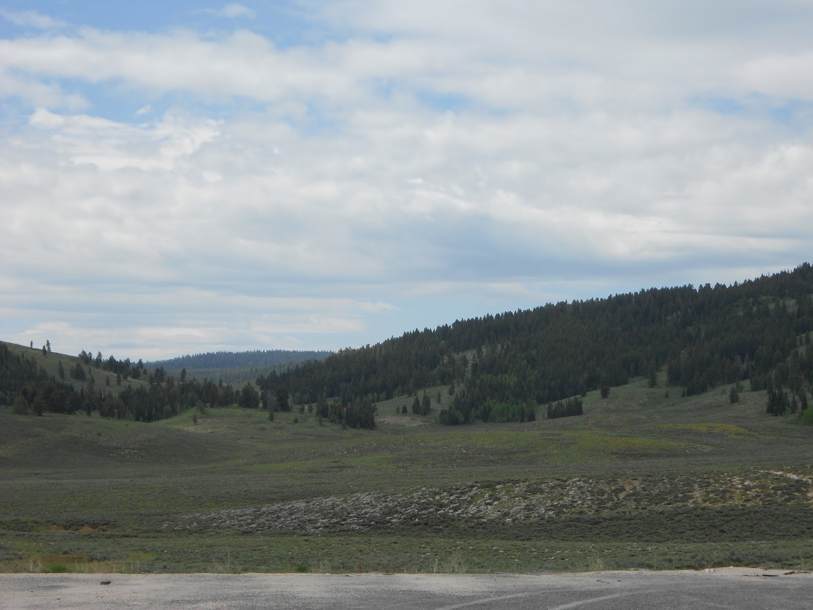
                         Middle Sinks area of upper Logan Canyon.

14. Kolob Arch, with a span of 310 feet, in Zion National Park. (Landscape Arch in Arches National Park measures 306-feet across.)
15. South Weber is in Davis County.
16. Bridal Veil Falls in Provo Canyon, with a 430-foot drop in two sections and an overall cascade of 604 feet.
17. Notch Peak, Millard County, has a 5,000-foot drop of almost 90 degrees on its west face.
18. Beaver, Iron and Millard
19. Levan
20. Bryce Canyon is an amphitheater — not a canyon — hollowed out of the Pink Cliffs by time, moisture and wind.


Answers to Part II
1. a. From Moab, at 4,000 feet, to Mount Peale, at 12,721 feet, has the greatest elevation difference at 8,721 feet.
2. c
3. b
4. c. The top of Little Cottonwood Canyon received 98.3 inches of moisture during 1983-84.
5. c. Callao, south of Wendover, had 0.71 of an inch of moisture during the 1952-53 water year.
6. b. Woodruff had a 50-degree below zero reading on Feb. 6, 1899.
7. b. St. George hit 117 degrees on July 5, 1985.
8. d. Neff's Cave, on lower Mount Olympus, is 1,170 feet deep.
9. b. The Jardine juniper in Logan Canyon is believed to be 3,200 to 3,500 years old.
10. a. Upper Red Castle Lake in the High Uintas is 11,600 feet above sea level.
11. b
12. c
13. b (7,725 square miles)
14. a (Although the county is 620 square miles, approximately 268 square miles of it is usable land. The rest is in the Great Salt Lake).
15. a (85,000 square miles).
16. c (9,706 feet above sea level).
17. b
18. c
19. d
20. b
SCORING
75-100: You're a geography whiz
60-74: You're very knowledgeable
45-59: Good score
30-44: You need to study a Utah map
Under 30: Sign up for Utah Geography 101

SOURCES: Utah State Highway maps; U.S. Forest Service maps; Deseret Morning News Archives; the National Weather Service; www.nps.gov;historyforkids.utah.gov.
(-Originally published in the Deseret News, April 30, 2004, by Lynn Arave.)

-NOTE: The author, Lynn Arave, is available to speak to groups, clubs, classes or other organizations about Utah history at no charge. He can be contacted by email at: lynnarave@comcast.net  


'Peak Performance' Test on Utah's Mountains

                                             Kings Peak.                                    (Photo by Ravell Call.)


THE Beehive State could easily have been nicknamed the "Mountain State."
That's because mountains can be found in all of the state's 29 counties. (Although Colorado has taller mountains, it contains a vast eastern plain that occupies a third of its land mass.)
There are almost 250 named mountain peaks in Utah that exceed 10,000 feet in height and many more that lack names. Kings Peak — Utah's highest point — sits at 13,528 feet above sea level.
The state's mountains are a critical part of the environment. For example, the mountains are watersheds and store snowpack, making Utah much more inhabitable than it would otherwise be as the nation's second-driest state.

They also help create Utah's "greatest snow on Earth" and offer other recreational opportunities, such as hiking and biking.

Can you pass this "Utah Mountains 300" test?


1. What is Utah's most famous mountain, at least by Hollywood standards?
2. Name Utah's second-highest mountain.
3. Behind the Uintas, what is the second-tallest mountain range in Utah?
4. If you hike near the biblically named Gog and Magog formations, you are near what county high point?
5. Name two significant Utah hikes that travel over something other than paving or dirt.
6. What Utah peak is surrounded by water and is the tallest point within a 10-mile area?
7. What is Park City's highest mountain?
8. What prominent Wasatch Mountain peak lost more than 50 feet of height in 1959 but stands taller than ever today?
9. What is the tallest peak in the Oquirrh Mountains?
10. What was the last major Utah mountain range to be surveyed and named?
-Can you decide:
1. For whom was Utah's tallest peak, Kings, named?
a. The king of England
b. Clarence King
c. Walter King
d. Larry King
2. The mountains east of Bear Lake are the:
a. Wellsville Mountains
b. Bear Lake Mountains
c. Cache Mountains
d. Wasatch Mountains
3. Beehive Peak, Pavant Range, southeast of Scipio, resembles a beehive on its north and east sides. However, on its west side, it resembles . . .
a. a human face
b. a pyramid
c. a lighthouse
d. none of the above
4. The highest peak in the Wasatch Mountains is:
a. Timpanogos Peak
b. Twin Peaks
c. Lone Peak
d. Mount Nebo
5. In what mountain range was Utah's coldest temperature recorded?
a. the Wasatch Mountains
b. the Uinta Mountains
c. the Wellsville Mountains
d. the La Sal Mountains
6. The towering mountains located east of Beaver in Beaver and Piute counties are:
a. Beaver Mountains
b. Tushar Mountains
c. Piute Mountains
d. Fremont Range
7. Utah's most "inaccessible" major mountain peak is:
a. Kings Peak
b. Ibapah Peak
c. Navajo Mountain
d. Deseret Peak
8. The steepest cliff in Utah comes off what peak?
a. Angel's Landing in Zion National Park
b. Notch Peak in the House Range
c. Timpanogos Peak
d. Kings Peak
9. Davis County's highest point is:
a. Thurston Peak
b. Francis Peak
c. Bountiful Peak
d. Davis Peak
10. Which Utah county has the lowest high point?
a. Cache
b. Millard
c. Weber
d. Rich
11. How tall is Salt Lake County's Mount Olympus?
a. 10,201 feet
b. 9,026 feet
c. 9,700 feet
d. 11,100 feet

                                  Navajo Mountain                     (Photo by Ravell Call.)

12. What landmark can be seen with the naked eye from the top of Navajo Mountain?
a. Grand Canyon
b. Rainbow Bridge
c. Grosvenor Arch
d. Hole in the Rock
13. What's the most unusual feature about Signal Peak, Washington County's high point?
a. A rock cairn on its summit
b. Its volcanic composition
c. It is forested on top
d. Its high temperature in summer
14. The top of Kings Peak, Utah's tallest point, could most accurately be described as:
a. A bald summit
b. A perennial snowpack
c. Piles of rock slabs
d. Lots of small, loose rock
15. Snowbird's tram goes to what elevation on Hidden Peak?
a. 11,000 feet
b. 10,992 feet
c. 12,000 feet
d. 10,000 feet
16. The Wasatch Mountain range reaches from:
a. Provo to Logan
b. Nephi to Logan
c. Provo to Wellsville
d. Nephi to Soda Springs, Idaho
17. Box Elder County's tallest mountain is:
a. Bull Mountain
b. Willard Peak
c. Sawtooth Peak
d. Promontory Point
18. Utah's San Francisco Mountains are located in what counties?
a. Beaver and Iron
b. Beaver and Millard
c. Washington and Iron
d. Kane and Garfield
19. Which of these characteristics best describe Mount Nebo:
a. Wasatch Range's tallest point
b. Composition of three individual peaks
c. Is at the south end of the Wasatch Range
d. Is biblically named
e. All of the above
20. The Abajo Mountains are nicknamed what?
a. Navajo Mountains
b. Indian Mountains
c. Blue Mountains
d. Horse Mountains

               The triple peaks of Mount Nebo.                                      (Photo by Ravell Call.)

Quiz answers
Fill in the blank
1. Ben Lomond Peak north of Ogden is said to have inspired the Paramount Pictures Corp. logo, as one of the company's founders, W.W. Hodkinson, grew up in Ogden. (However, the peak's slope has been exaggerated, Hollywood style.)

                                   South Kings Peak                                     (Photo by Ravell Call.)
2. South Kings Peak, which rises 13,512 feet above sea level. Located a mile south of Kings Peak, it was believed to be Utah's highest peak until 1966, when satellite measurements proved Kings Peak is taller.
3. The La Sal Range, east of Moab, rises to 12,721 feet above sea level.
4. Naomi Peak in Cache County. The summit rises 9,979 feet above sea level. Gog and Magog are northeast of Naomi Peak.
5. Virgin Narrows in Zion National Park travels mostly through the Virgin River. The trail to Delicate Arch in Arches National Park includes a long segment over slickrock.
6. Antelope Island's Frary Peak, which is 6,595 feet above sea level.
7. Jupiter Hill, which is 9,998 feet above sea level.
8. Francis Peak in Davis County. In 1959, it lost some 50 feet in height when it was leveled off by construction crews. Today, the tallest point of the peak stands 9,610 feet (including the 115-foot high Francis Peak radar apparatus).
9. Flat Top Mountain, which stands at 10,620. The peak is in Utah County, west of Provo.
10. The Henry Mountains, which are located between Capitol Reef and Canyonlands, were all but unknown until after the Civil War. The range, which stands at 11,522 feet, were not surveyed and named until the 1870s, making it one of the last in the nation to be mapped.

Multiple choice
1. c) The peak is named for Clarence King, a geologist, surveyor and former director of the U.S. Geological Survey
2. d) The Wasatch Mountains
3. b) a pyramid
4. d) Mount Nebo's north peak, at 11,928 feet above sea level, is 178 feet higher than Timpanogos Peak.
5. a) the Wasatch Mountains. Peter Sinks, which is found in the Wasatch Range southwest of the Bear Lake Summit, recorded an all-time Utah record low temperature of 69 degrees below zero on Feb. 1, 1985.
6. b) The Tushar Mountains, which rise to 12,169 feet above sea level.
7. c) Navajo Mountain, located northeast of Page, Ariz., near Lake Powell. The mountain, which stands 10,388 feet above sea level, located on the Navajo reservation and requires a special permit for backcountry access.
8. b) Notch Peak in the House Range southwest of Delta. The west side of this 9,655 peak features a 5,033-foot drop — with almost a 90-degree incline — to the Tule Valley below.
9. a) Thurston Peak, east of Layton, stands at 9,706 feet above sea level.
10. d) Rich County has an unnamed peak that is 9,255 feet above sea level. This is the highest point in that county the lowest amount Utah's other counties.
11. b) Mount Olympus is 9,026 feet above sea level.
12. b) Rainbow Bridge is visible from Navajo Mountain's north side.
13. c) While most other Utah county high points are well above the timberline, Signal isn't.
14. c) Kings Peak is composed of a thick pile of mostly flat, rock slabs.
15. b) The Snowbird tram reaches 10,992 feet above sea level, though it is commonly rounded off to 11,000 feet.
16. d) The Wasatch Mountains go from Nephi to Soda Springs, Idaho.
17. a) Bull Mountain, at 9,934 feet above sea level, is located in the Raft River Mountains northwest of Snowville.
18. b) The San Francisco Mountains straddle Beaver and Millard counties and are sandwiched between the Wah Wah and the Beaver Mountain ranges.
19. e) Mount Nebo has all of those characteristics
20. c) The Abajo Mountains, located west of Monticello, are sometimes nicknamed the "Blue Mountains," or "Blues," for their color. The range's highest point, Abajo Peak, rises to 11,019 feet above sea level.
SOURCES: U.S. Geological Survey; U.S. Forest Service and Utah highway maps.
SCORE
Give yourself four points for each of the "Do you know" questions and three points for each of the "Can you decide" questions answered correctly. There are 100 points possible.
80-100: You're a Utah mountain expert
60-79: You know your way around Utah's back country
40-59: You'd better pull out the topographical maps
20-39: You'd better invest in some hiking experiences
Below 20: Are you living in Kansas?

(-Originally published in the Deseret News, March 31, 2006, by Lynn Arave.)


-NOTE: The author, Lynn Arave, is available to speak to groups, clubs, classes or other organizations about Utah history at no charge. He can be contacted by email at: lynnarave@comcast.net