KINGS Peak is Utah's highest point at 13,528 feet above sea level. As such, it is an often hiked summit by peak baggers and many hikers each year.
But when is Kings Peak NOT Kings Peak?
On any hike or reference to the peak as the state's tallest before 1966.
Today's Kings Peak was undiscovered until the mid-1960s.
Prior to satellite measurements, the U.S. Geological Survey pegged today's South Kings Peak (13,512 feet) as Utah's tallest. Any hikers going to Kings Peak prior to 1966 would have likely scaled the actual state's second-tallest peak as their first priority instead.
In fact, until 1966, surveyors thought South Kings Peak was only 13, 498 feet above sea level.
I've talked to some senior hikers who scaled Kings Peak before 1966 and they said they scrambled right by the north side of today's Kings Peak, en route to what they then erroneously thought was the highest point in Utah.
Kings Peak (north) was simply generally ignored by most hikers until 1966.
Now this isn't to say that no one knew about today's Kings Peak, or didn't climb it as a lofty summit too.
A Jan. 23, 1914 article in the Vernal, Utah Express newspaper referred to North Kings Peak (today's actual higher summit) as being 13,496 feet above sea level, while South Kings was pegged then as being just two feet taller at 13,498 feet.
In reality, the measurement of South Kings was short by 14 feet, but North Kings was shortchanged by 32 feet.
A Jan. 30, 1947 article in the Vernal Express newspaper stated that in the mid-1940s, two men climbed North Kings Peak and constructed a two-foot high monument on the highest part of the summit.
Then, one of the men proclaimed, "There, that makes them even."
Other newspapers of the era referred to the "twin Kings Peaks."
So, both Kings Peaks were occassionally climbed, though as recent at the early 1960s, Forest Service estimates were that only 30 or so hardy souls climbed the believed-to-be highest Kings Peak in a single summer.
By the 21st Century, estimates were that 30 or more hikers were scaling Kings Peak daily from late June into late August.
Now the fact that the highest Kings Peak has changed does make historical differences. For example, in June of 1961, a helicopter crash landed on Kings Peak. The crewmen walked away unharmed, but this crash took place on today's South Kings Peak. Good thing too, as South Kings has a lot more usable space on top. If they would have crashed on today's Kings Peak, the copter likely would have slid down hundreds of feet on one side or the other.
-Now this stacking rocks upward to make one peak taller is a frequent game for some peak baggers. I've sometimes done it myself and the dense, flat slabs of rock atop north Kings Peak make this rather like stacking hay.
Until wind or people knock the slabs over, it seems you really do make a peak taller.
After all, the summit of Kings Peak seems to be mostly loose slabs of rock.
It makes sense that a satellite would bounce a signal off the tallest point of any peak. However, I've asked surveyors about making a peak taller by stacking rocks and I have never received even an answer in jest, as to its effect .... They act like that's a question not to be asked!
--Also, there's this legend I've heard about Sir Edmund Hillary, one of the first two men to conquer Mt. Everest in 1953, that he also climbed Kings Peak.
This is true, but it was in the summer of 1978 when Sears and Kellwood (an outdoor equipment manufacturer), was testing camping gear in the Yellowstone drainage of the High Uintas.
Hillary, age 59 then, was said to have had little trouble hiking Kings Peak and the Uintas.
Hillary had also floated the Green River in Utah during 1969, as part of the centennial commemoration of John Wesley Powell's 1869 original exploration of the area. So, he spent time in the Beehive State, if only because the Kellwood company had an office in St. George, Utah.
(This is according to "Camping With Ed: From the Field Test Journals" book by
William N. Kelley, with a forward by Hillary himself.)
--Even though Kings Peak is the highest "point" in Utah, it isn't really the mountain with the sharpest rise from the surrounding terrain.
For example, most of the valleys surrounding Kings Peak are at just over 10,000 feet in elevation. This means there's a difference of just 2,700 approximate feet from valley to peak in the area. In contrast, Mount Peale (12,721 feet above sea level) has the greatest difference in this vertical relief category. Moab, at about 4,000 feet elevation, means Peale rises about 8,721 feet above its surrounding topography — the most of anywhere in Utah.
Utah is also a large enough state that some peculiarities exist in its mountains. For example, generally the farther south you travel, the higher the timberline (not accounting for variances in south or north facing slopes.) For example, this means that Thurston Peak, Davis County, at 9,706 feet above sea level, is well above the treeline. Yet 300 miles to the south, Signal Peak, Washington County's highest point at 10,365 feet, is completely forested in.
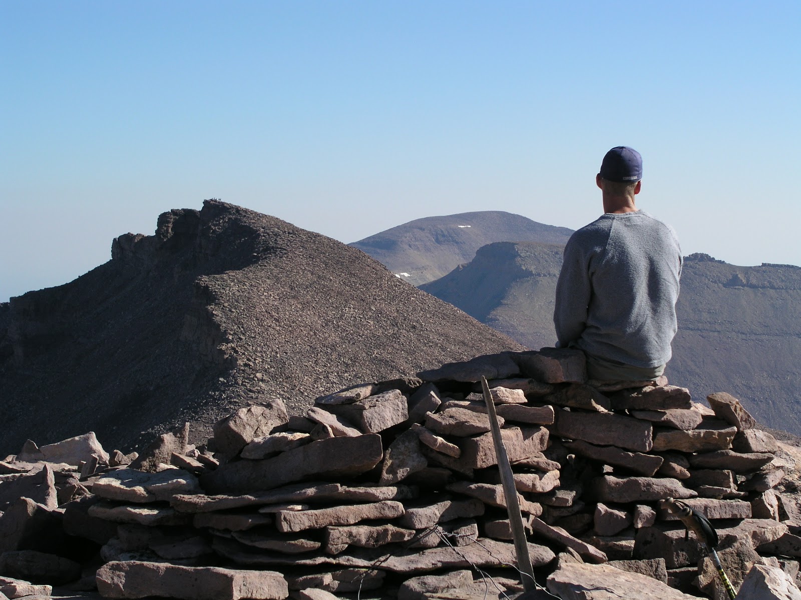
(The accompanying photograph by Ravell Call shows an unusual, "triple peak" view. The picture shows Craig A. Lloyd admiring the view from atop South Kings Peak and looking toward Kings Peak and further away, Gilbert Peak. So, Utah's 3 tallest summits are all highlighted in this picture.
The second photo shows Lynn Arave on the south side and just below Kings Peak, headed for South Kings Peak. The third photo below, also by Ravell Call, shows a bunch of hikers in Henry's Fork Basin, with Kings Peak rising up in the background, in between Gunsight Pass.
The fourth photo below shows the old Kings Peak metal plaque, circa 1990. It has been missing since about 1999.)


-NOTE: The author, Lynn Arave, is available to speak to groups, clubs, classes or other organizations about Utah history at no charge. He can be contacted by email at: lynnarave@comcast.net
No comments:
Post a Comment