Showing posts with label Kings Peak. Show all posts

Thursday, February 11, 2021

1906: When Utah had a 'missing' mountain


                                                             The top of Kings Peak.

CAN you lose a mountain?
The Richfield Reaper newspaper highlighted such a supposed mystery in its April 5, 1906 edition and that query cannot be found anywhere else. At the least it highlights how little was known about Utah’s highest summits in the early 20th Century.


“Where is Mount Hodges?” the newspaper asked in a story titled, “The mountain giants of Utah.” It claimed Utah had seven peaks over 13,000 feet in height and that Mount Hodges was the kingpin of them all at 13,687 feet.
“This is about the largest piece of property that has ever been lost, strayed or stolen in a civilized country, and in comparison would make any of the numerous lost mines assume diminutive proportions. A mountain reaching nearly three miles vertical above sea level, unless it has changed its name and is posing under a nom de plume, ought not to be difficult to find. Mount Hodges, the largest unlocated peak in Utah, was named many years ago by Clarence King of the geological survey. While no reward is offered for its apprehension, word of its whereabouts would doubtless be gladly and thankfully received by the residents of the state,” the essence of the Richfield, Utah newspaper report stated.
The old Richfield newspaper story reported that Mount Hodges could not be found on any map. The writer did not list his source for Mount Hodges even existing. Yet, he also listed six other Utah peaks that were believed to be over 13,000 feet – Gilbert, Emmons, Wilson, Lovenia, Tokewanna and Mt. Peale. That’s where the answer to his puzzle is likely found.
Today, a Google or map search yields no Mount Hodges and no similarly named peak that rises over 13,000 feet.
Here’s the actual height in feet and the ranking among Utah’s tallest summits for the six mountains he listed: 3. Gilbert, 13,442; 4. Emmons, 13,440; 5. Lovenia, 13,219; 6. Tokewanna, 13, 165; 9. Wilson, 13,049; and 14. Mt. Peale, 12,721.
What’s missing on that modern and accurate list of tallest summits in Utah is none other that Utah’s highest, Kings Peak, 13,528 and the runnerup, South Kings Peak, 13,512.

                                South Kings Peak.

Could it be that whatever source the Richfield newspaper was using more than 11 decades ago did not have the Kings Peak name, but Hodges instead? Kings Peak is actually named for Clarence King of the U.S. Geological Survey and as the state’s tallest fits this puzzle nicely.
-Notwithstanding the lack of facts in 1906 for those mountains, a much older story in the Deseret News story of Aug. 26, 1874 was more on the mark, but still incomplete.
 The story lamented how neighboring Colorado boasted having six peaks with summits over 14,000 feet, while Utah has none. (In reality, Colorado has 56 named summits over 14,000 feet.)

          Mount Elbert in Colorado, that state's highes peak at 14,433 feet above sea level.

“This beats the best we can do in Utah,” the report by C.R. Savage stated. “Peak climbing is fashionable in that Territory. With us it is not. Visitors to Utah get all their impressions from our city hotels. Very few pierce the hidden wonders of the Wasatch, as seen in Big Cottonwood and American Fork canyons, southward, our Clear Creek, Little Zion valleys, etc.”
What was “Little Zion?” The Deseret News of April 16, 1875 stated, “Those who admire the wonders of nature should pay a visit to Little Zion valley.”

This was one of the very first references to what would become Zion National Park. “Little Zion” was its name then, as some in Utah Territory still thought strictly speaking, Salt Lake City was the true Zion.
Even as late as 1916, “Little Zion” was how the future national park was still referred to. The Washington County News of St. George in its Oct. 12, 1916 edition called it that.


-Access to Zion National Park was also Not a direct route during its early years. The Beaver County News of Oct. 21, 1937 reported on a new $240,000 bridge over the Virgin River that shortened the distance between Hurricane and St. George by 13 miles – and that this also shortened the distance to Zion Park by the same distance.


The story stated the new bridge “makes unnecessary further use of the one of the most tortuous and dangerous dugways in the state.”
The Hurricane Chamber of Commerce hosted a full day of celebration for the new bridge, noting that a new high school, LDS chapel and a culinary water system were all added to Hurricane in the past two years.


Saturday, September 22, 2018

When Sir Edmund Hillary of Mount Everest fame hiked the High Uintas -- twice


               South Kings Peak, with Kings Peak rising in the center background.

 THERE'S a legend about Sir Edmund Hillary, one of the first two men to conquer Mt. Everest in 1953, that he also climbed Kings Peak.
This is actually a true story, but it happened in the summer of 1978 when Sears and Kellwood (an outdoor equipment manufacturer), was testing camping gear in the Yellowstone drainage of the High Uintas.
Hillary, age 59 then, was said to have had little trouble hiking Kings Peak and the Uintas.
No stranger to Utah, Hillary had also floated the Green River during 1969, as part of the centennial commemoration of John Wesley Powell's 1869 original exploration of the area. (Source: http://www.hupc.org)

                                   Kings Peak on its southern side.

And, Sir Hillary had first visited the High Uintas in July of 1962, when he and his family enjoyed a 4-day camping trip in the Granddaddy Basin area.
"New Zealand mountain climber and family thrilled with pack trip into High Uintas areas" was a July 19, 1962 headline in the Uinta Basin Standard newspaper.
Duchesne District Ranger Larry Colton served as a guide for the Hillarys, as the family hiked and fished.
According to the newspaper, Hillary's wife, Lady Louise, and their three children -- Peter, 7, Sarah, 5, and Belinda, 3. -- ventured into the primitive area of the High Uintas.
Sir Hillary was under contract with the U.S. Forest Service to make a report on campgrounds in the western U.S. that year.

            Mirror Lake, with Bald Mountain rising in the background.

The family began at Mirror Lake, backpacked into the Granddaddy Basin area and then returned to Mirror Lake. They did a lot of hiking, but not any serious peaks. Sir Hillary said this trip was for finding "smiling" and not "fierce" peaks, according to the newspaper account.
The only negative to the trip were all the mosquitoes that they encountered, but that they got used to them.
Another Utah newspaper, the Vernal Express, reported that on that 1962 trip, Sir Hillary declared it "absolutely wonderful."

                      The High Uintas, northwest of Mirror Lake.

-A version of this story was also published in the Deseret News on Sept. 22, 2018.

Friday, May 19, 2017

Utah Outdoor Myths


By Lynn Arave

UTAH is high elevation territory, with a vast amount of outdoor opportunities and open spaces. However, there are some things about the Beehive State's outdoors that a simply myths -- incorrect beliefs.
-Here are some of those myths:


1. The Crimson Trail in Logan Canyon is so named because of the spectacular fall colors there.
FALSE:
This family-friendly, moderate hike was originally called “The China Wall” in its earliest days, because of the long wall-like formation that lines both sides of Logan Canyon in the area.
Later, the Crimson name took over, often wrongly believed to be based on the vivid fall colors of foliage in the area — which, arguably, are indeed striking there each autumn.
However, there is a historical reason for the Crimson title.
From 1877 to 1926, there existed a “Brigham Young College” (and high school) in Logan, sponsored by The Church of Jesus Christ of Latter-day Saints. This trail in Logan Canyon was often considered the “Senior Walk” for graduating students and the school’s colors were crimson and gold. Hence the “Crimson” trail name.

When the college closed, Logan High was built on the site and it retained the same school colors. -- From the Ogden Standard-Examiner of Sept. 1, 2016, by Lynn Arave.


                       Looking across Logan Canyon, south to where the Crimson Trail is.


                       The Wellsville Mountains from near Sardine Summit.

2. The Wellsville Mountains are the steepest mountains in the world.
FALSE:


Some reports claim the Wellsville Range is the steepest mountains in the world. They certainly are among the steepest in Utah — especially near Sherwood Hills. However, geographically speaking, there is no standard for determining the steepness of mountains, and parts of the Brooks Range in Alaska would surely exceed the Wellsvilles. -- From the Deseret News, June 22, 2001.

-Also, the Wellsville Mountains are a sub section of the Wasatch Mountain range.


                                         The south side of Kings Peak.

3. Kings Peak is so named because it is the king, the tallest of Utah's mountains.
FALSE:
As the  original metal plaque atop Kings Peak (shown below) states, the mountain is named for Clarence King, who was the first director of the U.S. Geological Survey (1979-1881.)
Kings Peak is Utah's tallest mountain at 13,528 feet above sea level.


                       Plaque atop Kings Peak, from the 1990s. 


                Kings Peak, center, as a triangle shape, as seen from Henry's Fork Basin.


4. Kings Peak has always been known as the highest peak in Utah.
FALSE:

Kings Peak, High Uintas, hasn’t always been recognized as the highest point in Utah. An April 15, 1911 Ogden Standard-Examiner article stated that Emmons Peak in the Uintas, at 13,694 feet above sea level, was tallest. That was the general belief of that year.

(In reality, Emmons is today’s 4th tallest in the Utah at 13,440 feet.)

However, just two years later, the Vernal Express newspaper on Jan. 23, 1913 stated that South Kings Peak was the state’s tallest summit at 13,498 feet. North Kings was second at 13,496 feet.

The Roosevelt Standard newspaper reported on Aug. 20, 1924 that members of Salt Lake’s Wasatch Mountain Club had hiked Kings Peak. On top, they “salted the peak,” by placing a bottle of briny water from the Great Salt Lake on its lofty summit.

The water bottle also had the signatures of Utah Gov. Charles R. Mabey and others on it.

A Jan. 30, 1947 article in the Vernal Express newspaper stated that in the mid-1940s, two men climbed North Kings Peak and constructed a two-foot high monument on the highest part of the summit.

Then, one of the men proclaimed, "There, that makes them even."

Other newspapers of the era referred to the "twin Kings Peaks."

For 53 years, that was the accepted belief, that South Kings was tallest in the Beehive State. So, anyone hiking Utah’s tallest in that time period went to the southern peak, missing or passing by the actual tallest peak – (North) Kings Peak at 13,528 feet.

In June of 1961, a helicopter crash-landed on Kings Peak. The crewmen walked away unharmed, but this crash took place on today's South Kings Peak. (Good thing too, as South Kings has a lot more usable space on top. If they would have crashed on today's Kings Peak, the copter likely would have slid down hundreds of feet on one side or the other.)

It wasn’t until 1966 that new measurements by satellite proclaimed the north Kings as highest and re-measured South Kings Peak to be second-highest at 13,512 feet.

Ironically, the U.S. Forest Service had placed the first official plaque on Kings Peak one year earlier in 1965. Back then, it estimated that only 30 people a year hiked on average to the summit. -- From the Ogden Standard-Examiner, July 24, 2014, by Lynn Arave.


        Mount Nebo from the south end,                               Photo by Ray Boren

5. Mount Timpanogos is the tallest summit in the Wasatch Mountains.
FALSE:

Consult any accurate map, like Forest Service or USGS Maps and they will confirm that Mount Nebo is 11,928 feet above sea level, while Mount Timpanogos is only 11,750 feet.

-Additionally, the Wasatch Mountains extend much further than most realize. They stretch from Mount Nebo on the south to Soda Point, just north of Grace, Idaho, on the north end. Thus, even the mountains west of Bear Lake are Wasatch Mountains.


                 Ravell Call atop Mount Nebo South Peak.                    Photo by Ray Boren.


                   Soda Point, the northern most part of the Wasatch Mountains, in Idaho.


                             Utah's southeast border sign, near Four Corners.

5. Utah's state borders are perfectly straight lines, north to south.
FALSE:

Utah has been called a "pretty, great state." Surprisingly it's a "pretty crooked state," too. And we're not talking crime, but the state's deceptively tidy shape.

Minus the distinctive notch in its northeast corner, Utah is commonly thought of as a perfect rectangle. However, those fourth-grade Utah history students are drawing it all wrong with straight lines.In fact, if the borders had been drawn straight - as intended - some Idaho border towns, like Franklin, might straddle the state line. At least one other community, Strevell - now a ghost town - would definitely have been in Utah.

Also, the state would be somewhat larger, maybe several hundred acres bigger, because of land that ended up in Idaho, Colorado or Wyoming.

Utah's true borders contain at least seven crooked spots that are considered "pretty" crooked by mapmaking standards, though perhaps only "slightly" irregular by public perceptions.

These irregularities vary from as small as a quarter of a mile off the true mark to almost a mile in error.

Looking closely at the official Utah State Highway Map, two of the irregularities can be spotted. On the small statewide map on the cover of the Utah Atlas & Gazetteer, a third crooked spot can be seen.

With the Gazetteer's detailed topographical maps, three more crooked locations can be readily seen. The seventh error stands out most on the Bureau of Land Management's overall state map.

Three of the irregularities involve a meandering line, while three others look like notches and the seventh resembles a hump. (See story above.)

Were these six crooked spots meant to be there?

"They're survey errors that were made when the state boundaries were laid out," said Gary Nebeker, chief of operations for the Salt Lake office of the U.S. Geological Survey Center.

The Salt Lake office of the Bureau of Land Management is the caretaker of the original survey documents made on the Utah state line boundaries. It agrees on the cause for the crooked lines.

"It was primarily survey errors," said Daniel W. Webb, chief cadastral surveyor for the BLM in Salt Lake City.

He said surveyors in the late 1800s had crude instruments and pulled 66-foot-long chains for measurements.

A colleague of Webb, Dave Cook, is a cartographer with almost 40 years of map experience with the BLM and the National Weather Service.

After several hours of examining the original, 100-plus-year-old diaries of the different federal surveyors, he could find no apparent reasons for their mistakes.

Cook speculated that surveyors were paid by the mile, so they were in a hurry. If they made a mistake - even if they knew it - they weren't likely to go back and redo it.

Survey crews traveled in parties of one to two dozen men and suffered harsh conditions on Utah's rugged borders in the 1870s and 1880s. Rocks and wooden posts were the common markers left by survey parties. They theoretically put markers every mile along state boundaries, though obviously some are missing more than a century later.

Cook said the sad thing is that we live with these mistakes. Longtime federal laws make states rely on existing survey monuments for borders, whether they are in the right place or not.

"Monuments prevail," he stressed.

Those laws have been challenged by various courts over the years and have always been upheld.

Even with exact location technology available with orbiting satellites, no federal entity has the time or money to correct such errors, according to Webb.

At best, small adjustments may be made as specific landownership issues are raised.

Since Utah's borders are crooked, so are those in the adjoining states of Idaho, Wyoming and Colorado. Cook believes many other states probably have similar boundary problems. For example, the same surveyor who made at least three mistakes across the Utah-Idaho border also kept going west to the Pacific Ocean.


Checking detailed Oregon maps, he made at least four similar mistakes along its southern border with California. (-From the Deseret News, July 26, 1998, by Lynn Arave.)


Thursday, July 31, 2014

When Kings Peak wasn’t Utah’s ‘tallest’


                               The view from the southeast side of Kings Peak.


By Lynn Arave

Kings Peak, High Uintas, hasn’t always been recognized as the highest point in Utah.
An April 15, 1911 Ogden Standard-Examiner article stated that Emmons Peak in the Uintas, at 13,694 feet above sea level, was tallest. That was the general belief of that year.
(In reality, Emmons is today’s 4th tallest in the Utah at 13,440 feet.)
However, just two years later, the Vernal Express newspaper on Jan. 23, 1913 stated that South Kings Peak was the state’s tallest summit at 13,498 feet. North Kings was second at 13,496 feet.
It stated that a "South Baldy" and a "North Baldy" were previously thought to be Utah's tallest summits at 12,210 and 12,680 feet above sea level.
-Back in 1881, it was even more sketchy. According to the Salt Lake Tribune of Aug. 18, 1881, Gilbert's Peak was believed to be Utah's tallest at 13,687 feet above sea level. Kings Peak was not even mentioned back then.
-In 1903, it wasn't much more accurate. A Salt Lake Tribune article from Dec. 8, 1903 reported that Uintah County surveyors were claiming that Emmons Peak was tallest in the state at 14,449 feet above sea level. (They were just 1,009 feet off the mark!)
-The Richfield Reaper newspaper of April 5, 1906 reported that a Mount Hodges had supposedly been named by U.S. surveyor Clarence King in the 1800s, but that now no one seems to know where that peak actually is. The newspaper called it "the largest unlocated peak in Utah." Could that have been today's South Kings Peak? Perhaps.
-The Salt Lake Tribune of April 10, 1914 finally got its somewhat right: it had Kings Peak as tallest at 13, 498, followed by Mount Emmons, 13,428 and Gilbert Peak, 13, 422.
(Lacking satellite measurements, North Kings would not be correctly named highest in the state until 1966.)
-The Roosevelt Standard newspaper reported on Aug. 20, 1924 that members of Salt Lake’s Wasatch Mountain Club had hiked Kings Peak (today's South Kings Peak). On top, they “salted the peak,” by placing a bottle of briny water from the Great Salt Lake on its lofty summit.
The water bottle also had the signatures of Utah Governor Charles R. Mabey and others on it.


A 1940s map pegged Kings Peak as the state's tallest at 13,498 feet above sea level.

A Jan. 30, 1947 article in the Vernal Express newspaper stated that in the mid-1940s, two men climbed North Kings Peak and constructed a two-foot high monument on the highest part of the summit.
Then, one of the men proclaimed, "There, that makes them even."
Other newspapers of the era referred to the "twin Kings Peaks."
For 53 years, that was the accepted belief, that South Kings, was tallest in the Beehive State. So, anyone hiking Utah’s tallest in that time period went to the southern peak, missing or passing by the actual tallest peak – (North) Kings Peak at 13,528 feet.
In June of 1961, a helicopter crash landed on Kings Peak. The crewmen walked away unharmed, but this crash took place on today's South Kings Peak. (Good thing too, as South Kings has a lot more usable space on top. If they would have crashed on today's Kings Peak, the copter likely would have slid down hundreds of feet on one side or the other.)
It wasn’t until 1966 that new measurements by satellite proclaimed the north Kings as highest and re-measured South Kings Peak to be second-highest at 13,512 feet.
(Ironically the U.S. Forest Service had placed the first official plaque on Kings Peak one year earlier in 1965. Back then, it estimated that only 30 people a year hiked on average to the summit.)

          The view looking down from Anderson's Pass to Heny's Fork,west of Kings Peak.

Kings Peak, Duchesne County, though it is the king of Utah peaks, is actually named for Clarence King of the U.S. Geological Survey, who explored the Uinta Mountains from 1968-1871. He was later the director of the Geological Survey.
By the 1970s, the Forest Service had a metal plaque on the correct tallest Kings Peak. However, that plaque vanished in the late 1990s, presumably by vandals, who either took it, or cast it off nearby cliffs.
 There's also a legend about Sir Edmund Hillary, one of the first two men to conquer Mt. Everest in 1953, that he also climbed Kings Peak.
This is actually a true story, but it happened in the summer of 1978 when Sears and Kellwood (an outdoor equipment manufacturer), was testing camping gear in the Yellowstone drainage of the High Uintas.
Hillary, age 59 then, was said to have had little trouble hiking Kings Peak and the Uintas.
(No stranger to Utah, Hillary had also floated the Green River during 1969, as part of the centennial commemoration of John Wesley Powell's 1869 original exploration of the area. He also backpacked with his family in the High Uintas in the summer of 1962.)
Dozens a day each summer are likely hiking to Kings Peak in the 21st Century.
Most popular starting point is the Henry’s Fork trailhead, accessed by seven miles of paved road and almost 20 miles of dirt road from Mountain View, Wyo.
Roundtrip hike distance is 30 miles, with a 4,128-foot elevation gain. The last mile is a scramble over large, loose slabs of rock.


               The author atop South Kings Peak, with Kings Peak in the background.

By the 1990s, some hikers began taking a steep, rock slide "shortcut," that directly accesses Anderson's Pass, instead of taking the traditional path over Gunsight Pass.
Kings Peak can be hiking in one, long extreme day, but most do conquer it in a two, or three-day backbacking trip and camping over at places like Dollar Lake.
At least one Salt Lake group snowshoes or cross country skis to Kings Peak each winter.
Not surprisingly, though Kings Peak is remote and almost 30 air miles from the nearest town, there is pretty good cell phone reception there (though in the surrounding valleys it is almost non-existent).
Danger from lightning storms is the key danger atop Kings Peak.
-Finally, a helicopter crashed on Kings Peak on June 16, 1961. This "Kings Peak" back then was actually today's South Kings Peak, state's second tallest. The crew was able to walk away and eventually met a rescue party. The copter was repaired and all traces of it were removed. (-From the Uintah Basin Standard Newspaper of June 22, 1961.)

-In 1933, some of the streams in the High Uintas had name changes. For example, today's Yellowstone River, located west of Kings Peak, used to be called Fast Fork, before that time. 
Lake Fork, which flows through Moon Lake, used to called West Fork. (-From the Vernal Express newspaper of May 11, 1933.)

(-Some material originally published by Lynn Arave in the Ogden Standard-Examiner on July 25, 2014.) 


-NOTE: The author, Lynn Arave, is available to speak to groups, clubs, classes or other organizations about Utah history at no charge. He can be contacted by email at: lynnarave@comcast.net  


Saturday, June 21, 2014

Mountainous State of Utah – ‘Life elevated’


                            The south side of Kings Peak, 13,528 feet.


By Lynn Arave

“LIFE elevated” has become the state’s slogan. Is that just all hype?
No, Utah is truly mountain territory and there are peaks scattered all over the state. Elevations in Utah range from 13,528 feet (Kings Peak) down to Beaver Dam Wash (2,185 feet).
Utah is indeed “High on the Mountain Top,” as a popular LDS Church hymn proclaims.
In fact, if you take the elevations of the highest point in each county for each of the 50 states and average them together, Utah is the “highest” state of them all.
Yes, six states -- Alaska, California, Colorado, Hawaii, Washington, Wyoming all boast mountains taller than Utah's highest, Kings Peak. However, those states also contain more low-elevation counties, reducing their statewide average.
The average of county high points for Utah is 11,226 feet, 435 feet higher than Colorado's 10,791. Nevada is third at 10,765 and Wyoming fourth at 10,179.
New Mexico, (9,404); Alaska, (9,259); Arizona (8,703); Idaho, (8,290); Montana, (7,502) and Hawaii (7,465) round out the top ten.  

                 Kings Peak, center, as reflected in a pool in Henry's Fork Basin

This formula was originally publicized by Winford Bludworth of Salt Lake City in the early 1990s. It was also used by Andy Martin of Tucson, Ariz., in his “County Highpoints” book, published a few years later.
(Of course, it does depend on what formula you use to determine average elevation, but just about any way you do it, Utah or Colorado will probably be the top state.)
 Note that Colorado does have twice as many counties as Utah does. Also, Colorado contains fifty-three 14,000-foot-plus peaks, while Utah has none. Yet, despite having many taller peaks than Utah, the eastern third of Colorado is a sloping plain toward Nebraska and Kansas, devoid of significant mountains.
A major reason for the Beehive State’s dominance is that it has mountains all over -- there are no "plains.” For example, even Washington County, containing St. George and the Beaver Dam Wash, soars to 10,000-feet plus in nearby mountains.
Beaver Dam Wash, the lowest Utah point is even taller than the high points of 13 other states. In fact, Utah's Rich County (9,255 feet), the lowest county “high point” in Utah, is taller than the high point of 37 other states.  Plus, it's the highest of the low county high points in all 50 states.

Highest point in each of Utah's 29 Counties:
Beaver: * Delano Peak, 12,169.
Box Elder:  "Bull Mountain," 9,934.
Cache: Naomi Peak, 9,979.
Carbon : Monument Peak, 10,452.
Daggett: * "Eccentic" bench mark, 12,276.
Davis:  * Thurston Peak, 9,706.
Duchesne : Kings Peak, 13,528.
Emery: East Mountain, 10,743.
Garfield:  Mt. Ellen, 11,522.
Grand:  Mt. Waas, 12,331.
 Iron: Brian Head, 11,307.
 Juab:  Ibapah Peak, 12,087.
 Kane:  ** Andy Nelson Peak/Gooseberry Point's S.E. Ridge, 10,027.
 Millard: Mine Camp Peak, 10,222.
 Morgan: * Thurston Peak, 9,706.
 Piute:  Delano Peak, 12,169.
 Rich: Bridger Peak/Swan Peak, north ridge, 9,255.
 Salt Lake:  American Fork Twin Peaks, 11,489.
 San Juan : Mt. Peale, 12,721.
 Sanpete: South Tent Mountain, 11,285.
 Sevier:  Fish Lake Hightop, 11,633.
 Summit:  Gilbert Peak, 13,442.
 Tooele:  Deseret Peak, 11,031.
 Uintah:  * "Eccentric" bench mark, 12,276.
 Utah:  North Nebo, 11,928.
 Wasatch: * Mount Cardwell, 10,743.
 Washington:  Signal Peak 10,365.
 Wayne:  Bluebell Knoll, 11,322.
 Weber:  Willard Peak, 9,764.
 *Shared high point with another county.
   
                               Willard Peak from the northwest at Inspiration Point.


The highest peaks in the Top of Utah:
(Note: All peaks are in Wasatch Range, unless otherwise note. Also, some summits straddle the county lines.)

 Box Elder County’s 5 tallest named peaks:
1. “Bull Mountain,” Raft River Mountains, 9,934
2.  Willard Peak, 9,764
3. George Peak, Raft River Mountains, 9,601
4.  “Inspiration Point”/Willard Mountain, 9,422
5.  Box Elder Peak, Wellsville Mountains, 9,372

              Thurston Peak, center, Davis County's highest summit.


Davis County’s 5 tallest named peaks:
1. Thurston Peak, 9,706
2. “Layton Peak,” 9,571.
3. Francis Peak, 9,547
4. “Ed’s Peak,” 9,381
5. Bountiful Peak, 9,259

Morgan County’s 5 tallest named peaks:
1. Thurston Peak, 9,706
2. Layton Peak,” 9,571.
3. Francis Peak, 9,547
4.   “Ed’s Peak,” 9,381
5.  DeMoisey Peak, 9,370

                       From the top of Mount Ogden looking northwest to Ben Lomond Peak.


Weber County’s 5 tallest named peaks:
1.  Willard Peak, 9,764
2. Ben Lomond Peak, 9,712
3. Mount Ogden, 9,572
4. Allen Peak, 9,465
5. Wolf Creek/James Peak, 9,422

Utah’s 10 tallest named mountain peaks:

   1. Kings Peak, Uinta Mountains, Duchesne County, 13,528.
   2. South Kings Peak, Uinta Mountains, Duchesne County, 13,512.
   3. Gilbert Peak, Uinta Mountains, Summit and Duchesne counties, 13,442.
   4. Mount Emmons, Uinta Mountains, Duchesne County, 13,440.
   5. Mount Lovenia, Uinta Mountains, Summit and Duchesne counties; 13,219.
   6. Tokewanna Peak, Uinta Mountains, Summit County, 13,165.
  7. Mount Powell, Uinta Mountains, Summit County, 13,159.
  8. “Wasatch Peak," bench mark, Uinta Mountains, Summit County, 13,156.
  9. Wilson Peak, Uinta Mountains, Summit and Duchesne counties, 13,049.
 10. "Squaw Peak" bench mark, Uinta Mountains, Summit County, 12,990.
   Note: There are 14 unnamed peaks over 13,000 feet above sea level in the Uinta Mountains.


 Tallest Utah Mountains NOT found in the Uintas Range:
1. Mount Peale, La Sal Mountains, San Juan County, 12,721.
 2. Mount Mellenthin, La Sal, Mountains, San Juan County, 12,645.
    3. Mount Tukuhnikivatz, La Sal Mountains, San Juan County, 12,482.
    4. Mount Waas, Grand County, 12,331.
    5. Manns Peak, Grand County, 12,272.
    6. Mount Tomasaki, La Sal Mountains, Grand County, 12,239.
    7. Delano Peak, Beaver and Piute counties, 12,169.
    8. Mount Belknap (or "Belnap") Beaver and Piute counties, 12,137.
    9. Mount Baldy, Beaver and Piute counties, 12,122.
   10. Ibapah Peak, Juab County, 12,087.
   11. Haystack Peak, Juab County, 12,020
   12. Mount Holly, Beaver and Piute counties, 11,985.
   13. Ibapah Azimuth, Juab County, 11,987.
   14. Mount Nebo North Peak, Utah and Juab counties, 11,928.
   15. Mount Nebo South Peak, Utah and Juab counties, 11,877.
   16. Mount Nebo Middle Peak, Utah and Juab counties, 11,824.
   17. South Mountain, San Juan County, 11,817.
   18. Mount Brigham, Piute County, 11,757.
   19. Mount Timpanogos “North Peak,” Utah County, 11,750.
  20. "Mount Timpanogos South Peak," Utah County 11,722.

SOURCES: USGS and U.S. Forest Service maps, “High in Utah” book, by Michael R. Weibel and Dan Miller.

(-Originally published by Lynn Arave in the Ogden Standard-Examiner on June 16, 2014.)

   
-NOTE: The author, Lynn Arave, is available to speak to groups, clubs, classes or other organizations about Utah history at no charge. He can be contacted by email at: lynnarave@comcast.net  


Saturday, November 3, 2012

When Today's Kings Peak Wasn't The King Of Peaks


KINGS Peak is Utah's highest point at 13,528 feet above sea level. As such, it is an often hiked summit by peak baggers and many hikers each year.
But when is Kings Peak NOT Kings Peak?
On any hike or reference to the peak as the state's tallest before 1966.
Today's Kings Peak was undiscovered until the mid-1960s. 
Prior to satellite measurements, the U.S. Geological Survey pegged today's South Kings Peak (13,512 feet)  as Utah's tallest. Any hikers going to Kings Peak prior to 1966 would have likely scaled the actual  state's second-tallest peak as their first priority instead.
In fact, until 1966, surveyors thought South Kings Peak was only 13, 498 feet above sea level.
I've talked to some senior hikers who scaled Kings Peak before 1966 and they said they scrambled right by the north side of today's Kings Peak, en route to what they then erroneously thought was the highest point in Utah.
Kings Peak (north) was simply generally ignored by most hikers until 1966.
Now this isn't to say that no one knew about today's Kings Peak, or didn't climb it  as a lofty summit too.

A Jan. 23, 1914 article in the Vernal, Utah Express newspaper  referred to North Kings Peak (today's actual higher summit) as being 13,496 feet above sea level, while South Kings was pegged then as being just two feet taller at 13,498 feet.
In reality, the measurement of South Kings was short by 14 feet, but North Kings was shortchanged by 32 feet.
A Jan. 30, 1947 article in the Vernal Express newspaper stated that in the mid-1940s, two men climbed North Kings Peak and constructed a two-foot high monument on the highest part of the summit.
Then, one of the men proclaimed, "There, that makes them even."
Other newspapers of the era referred to the "twin Kings Peaks."
So, both Kings Peaks were occassionally climbed, though as recent at the early 1960s, Forest Service estimates were that only 30 or so hardy souls climbed the believed-to-be highest Kings Peak in a single summer.
By the 21st Century, estimates were that 30 or more hikers were scaling Kings Peak daily from late June into late August.
Now the fact that the highest Kings Peak has changed does make historical differences. For example, in June of 1961, a helicopter crash landed on Kings Peak. The crewmen walked away unharmed, but this crash took place on today's South Kings Peak. Good thing too, as South Kings has a lot more usable space on top. If they would have crashed on today's Kings Peak, the copter likely would have slid down hundreds of feet on one side or the other.

-Now this stacking rocks upward to make one peak taller is a frequent game for some peak baggers. I've sometimes done it myself and the dense, flat slabs of rock atop north Kings Peak make this rather like stacking hay.
Until wind or people knock the slabs over, it seems you really do make a peak taller.
After all, the summit of Kings Peak seems to be mostly loose slabs of rock.
It makes sense that a satellite would bounce a signal off the tallest point of any peak. However, I've asked surveyors about making a peak taller by stacking rocks and I have never received even an answer in jest, as to its effect .... They act like that's a question not to be asked!


--Also, there's this legend I've heard about Sir Edmund Hillary, one of the first two men to conquer Mt. Everest in 1953, that he also climbed Kings Peak.
This is true, but it was in the summer of 1978 when Sears and Kellwood (an outdoor equipment manufacturer), was testing camping gear in the Yellowstone drainage of the High Uintas.
Hillary, age 59 then, was said to have had little trouble hiking Kings Peak and the Uintas.
Hillary had also floated the Green River in Utah during 1969, as part of the centennial commemoration of John Wesley Powell's 1869 original exploration of the area. So, he spent time in the Beehive State, if only because the Kellwood company had an office in St. George, Utah.
(This is according to "Camping With Ed: From the Field Test Journals" book by
William N. Kelley, with a forward by Hillary himself.)


--Even though Kings Peak is the highest "point" in Utah, it isn't really the mountain with the sharpest rise from the surrounding terrain.
For example, most of the valleys surrounding Kings Peak are at just over 10,000 feet in elevation. This means there's a difference of just 2,700 approximate feet from valley to peak in the area. 
In contrast, Mount Peale (12,721 feet above sea level) has the greatest difference in this vertical relief category. Moab, at about 4,000 feet elevation, means Peale rises about 8,721 feet above its surrounding topography — the most of anywhere in Utah. 
Utah is also a large enough state that some peculiarities exist in its mountains. For example, generally the farther south you travel, the higher the timberline (not accounting for variances in south or north facing slopes.) For example, this means that Thurston Peak, Davis County, at 9,706 feet above sea level, is well above the treeline. Yet 300 miles to the south, Signal Peak, Washington County's highest point at 10,365 feet, is completely forested in. 
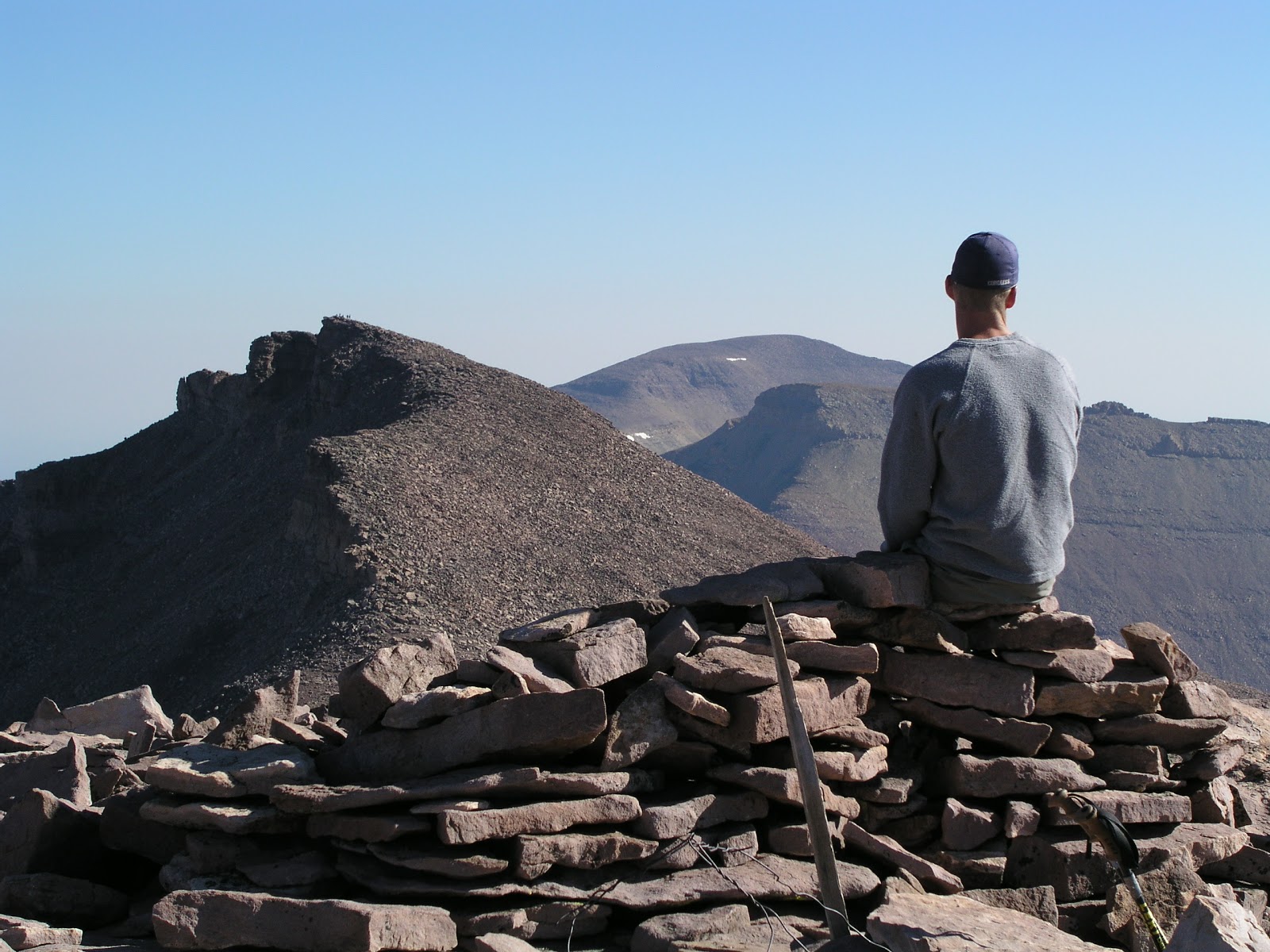
(The accompanying photograph by Ravell Call shows an unusual, "triple peak" view. The picture shows Craig A. Lloyd admiring the view from atop South Kings Peak and looking toward Kings Peak and further away, Gilbert Peak. So, Utah's 3 tallest summits are all highlighted in this picture.
The second photo shows Lynn Arave on the south side and just below Kings Peak, headed for South Kings Peak. The third photo below, also by Ravell Call, shows a bunch of hikers in Henry's Fork Basin, with Kings Peak rising up in the background, in between Gunsight Pass.
The fourth photo below shows the old Kings Peak metal plaque, circa 1990. It has been missing since about 1999.) 


-NOTE: The author, Lynn Arave, is available to speak to groups, clubs, classes or other organizations about Utah history at no charge. He can be contacted by email at: lynnarave@comcast.net