Grosvenor Arch. Photo by Ravell Call
By Lynn Arave
MILLIONS of years ago, springs and spouting geysers welled upward in an area not unlike portions of today's Yellowstone National Park. Over time the source of these waters dried up; the sediment-filled spouts solidified, surrounded by a landscape of Entrada sandstone. More eons passed, and while the softer sandstone eroded away grain by grain, the plugs of these mineral faucets - made of harder stuff - proved more resilient.
Today, frozen in time, they're a geologic phenomenon and a centerpiece of Kodachrome Basin State Park, a sparsely visited wonderland of pale spires (those ancient cores), cliffs and arches - such as the spectacular Grosvenor - carved in the region's malleable sunset-colored sandstones.For many years the area, known as both Thorley's Pasture (for rancher Tom Thorley) and Thorny Pasture (for the cactus there), and for a time as Chimney Rocks, was a popular local attraction - especially after a better dirt road made access easier in the 1930s.
Kodachrome leaped to national notoriety when it was featured in the September 1949 issue of National Geographic magazine in an article by writer-photographer Jack Breed about south-central Utah proclaiming the "First Motor Sortie Into Escalanteland." The expedition into a basically unsettled area of the Colorado Plateau involved 15 adventurers, three Jeeps, two trucks and 35 horses. Because of the "astonishing variety of contrasting colors in the formations," they applied the name "Kodachrome Flat" to the area.
Kodachrome leaped to national notoriety when it was featured in the September 1949 issue of National Geographic magazine in an article by writer-photographer Jack Breed about south-central Utah proclaiming the "First Motor Sortie Into Escalanteland." The expedition into a basically unsettled area of the Colorado Plateau involved 15 adventurers, three Jeeps, two trucks and 35 horses. Because of the "astonishing variety of contrasting colors in the formations," they applied the name "Kodachrome Flat" to the area.
For some time there was talk that Kodak, which owned the term "Kodachrome" for its slide film, opposed such use of its product's name. Eventually, however, that proved not to be the case, and today Kodachrome Basin has Kodak's blessing. (In fact, official park brochures used to list Kodak as the "official film" of the state park.)
The state of Utah bought land for the preserve in 1962. But the first real improvements - a campground and ranger residence - weren't built until 1974. In 1988, modern restrooms and hot showers were added.
The park had only 1,000 visitors per year in its early days, but by 1992, visits had multiplied to 64,000.
The naming of neighboring Grand Staircase-Escalante National Monument in the mide-1990s raised interest in Kodachrome too.
The desert climate and slickrock also make the Kodachrome vicinity a great place to visit in late fall or early spring, when many other Utah state parks are too cold for a comfortable visit.
The park can also have a wide temperature range in a single day because of its 5,800-foot elevation.
There are at least 67 chimneylike "sand pipes" in the Kodachrome area. Such spires, found nowhere else in the world, are up to 52 meters high. The most significant are found in the Grand Parade area near the campground.
Chimney Rock, a giant thumb rising from the plateau, is one of the most popular scenic attractions. A dirt road leads to the formation about a mile from the campground on the park's east side. The short but bumpy ride can be quite a sight, as in late summer when sightseers pass through a gigantic field of blooming sunflowers.
The approach to Grosvenor Arch. Photo by Ravell Call.
Grosvenor Arch, about 10 miles southeast of Kodachrome, is perhaps the area's most famous formation - and deservedly so.
A beautiful and impressive stone rainbow on the lip of a soft-orange mesa, Grosvenor (pronounced Grove-nor) was named by the National Geographic expedition in 1949 in honor of the society's president, Gilbert Grosvenor. The arch, with a 99-foot span, tops out at 152 feet above the ground.
Breed described the arch in his 1949 article:
"This striking natural bridge is carved of creamy rock, a rarity in a land of brilliant reds. Actually it is a double arch, with the larger span on the end of a buttress that cuts from the main sandstone butte."
A smaller arch within the state park bears Tom Shakespeare's name. The former manager of the park discovered it in the 1970s while looking for a coyote den. His name was selected over options like "Tom Thumb's Arch" as a result of a local contest. A side road on the way to Chimney Rock leads to the Shakespeare trailhead, where a sandy, 600-yard trail leads to the arch.
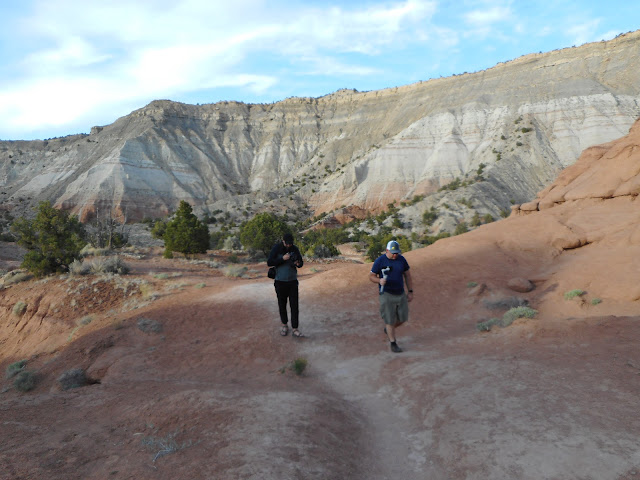
Hiking is a popular park pastime. Besides the Shakespeare Arch trail, visitors can explore the Panorama, Eagle View and Angels Palace trails. Panorama is the longest round trip at 3 miles.
A visit to Kodachrome can be a pleasant, half-day jaunt or a camping and hiking destination. The state park offers a modicum of solitude - a quality that's now just a memory in the region's other, more-crowded national and state parks.
\
- TO REACH KODACHROME: Kodachrome Basin State Park is south of Cannonville, off U-12, one of Utah's "scenic byways." The park is about 290 miles from Salt Lake City.


No comments:
Post a Comment