Wednesday, June 14, 2017

Early Southern Utah: From the Four Corners to Monument Valley to Zion Canyon to the Pine Valley Mountains


By Lynn Arave

FOUR Corners is a popular tourist destination today, but just over a century ago it was still an emerging novelty, yet a very remote spot to visit.
As the junction where the four corners of four states – Utah, Colorado, New Mexico and Arizona – meet, this place is unique in America.

                                   In 4 states at the same time!

“A Geographical Novelty” was a Feb. 28, 1902 headline in the Coalville Times Newspaper. This article stated that even world-wide, there was not a similar place where four counties met at such a junction.


The Salt Lake Herald Newspaper on Aug. 13, 1902 stated that the Four Corners was located in the midst of desert. Grass for stock was sparse in the area. A Herald article on Sept. 11, 1902 also explained how many Navajos were starving in the Four Corners region, with food shortages.

              Even today, it is barren land around the Four Corners.

The Logan Republican Newspaper of June 8, 1904 said the first shaft type monument had recently been erected at the Four Corners. However, access to the remote place was still difficult, with Mancos, Colorado, some 100 miles distant, being the nearest railroad town to the Four Corners.

                                    Monument Valley

-Still another remote area in southeastern Utah of old was Monument Valley. First referred to in its early days as “Monumental Valley,” (Salt Lake Herald Newspaper of Nov. 1, 1908), it was later referenced as “Monumental Park” too.
The Salt Lake Tribune of Sept. 5, 1915 stated that it required a week of travel from Salt Lake City at that time to even reach the remote location. It was two years later before the first talk of making a regular road to reach the place happened.

-The Henry Mountains further north are another mysterious Utah place. It is often stated that these mountains were among the last to be named ranges in the entire United States.
The first newspaper reference to the Henry Mountains appeared in the Salt Lake Herald of June 18, 1875.
The Henry Mountains were also among the last places to be mapped too. The Richfield Reaper Newspaper of Dec. 30, 1937 stated that the first geological maps of the Henry Mountains were made in 1937.

-Some features in Zion National Park DON’T have the same names they originally had. Back when the place was sometimes referred to as “Little Zion,” a few titles were different.

                The big curve in Zion Canyon, near the former "Raspberry Bend."

For example, a story in the Ephraim Herald Newspaper of Nov. 22, 1919 included an early map of Zion Canyon.
The sharp curve in the canyon just past Weeping Rock was originally called “Raspberry Bend.”
Also, Native American “cliff dwellings” were listed on that map in the Weeping Rock area. These are not marked on maps today. “Mummy Cave” was also nearby and according to the newspaper article was where petrified mummies of early cliff dwellers here were found – several hundred feet above the valley floor. 
In addition, what is called the Great White Throne today had an alternate name in the early 20th Century --  “El Gobernador.”
Plus, today’s “Grotto” area was originally named “Wylie Camp,” a rustic hotel, established in 1917.

              Looking north to St. George and the Pine Valley Mountains.

-The Pine Valley Mountains, north of St. George, are the highest elevations in southwestern Utah. A May 3, 1935 article in the Parowan Times Newspaper stated that the original name for the mountains as “Kaib-a-harur” – meaning “Mountain Standing Still.”
By 1935 there were already elaborate trails in these mountains, which assisted hiking and horseback trips, as well as hunters.
The Washington County Newspaper of June 17, 1926 stated that from “Signal Point,” the highest place in the Pine Valley Mountains at 10,300 feet, “one may from the same spot and with the aid of field glasses, witness people living in snowbound valleys to the north; see men hauling wood on bob-sleds; watch boys skating and observe gangs of men cutting and hauling natural ice 2- inches in thickness. Without moving a step but simply by turning the telescope of the south, one may see children in summer frocks, ladies picking roses from lawns and all classes of gardening in full summer sway.”
That was obviously referring to the elevation difference between Cedar City (5,850 feet above sea level) and St. George (elevation 2,800 feet).

                                       Vermillion Castle.

-“Vermillion Castle,” northeast of Parowan was so named in May of 1935. According to the Parowan Times Newspaper of May 17, 1935, Simon A. Matheson won a $5 prize for calling the forest campground there “Vermillion” in a Parowan Chamber of Commerce contest. He cited the “castle-like cliffs” as the inspiration for the title.
Previously, the area had been called “Five Mile.”
The road to Vermillion was first oiled in the late 1930s. Heavy rains washed out the road as recently as August 8, 1963.


Friday, May 19, 2017

Salt Lake Temple: Most Expensive LDS Temple Ever?


By Lynn Arave

THE next time you enjoy the gothic and symbolic features of the one and only Salt Lake LDS Temple, consider it’s dollar price to build -- $3,469,118.
That was the price given by Elder George Reynolds, a member of the Quorum of the Seventy, back in 1895, to a Philadelphia newspaper, as quoted in the Deseret Weekly News of March 23, 1895.


Factor in the inflation and even in 1916 dollars (the furthest back an on-line government inflation calculator goes), that price equals at least $86,559,450 in 2017 dollars.
(The Church of Jesus Christ of Latter-day Saints hasn’t revealed the actual costs of any temples for many decades now.)
However, in contrast the San Diego Temple, which opened in 1993, was reported by the Los Angeles Times to have cost an estimated $24 million. (That’s $40.6 million in 2017 dollars.)

                                                             San Diego Temple.

And, the original Ogden Temple, that opened in 1972, cost $4.29 million (or some $25 million in today’s dollars.)
Note that the Salt Lake Temple required some 40 years to build – far more than any other temple. Also, some volunteer, unpaid labor was used back then, or the price over four decades likely would have been much more, likely $100 millon plus.
Furthermore, Elder Reynolds in that 1895 article stated that exact costs of the temple were impossible. Still, he said about the Salt Lake Temple’s construction:


“In the early stages the progress was slow and very expensive, for it took four yoke of oxen four days to bring a single stone from the quarry twenty miles distant.”
He said some estimated it cost $100 for every stone cut, moved by oxen to the temple site and then laid in place. He also stressed that metal and other materials were very expensive to obtain, especially until the railroad came long.

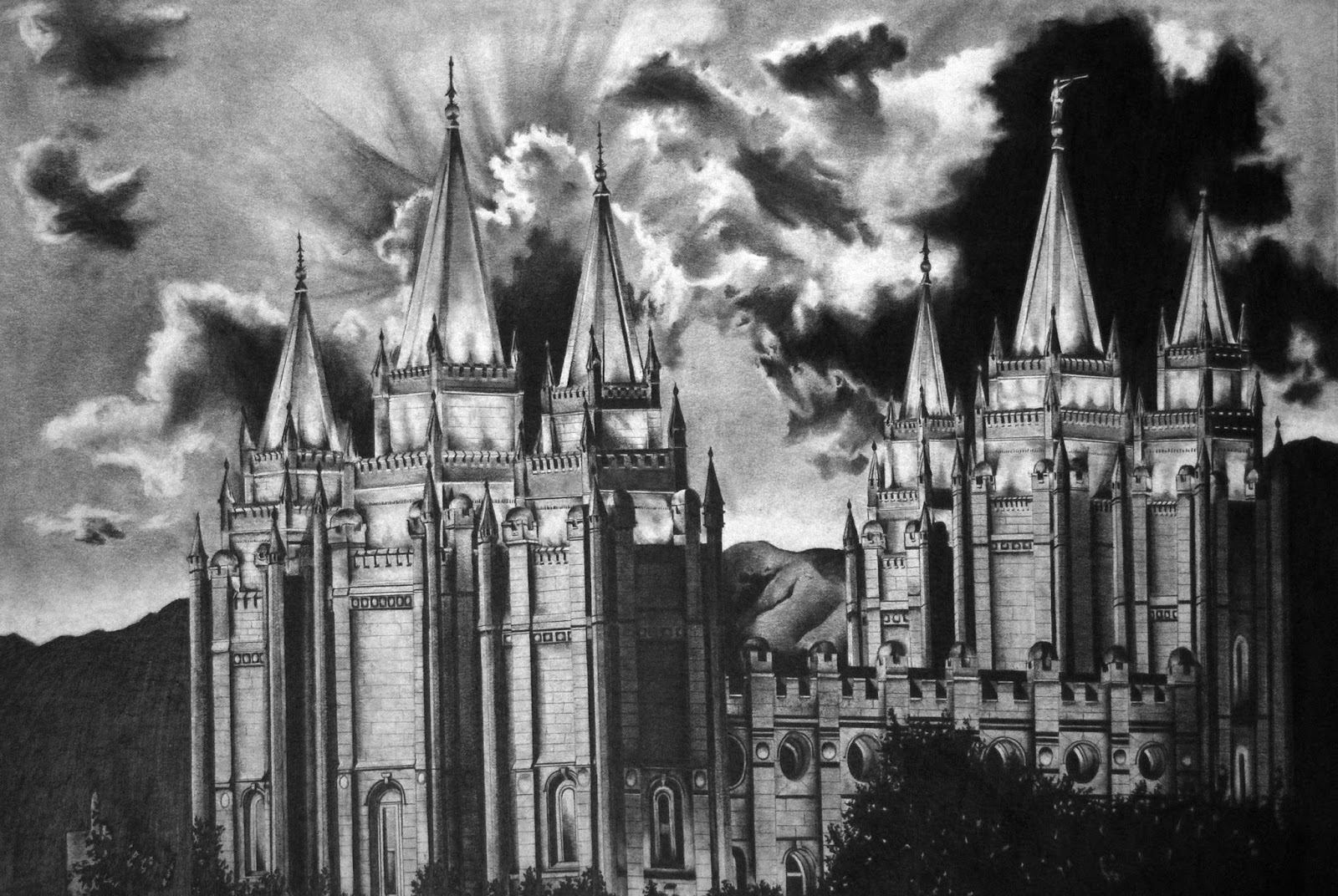
                                                        Pencil drawing by Steve Arave

Levan, Utah: Sinkng the 'Navel myth'


By Lynn Arave

Is the Beehive State’s most common “belly button” joke true? Is Levan, Utah, in Juab County, actually named for being the word “navel” spelled backwards, since geographically a belly button would be about where this town is located, in the center of Utah?
As amusing and widespread as this strange name origin is, it is likely not true. However, myth can supersede fact over time and that is almost surely what has happened with Levan’s origin.
Consider the following:
-The likely first-ever public reference to the town of Levan was in the Deseret News on May 6, 1868:
“A new town site has been surveyed between           chicken and pigeon creeks on the east side of the valley some three and half miles northeast of the old Chicken Creek settlement. A field has also been surveyed and improvements have commenced. The new location is called Levan.”
Now one problem here is that you’ve got to adjust for history and different borders back then. In 1868, there was NO State of Utah -- that was 28 years distant.
It was the Territory of Utah, with the borders including a portion of western Colorado and a chunk of Wyoming. Thus, the Territory was wider in 1868 than today and not as conducive to adding a "navel" to it, at least where Levan is located.
Wyoming was made a state three months after the community of Levan began (taking away that "chunk" from Utah) and the State of Colorado came along in 1876. So, Utah's borders weren't like today until 1876, eight years after Levan came along.
(Nevada was made a State in 1864, but Utah territory kept a portion of today's Nevada until boundary changes in January of 1867.)


Even if Brigham Young named the community, it likely wasn’t for the navel reason.
And, furthermore, why in the world would Brigham start out a new town with a joke kind of name, given the rough living conditions of the territory back then?
The masterful book, “Utah Place Names,” John W. Van Cott states on the Levan monkier: “There are several French, Latin, or Piute interpretations of the name, suggesting it means East of the Sunrise, Land of the Sunrise, Rear rank of a moving Army, Frontier Settlement or Little Water. The tongue-in-cheekers say the name is a reverse spelling of Navel, because it is located in the center of the state. Several different spellings have been recorded.”
Any of those meanings probably make more sense than navel.
Yet, ultimately Navel is still becoming the origin of the name Levan, because of extreme popular reference over time.
Former Levan Mayor Connie Dubinsky was quoted in the Salt Lake Tribune on March 4, 1997 as saying,
''We don't really know for sure, but that's what we tell people.'’
So, this is really more a case of almost universal acceptance of a myth that becomes truth over time. Thus, technically Levan is not a 'belly button" town, but it is the "Navel" community by default.
AND, ever since one of the last new sections of I-15 opened in 1986 and meant most Utahns bypass Levan, the little town needs ALL the publicity it can get.
Levan is located about 11 miles south of Nephi along U-28. Before 1986, the majority of drivers went directly through Levan.
Also note too that U.S. Highway 89, between Logan and Brigham City, is not almost universally called "Sardine Canyon," even though the actual Sardine Canyon isn't traversed there. Again, popular usage became the rule.)
Secondly, note also that some local histories of Levan don’t even have the Chicken Creek reference correct, since they state that Chicken Creek was Levan’s original name. No, Chicken Creek was a former settlement, located 3.5 miles northeast of Levan.
-Another strange moniker was the town of Payson’s original title. It was originally named “Peteetneet.”
It was titled for the creek in the area and after a local Indian chief. Later, the branch of the LDS Church was named Peteetneet too. Then, the town was renamed after James Pace, a settler who led the emigrants there. At first it was spelled “Pacen” and later “Payson.”
-Here are some other odd Utah names, past and present:
Delicate Arch in Arches National Park was originally known by three other names: Schoolmarm's Bloomers, Cowboy Chaps and Mary's Bloomers.
Fairfield, west of Utah Lake in Utah County, was first known as Frogtown, for the plentiful amphibians in the nearby Sevier River.
"Ragtown" was the original name for Magna, which also, for some reason, surrendered its attractive second title, "Pleasant Green" too.
Baptist Draw, in Emery County, received its name when early settler Joe Swasey "baptized" his dog by tossing it into one of the draw's water pockets.
Bottle Hollow, Uintah County, was so named because it was a mile-long dump for empty liquor bottles of U.S. soldiers stationed at Fort Duchesne in the 1880s.
China Lake in Summit County got its name either after a Chinese man and his mule drowned in it or because it was said you could sink down to China before reaching the bottom of the deep lake.
Deadman Ridge, Garfield County, got the title after Myron Shurts was killed by lightning there in 1912.
SOURCES: Deseret News Archives, “Utah Place Names,” by John W. Van Cott.


\


\

Utah's own 'Noah's Ark'

                                                   Photographs by Ravell Call and Lynn Arave

By Lynn Arave

THE  search for Noah's ark has sparked many an ambitious expedition or documentary over the years. However, some 40 miles from Zion National Park is Utah's own Noah's Ark, as officially named on government maps.
Of course, this isn't the real ark, but it's intriguing nevertheless -- especially with its red color. 
It is located about five miles southeast of Parowan on the south side of First Left Hand Canyon at an elevation of 8,592 feet above sea level.
Approaching 1,000 feet in length, this red rock formation is about twice the estimated length of the biblical boat, which is commonly said to be at least 300 cubits (a cubit is commonly believed to be 18 inches long), or about 550 feet long and 45 feet high.


There's a signed trail starting in the Vermilion Picnic Area that leads to a closer view of Noah's Ark. However, the view from the road and picnic area is not bad.
Although signs say the trail is 1 mile long one-way, it is closer to 1.5 miles long. It climbs steeply in places, starting from an elevation of 6,927 feet above sea level and topping out at 8,037 feet — for a total climb of 1,110 feet.
There is some shade along this trail, but it is not one to do in the heat of a summer day.

The trail ends on a small plateau that also offers a view of the Little Salt Lake and the surrounding area.
There's also Grand Castle, a kingly sort of red rock formation to the north of Noah's Ark. To the west and near the canyon floor is Vermilion Castle.
The Dixie National Forest has no additional information available on the Noah's Ark Trail.
Bruce Matheson, a longtime resident of Parowan, said the formation is a landmark for all locals in the canyons. He doesn't know where the name came from. Its origin is not mentioned in the history books, and it is just assumed that some early settler starting calling it Noah's Ark and the name stuck.
"The Parowan area has some of the most gorgeous rock formations around," Matheson said. "The colors are very vivid."
He's heard of a few men over the years who have managed to get to the top of Noah's Ark, though it looks to be a steep and risky climb.
Mike Ward, who lives in Paragonah, says Noah's Ark and the surrounding area are spectacular.
"The whole area is a stunner," he reported in an e-mail to the Deseret Morning News.
He said Second Left Hand Canyon, to the south, is his favorite — especially since it has a mountain bike trail that connects with Brian Head.
• To reach the Noah's Ark Trail, go south on I-15 to Parowan (Exit 75) and go through town, turning left (east) off Main Street onto state Route 143. Turn left after about one mile and go east into First Left Hand Canyon, which heads to Yankee Meadows. (This is a paved, narrow road with 13 percent grades, if you continue past Vermilion.)
Watch the signs and turn into Vermilion Picnic Area and drive the dirt road loop, looking for the signed trailhead. There are restrooms in the picnic area.
• The Parowan Canyon area is also home to a slew of other oddly shaped features. For example, there's Free Thought Canyon; Valentine Peak (where the sun rises each Feb. 14 perfectly lined with its summit); Squaw Hollow; Hole in the Rock; Billy West Canyon; and Yankee Meadows.
-From  a Deseret News article on Nov. 8, 2007, by Lynn Arave.
                                Looking west from the Noah's Ark area

Kodachtrome Basin:: A wonderland of pale spires, cliffs and arches


                                                              Grosvenor Arch.                  Photo by Ravell Call


By Lynn Arave

MILLIONS of years ago, springs and spouting geysers welled upward in an area not unlike portions of today's Yellowstone National Park. Over time the source of these waters dried up; the sediment-filled spouts solidified, surrounded by a landscape of Entrada sandstone. More eons passed, and while the softer sandstone eroded away grain by grain, the plugs of these mineral faucets - made of harder stuff - proved more resilient.


Today, frozen in time, they're a geologic phenomenon and a centerpiece of Kodachrome Basin State Park, a sparsely visited wonderland of pale spires (those ancient cores), cliffs and arches - such as the spectacular Grosvenor - carved in the region's malleable sunset-colored sandstones.For many years the area, known as both Thorley's Pasture (for rancher Tom Thorley) and Thorny Pasture (for the cactus there), and for a time as Chimney Rocks, was a popular local attraction - especially after a better dirt road made access easier in the 1930s.

Kodachrome leaped to national notoriety when it was featured in the September 1949 issue of National Geographic magazine in an article by writer-photographer Jack Breed about south-central Utah proclaiming the "First Motor Sortie Into Escalanteland." The expedition into a basically unsettled area of the Colorado Plateau involved 15 adventurers, three Jeeps, two trucks and 35 horses. Because of the "astonishing variety of contrasting colors in the formations," they applied the name "Kodachrome Flat" to the area.


For some time there was talk that Kodak, which owned the term "Kodachrome" for its slide film, opposed such use of its product's name. Eventually, however, that proved not to be the case, and today Kodachrome Basin has Kodak's blessing. (In fact, official park brochures used to list Kodak as the "official film" of the state park.)

The state of Utah bought land for the preserve in 1962. But the first real improvements - a campground and ranger residence - weren't built until 1974. In 1988, modern restrooms and hot showers were added.
The park had only 1,000 visitors per year in its early days, but by 1992, visits had multiplied to 64,000.
The naming of neighboring Grand Staircase-Escalante National Monument in the mide-1990s raised interest in Kodachrome too.

The desert climate and slickrock also make the Kodachrome vicinity a great place to visit in late fall or early spring, when many other Utah state parks are too cold for a comfortable visit. 


The park can also have a wide temperature range in a single day because of its 5,800-foot elevation. 
There are at least 67 chimneylike "sand pipes" in the Kodachrome area. Such spires, found nowhere else in the world, are up to 52 meters high. The most significant are found in the Grand Parade area near the campground.

Chimney Rock, a giant thumb rising from the plateau, is one of the most popular scenic attractions. A dirt road leads to the formation about a mile from the campground on the park's east side. The short but bumpy ride can be quite a sight, as in late summer when sightseers pass through a gigantic field of blooming sunflowers.

                                  The approach to Grosvenor Arch.                               Photo by Ravell Call.

Grosvenor Arch, about 10 miles southeast of Kodachrome, is perhaps the area's most famous formation - and deservedly so.

A beautiful and impressive stone rainbow on the lip of a soft-orange mesa, Grosvenor (pronounced Grove-nor) was named by the National Geographic expedition in 1949 in honor of the society's president, Gilbert Grosvenor. The arch, with a 99-foot span, tops out at 152 feet above the ground.

Breed described the arch in his 1949 article:

"This striking natural bridge is carved of creamy rock, a rarity in a land of brilliant reds. Actually it is a double arch, with the larger span on the end of a buttress that cuts from the main sandstone butte."
A smaller arch within the state park bears Tom Shakespeare's name. The former manager of the park discovered it in the 1970s while looking for a coyote den. His name was selected over options like "Tom Thumb's Arch" as a result of a local contest. A side road on the way to Chimney Rock leads to the Shakespeare trailhead, where a sandy, 600-yard trail leads to the arch.

Hiking is a popular park pastime. Besides the Shakespeare Arch trail, visitors can explore the Panorama, Eagle View and Angels Palace trails. Panorama is the longest round trip at 3 miles.

A visit to Kodachrome can be a pleasant, half-day jaunt or a camping and hiking destination. The state park offers a modicum of solitude - a quality that's now just a memory in the region's other, more-crowded national and state parks.
\
- TO REACH KODACHROME: Kodachrome Basin State Park is south of Cannonville, off U-12, one of Utah's "scenic byways." The park is about 290 miles from Salt Lake City. 


Calf Creek -- Predicted for national park status back in 1930

                                              
-Photograph by Eugene Crosser on Wikipedia Commons.


  CALF CREEK, a wondrous southern Utah waterfall was "discovered" in about 1930 and Garfield County residents thought the landmark deserved National Park status.
Calf Creek is located between the Utah towns of Boulder and Escalante, off Highway 12. The popular lower falls features an approximate 130-foot water drop of the Escalante River, while the upper falls is about 90 feet high.
According to the book, "Utah Place Names," the box-like canyon of the lower falls, was used to almost naturally hold calves in place, presumably during the early 20th Century.
A Garfield County newspaper report from May 9, 1930 praised the completion of a new road through the area, where cars "can go up the grade in second gear." Still, the rest of the road in the area was reported as rough and dangerous.
Notwithstanding, the newspaper reported stated: "Then, about three-fourths of a mile above camping grounds is a most wondrous side canyon, called 'Calf Creek,' which is sufficient in grandeur that there is an application to have it designated as a national park. The marvelous waterfall is a 136 feet in height, sending its silvery sprays over most beautiful ferns. The formation of canyon and all compose a spectacle which is not an exaggeration when called a scenic paradise."
Of course, the national park status didn't easily come to pass. Calf Creek was designated as a National Recreation Area on Aug. 31, 1963.
A $2 user fee began in July of 1975, based on the popularity of the area.
Calf Creek was part of the Grand Staircase-Escalante National Monument, created in 1996, and so it did finally gain national status.
Today, a 2.5-mile long trail along the river leads to the lower Calf Creek falls, while a slickrock slope takes more rustic hikers to the upper falls, still not readily marked along the roadside.

NOTE: Some maps erroneously list Calf Creek Recreation Area as California Creek Recreation area.


Utah Outdoor Myths


By Lynn Arave

UTAH is high elevation territory, with a vast amount of outdoor opportunities and open spaces. However, there are some things about the Beehive State's outdoors that a simply myths -- incorrect beliefs.
-Here are some of those myths:


1. The Crimson Trail in Logan Canyon is so named because of the spectacular fall colors there.
FALSE:
This family-friendly, moderate hike was originally called “The China Wall” in its earliest days, because of the long wall-like formation that lines both sides of Logan Canyon in the area.
Later, the Crimson name took over, often wrongly believed to be based on the vivid fall colors of foliage in the area — which, arguably, are indeed striking there each autumn.
However, there is a historical reason for the Crimson title.
From 1877 to 1926, there existed a “Brigham Young College” (and high school) in Logan, sponsored by The Church of Jesus Christ of Latter-day Saints. This trail in Logan Canyon was often considered the “Senior Walk” for graduating students and the school’s colors were crimson and gold. Hence the “Crimson” trail name.

When the college closed, Logan High was built on the site and it retained the same school colors. -- From the Ogden Standard-Examiner of Sept. 1, 2016, by Lynn Arave.


                       Looking across Logan Canyon, south to where the Crimson Trail is.


                       The Wellsville Mountains from near Sardine Summit.

2. The Wellsville Mountains are the steepest mountains in the world.
FALSE:


Some reports claim the Wellsville Range is the steepest mountains in the world. They certainly are among the steepest in Utah — especially near Sherwood Hills. However, geographically speaking, there is no standard for determining the steepness of mountains, and parts of the Brooks Range in Alaska would surely exceed the Wellsvilles. -- From the Deseret News, June 22, 2001.

-Also, the Wellsville Mountains are a sub section of the Wasatch Mountain range.


                                         The south side of Kings Peak.

3. Kings Peak is so named because it is the king, the tallest of Utah's mountains.
FALSE:
As the  original metal plaque atop Kings Peak (shown below) states, the mountain is named for Clarence King, who was the first director of the U.S. Geological Survey (1979-1881.)
Kings Peak is Utah's tallest mountain at 13,528 feet above sea level.


                       Plaque atop Kings Peak, from the 1990s. 


                Kings Peak, center, as a triangle shape, as seen from Henry's Fork Basin.


4. Kings Peak has always been known as the highest peak in Utah.
FALSE:

Kings Peak, High Uintas, hasn’t always been recognized as the highest point in Utah. An April 15, 1911 Ogden Standard-Examiner article stated that Emmons Peak in the Uintas, at 13,694 feet above sea level, was tallest. That was the general belief of that year.

(In reality, Emmons is today’s 4th tallest in the Utah at 13,440 feet.)

However, just two years later, the Vernal Express newspaper on Jan. 23, 1913 stated that South Kings Peak was the state’s tallest summit at 13,498 feet. North Kings was second at 13,496 feet.

The Roosevelt Standard newspaper reported on Aug. 20, 1924 that members of Salt Lake’s Wasatch Mountain Club had hiked Kings Peak. On top, they “salted the peak,” by placing a bottle of briny water from the Great Salt Lake on its lofty summit.

The water bottle also had the signatures of Utah Gov. Charles R. Mabey and others on it.

A Jan. 30, 1947 article in the Vernal Express newspaper stated that in the mid-1940s, two men climbed North Kings Peak and constructed a two-foot high monument on the highest part of the summit.

Then, one of the men proclaimed, "There, that makes them even."

Other newspapers of the era referred to the "twin Kings Peaks."

For 53 years, that was the accepted belief, that South Kings was tallest in the Beehive State. So, anyone hiking Utah’s tallest in that time period went to the southern peak, missing or passing by the actual tallest peak – (North) Kings Peak at 13,528 feet.

In June of 1961, a helicopter crash-landed on Kings Peak. The crewmen walked away unharmed, but this crash took place on today's South Kings Peak. (Good thing too, as South Kings has a lot more usable space on top. If they would have crashed on today's Kings Peak, the copter likely would have slid down hundreds of feet on one side or the other.)

It wasn’t until 1966 that new measurements by satellite proclaimed the north Kings as highest and re-measured South Kings Peak to be second-highest at 13,512 feet.

Ironically, the U.S. Forest Service had placed the first official plaque on Kings Peak one year earlier in 1965. Back then, it estimated that only 30 people a year hiked on average to the summit. -- From the Ogden Standard-Examiner, July 24, 2014, by Lynn Arave.


        Mount Nebo from the south end,                               Photo by Ray Boren

5. Mount Timpanogos is the tallest summit in the Wasatch Mountains.
FALSE:

Consult any accurate map, like Forest Service or USGS Maps and they will confirm that Mount Nebo is 11,928 feet above sea level, while Mount Timpanogos is only 11,750 feet.

-Additionally, the Wasatch Mountains extend much further than most realize. They stretch from Mount Nebo on the south to Soda Point, just north of Grace, Idaho, on the north end. Thus, even the mountains west of Bear Lake are Wasatch Mountains.


                 Ravell Call atop Mount Nebo South Peak.                    Photo by Ray Boren.


                   Soda Point, the northern most part of the Wasatch Mountains, in Idaho.


                             Utah's southeast border sign, near Four Corners.

5. Utah's state borders are perfectly straight lines, north to south.
FALSE:

Utah has been called a "pretty, great state." Surprisingly it's a "pretty crooked state," too. And we're not talking crime, but the state's deceptively tidy shape.

Minus the distinctive notch in its northeast corner, Utah is commonly thought of as a perfect rectangle. However, those fourth-grade Utah history students are drawing it all wrong with straight lines.In fact, if the borders had been drawn straight - as intended - some Idaho border towns, like Franklin, might straddle the state line. At least one other community, Strevell - now a ghost town - would definitely have been in Utah.

Also, the state would be somewhat larger, maybe several hundred acres bigger, because of land that ended up in Idaho, Colorado or Wyoming.

Utah's true borders contain at least seven crooked spots that are considered "pretty" crooked by mapmaking standards, though perhaps only "slightly" irregular by public perceptions.

These irregularities vary from as small as a quarter of a mile off the true mark to almost a mile in error.

Looking closely at the official Utah State Highway Map, two of the irregularities can be spotted. On the small statewide map on the cover of the Utah Atlas & Gazetteer, a third crooked spot can be seen.

With the Gazetteer's detailed topographical maps, three more crooked locations can be readily seen. The seventh error stands out most on the Bureau of Land Management's overall state map.

Three of the irregularities involve a meandering line, while three others look like notches and the seventh resembles a hump. (See story above.)

Were these six crooked spots meant to be there?

"They're survey errors that were made when the state boundaries were laid out," said Gary Nebeker, chief of operations for the Salt Lake office of the U.S. Geological Survey Center.

The Salt Lake office of the Bureau of Land Management is the caretaker of the original survey documents made on the Utah state line boundaries. It agrees on the cause for the crooked lines.

"It was primarily survey errors," said Daniel W. Webb, chief cadastral surveyor for the BLM in Salt Lake City.

He said surveyors in the late 1800s had crude instruments and pulled 66-foot-long chains for measurements.

A colleague of Webb, Dave Cook, is a cartographer with almost 40 years of map experience with the BLM and the National Weather Service.

After several hours of examining the original, 100-plus-year-old diaries of the different federal surveyors, he could find no apparent reasons for their mistakes.

Cook speculated that surveyors were paid by the mile, so they were in a hurry. If they made a mistake - even if they knew it - they weren't likely to go back and redo it.

Survey crews traveled in parties of one to two dozen men and suffered harsh conditions on Utah's rugged borders in the 1870s and 1880s. Rocks and wooden posts were the common markers left by survey parties. They theoretically put markers every mile along state boundaries, though obviously some are missing more than a century later.

Cook said the sad thing is that we live with these mistakes. Longtime federal laws make states rely on existing survey monuments for borders, whether they are in the right place or not.

"Monuments prevail," he stressed.

Those laws have been challenged by various courts over the years and have always been upheld.

Even with exact location technology available with orbiting satellites, no federal entity has the time or money to correct such errors, according to Webb.

At best, small adjustments may be made as specific landownership issues are raised.

Since Utah's borders are crooked, so are those in the adjoining states of Idaho, Wyoming and Colorado. Cook believes many other states probably have similar boundary problems. For example, the same surveyor who made at least three mistakes across the Utah-Idaho border also kept going west to the Pacific Ocean.


Checking detailed Oregon maps, he made at least four similar mistakes along its southern border with California. (-From the Deseret News, July 26, 1998, by Lynn Arave.)