.jpg)
THE popular Causeway to Antelope Island slices across the mineral-laden Great Salt Lake like a seven-plus-mile ribbon of asphalt, gravel and rock.
However, we take this wide, smooth highway for granted -- and yet the fickle Great Salt Lake hasn't always permitted the causeway to reside there -- it has been washed out in the past and could also suffer the same fate in the future.
Like the Great Salt Lake, the causeway has stormy history of ups and downs. The rising lake in the early 1980s soon wiped out and covered the roadway. Here are some highlights:
-1964: Much of the road base for the causeway is built early in the year, but the base itself is constructed only 6.25 miles out into the lake, since a 1.25-mile-wide sand bar allows access to the island because of the lake's low level at the time. But the rising lake cuts off part of the roughed-in road to the island by fall.
-1968: In the spring, the causeway is completed as a 7.5-mile dirt road and unofficially opened to the public for a brief time - until the lake washes away a portion of the road a few weeks later. By October, construction on a 70-foot bridge at the causeway's west end is completed, while most of the dead-end causeway remains open 24 hours a day until November, when a control gate is placed on the road's east end (and locked during off-hours) to curb vandalism.
-1969: The causeway to Antelope Island officially opens on Jan. 5, 1969. By Feb. 1, high waves force closure of the road and begin to erode it. By late February, a 3,000-foot section of the road is under water. The road remains awash but safe later in the spring, and $100,000 is spent to repair and strengthen the road. (About 124,000 tourists cross the causeway in its first year.)

-1970: Winds and high water threaten the causeway again in the spring. The road is raised 2.5 feet along a two-mile section susceptible to washouts. The dirt road is again soon passable, though bumpy, for the year's 198,000 tourists.
-1972: In late January, 14 cars become stuck in mud on the wet road and it is closed again. A month later, the road is reopened and repaired.
-1973: The road receives its annual spring dunking and is again awash in several places. The lake's spring level reaches 4,200.30 feet. In the fall, high winds wash out a 100-foot section of the road.
-1974: Unexpected wave damage temporarily halts causeway reconstruction intent on raising the road bed 4 to 5 feet.
1975: The causeway hastily reopens in April and then closes again "in the blink of an eye" as construction continues to raise and widen the road. On Oct. 11, the causeway reopens after being closed for nearly two years straight. (It has actually been six years since it was open for any real length of time.)
-1976: The road is closed during February for bridge work. In March, the lake attacks the causeway again, but the road remains undamaged for a change. The road closes on weekdays starting in August until October so it can be completed as a two-lane paved highway.
-1977: The causeway is blamed for increased odors around the lake and also for drastic changes in lake salinity.
-1978: More than 400,000 visitors cross the causeway en route to Antelope Island.
-1979: A $1 per car fee, the first such admission cost ever, is charged at the east end of the causeway.
-1983: The rising lake and spring winds threaten the causeway. By June, portions of the causeway's pavement width have been reduced from 44 to 15 feet. For the first time in seven years of uninterrupted service, the causeway is closed. By fall, the lake level is only about 2 feet below the road.
-1984: The causeway is still closed and now under almost 2 feet of water.
-1985: A ferry system with rubber rafts allows some visitors to cross the lake parallel to the causeway and visit Antelope Island.
-1986: The ferry service ends because of a lack of fresh water on the island. Most of the causeway is almost 5 feet under the lake.
-1989-1991: Some of the causeway, left intact, despite erosion, now rises above the briny waters of the Great Salt Lake and becomes its own tourist stop, as visitors long to return to Antelope Island. By 1991, the Utah Parks services posts no trespassing signs along the eroded causeway to ensure safety.
-By the mid-1990s, the waters of the Great Salt Lake have receded and Davis County decides to rebuild the roadway. This time, they make the causeway significantly higher/wider than before -- and despite windstorms and waves, it has now approaching a 20-year span of uninterrupted travel to the lake's largest island.
------------------------------
Lynn Arave's report on the Syracuse/Antelope Island causeway in the spring of 1991, before it was rebuilt:
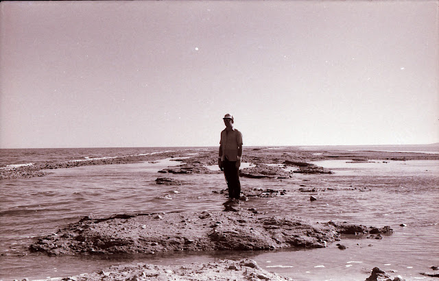
I was able to take a hike along the battered Syracuse causeway to Antelope Island before a no trespassing sign was posted there.
Deep gravel and sand make any travel on the old roadway difficult. Mountain bikes get bogged down more often than not by the loose terrain, and even walkers struggle with traction.
Even at a brisk walking pace of about 3.5 mph, it takes just over an hour to reach the severed end of the causeway. Still, since all but 400 yards of the old causeway was under water only a year ago, the additional 6,600 yards that have risen since add to the attraction and help compensate for the work of a nearly eight-mile roundtrip walk.
The pungent lake smell doesn't dissipate either, like it used to, after the first quarter-mile. Because of puddles and lake damage, the rotting smell is now widespread along the causeway.
Most of the asphalt portions of the road have eroded and can be spotted in the lake as pulverized, fist-size chunks, attesting to the power of water, wind and waves to undermine and destroy a hard asphalt road. Somehow there are some paved sections (complete with painted lines) as long as 100 feet that are almost completely intact, up to three miles out from the mainland. Generally speaking, though, the causeway surface gets rougher and wetter the further out you go.
The old power cable that supplied electricity to a causeway street light system and to Antelope Island is also exposed and occasionally visible along the way.
It's a long, sometimes boring walk to where the road is severed, but the allure of Antelope Island increases every day the causeway remains out of service
I found that the old road was indeed solid up to 3.5 miles out, where there's a big breach in a curved portion of the road. At the time, it was possible to continue another 600 yards out, but winter storms have obviously now covered that section with water.
At 3.8 miles out I encountered a breach that was about 3 feet deep. End of trip. No wading or swimming for me. The causeway appeared to continue, intermittently, above and below water, for an additional 2.5 miles, but that still leaves about 1.5 miles of almost completely open water before Antelope Island.
SOURCES: Personal journal, various Utah newspaper reports.
(-Updated from reports by Lynn Arave in the Deseret News.)
No comments:
Post a Comment