Saturday, November 3, 2012

Do Mountain Peaks Change?


                                   The rugged backside of Mt. Ogden Peak today.

MOUNTAIN Peaks do change substantially over just a few decades, thanks to man.
This means history-wise, mountain peaks can change more rapidly than some of the natural landmarks in the valley below.
Take Mount Ogden, the tallest peak to the east of Ogden, Utah, at 9,572 feet above sea level.
In 1988, the peak had one small metal plaque and a single, narrow transmitter tower on its summit.
(See the 1988 photo below.)
That was the year when Weber State University's "Flaming W" fall hike to the top of Mount Ogden was revived. (I had pretty good video footage of that event.)
By 2010, 22 years later, there was an array of transmitters installed on the peak, as well as a cement helicopter pad.
You sat on rugged rocks when visiting the peak in the 1980s.
Today, it is cool to rest of a flat cement pad.
Back in 1988, there was no dirt road up the final approach to Mt. Ogden -- you had to scramble all the way up. There was a dirt road to the dip between peaks, to the south, but that's where the road ended.
(Note the newer, color photos below that show the many transmitters and the cement landing pad.)
Certainly some would argue that the many transmitters there now pollute the peak.
However, they comprise cell phone transmitters, emergency transmitters and even Utah Transit Authority repeaters. Without them, outdoor users in the area would probably receive no cell signal.
Also, emergency communications in the valley below would be spotty, making it less safe to help those in medical or emergency need.
Even the name of Mount Ogden has changed over the decades.
Dr. A.B. Condon of Ogden succeeded in getting the name of what had been called Observatory Peak since the 1870s, changed to Mount Ogden Peak in 1920.
--And, in Davis County, to the south, there is even a much more changed peak -- Francis Peak.
Although most maps list Francis Peak as being 9,547 feet above sea level, that was BEFORE the radar domes were constructed on its summit, during 1958-1959.
Built at a cost then of $2 million (more than $16 million in 2012 dollars), the facilities removed 32 feet in height from Francis Peak and forever changed its appearance.
So, you might argue that Francis Peak is only 9,515 feet tall now -- at least the rock portions are.
However, the radar domes add another 115 feet in artificial height and so a satellite GPS would measure the peak's elevation at more like 9,630 feet above sea level.
That's not enough to rival Thurston Peak (9,706 feet above sea level) as the highest peak in the area, though.
What I would love to find someday is a photograph of how Francis Peak looked BEFORE 1958, when it was still in its natural state.


Church Office Building -- 38 Stories Tall?


By Lynn Arave

THE Church Office Building of The Church of Jesus Christ of Latter-day Saints, at 28 stories tall, or 420 feet high, is often considered the second tallest building in Salt Lake City and Utah.
However, did you know that the original plans for that building called for 38 stories, not 28?
Yes, the original, more ambitious plans were for the building to rise 38 stories above North Temple Street, one story for every year that church organizer and president, Joseph Smith, lived.
However, the actual feasibility of the plumbing and heating systems caused for 10 stories to be taken out and the more modest 28 stories to come into reality.
The building was not officially dedicated until 1975, though it was in partial use by 1972.

J. Howard Dunn, who was in charge of project development for the Church's building committee, said in a 1962 Church News article that the plans were changed and eight stories were scrapped to better meet mechanical requirements of the engineering department. Heating and air conditioning for the skyscraper would best be handled in 14-story units, beginning above the first two floors. At that time, the high-rise was to be 30 stories. Later, two more stories were also eventually deleted from that plan.
The building height was reduced for two other reasons as well: First, construction began on the Granite Records Vault in Little Cottonwood Canyon in 1960 and reduced the downtown office building space needed; second, departing missionaries were to be housed elsewhere, again reducing required space.
The original building plans had called for housing space for up to 430 outgoing missionaries in the first few floors of the Church Office Building. As it turned out, missionaries were housed across the street to the north in an old school until the Missionary Training Center opened in Provo in 1978. (Missionaries were fed in the Church Office Building cafeteria in the early 1970s.)
The Church Office Building cost $31.4 million (the equivalent of about $185 million today). The new building led to the substantial widening of North Temple and State streets, too.
"The building is designed for immediate and future needs of the church," Mark B. Garff, chairman of the church building committee, told the Deseret News in 1969.
George Cannon Young designed the building, which was under design as early as 1961. The old Deseret Gymnasium, 37 E. South Temple, had to be relocated across the street to where the LDS Conference Center is now. Some LDS Business College buildings and other structures also had to be moved to make room.
Work on the three-story, underground, 1,400-space parking structure — Utah's largest building excavation at the time — began first in 1962 and was finished by about 1967. The extracted dirt, 250,000 cubic yards, provided fill material for original I-15 construction in Salt Lake County.
When completed, the Church Office Building also allowed the church to temporarily house all General Authorities there while doing a substantial remodel of the Church Administration Building, 47 E. South Temple.

"You'll remember when this (Church Office) Building was first built, this is the floor (the 18th Floor) the First Presidency occupied for several years,"  Bishop H.David Burton, Presiding Bishop of the LDS Church, recalled. "When this building was completed, the Administration Building was then torn apart and restructured as it currently is, and all the church departments formerly packed in that building like sardines were now over here or in other places, and it was time to make that truly the administrative nerve center of the church."
Bishop Burton continued: "My memory is that it was President Kimball's administration that occupied these three offices that the Presiding Bishopric now occupies, just as they were built 35 years ago. For the better part of two years, this was the home of the First Presidency."
Constructed prior to today's more stringent seismic codes, there's occasional debate of how the building would fare during a major earthquake.
"Building codes have changed some, and if we were to build this building again today, we'd build it probably the same way but probably with a little more stringent standards,"Bishop Burton said. "It's good, it's served well, it's been a great asset to the church in every way. It has been a marvelous addition to church headquarters."
The building also remains a top Utah tourist attraction, with thousands each year who enjoy the commanding, bird's-eye view from the 26th floor observation deck — some 400 feet high.
"Enjoy a magnificent view of the Wasatch mountain range on the east, the Oquirrh range to the west, and the state Capitol building (patterned after the nation's Capitol) to the north," reads a section on places to visit at lds.org. "A view from this observation deck is a great way to become oriented on your visit to Salt Lake City."
(A portion of this blog was taken from an April 1, 2010 Deseret News story, co-written by Lynn Arave, with Scott Taylor.)
The accompanying photograph shows the view from the Triad Center, looking east and the LDS Church Office Building is on the left side.
-For a source on this 38-story tall plan,
go to:
http://www.deseretnews.com/article/700021084/For-35-years-Church-Office-Building-has-been-symbolic-Mormon-headquarters-operational-center-for.html?pg=all


-NOTE: The author, Lynn Arave, is available to speak to groups, clubs, classes or other organizations about Utah history at no charge. He can be contacted by email at: lynnarave@comcast.net  


When Today's Kings Peak Wasn't The King Of Peaks

By Lynn Arave

KINGS Peak is Utah's highest point at 13,528 feet above sea level. As such, it is an often hiked summit by peak baggers and many hikers each year.
But when is Kings Peak NOT Kings Peak?
On any hike or reference to the peak as the state's tallest before 1966.
Today's Kings Peak was undiscovered until the mid-1960s. 
Prior to satellite measurements, the U.S. Geological Survey pegged today's South Kings Peak (13,512 feet)  as Utah's tallest. Any hikers going to Kings Peak prior to 1966 would have likely scaled the actual  state's second-tallest peak as their first priority instead.
In fact, until 1966, surveyors thought South Kings Peak was only 13, 498 feet above sea level.
I've talked to some senior hikers who scaled Kings Peak before 1966 and they said they scrambled right by the north side of today's Kings Peak, en route to what they then erroneously thought was the highest point in Utah.
Kings Peak (north) was simply generally ignored by most hikers until 1966.
Now this isn't to say that no one knew about today's Kings Peak, or didn't climb it  as a lofty summit too.

A Jan. 23, 1914 article in the Vernal, Utah Express newspaper  referred to North Kings Peak (today's actual higher summit) as being 13,496 feet above sea level, while South Kings was pegged then as being just two feet taller at 13,498 feet.
In reality, the measurement of South Kings was short by 14 feet, but North Kings was shortchanged by 32 feet.
A Jan. 30, 1947 article in the Vernal Express newspaper stated that in the mid-1940s, two men climbed North Kings Peak and constructed a two-foot high monument on the highest part of the summit.
Then, one of the men proclaimed, "There, that makes them even."
Other newspapers of the era referred to the "twin Kings Peaks."
So, both Kings Peaks were occassionally climbed, though as recent at the early 1960s, Forest Service estimates were that only 30 or so hardy souls climbed the believed-to-be highest Kings Peak in a single summer.
By the 21st Century, estimates were that 30 or more hikers were scaling Kings Peak daily from late June into late August.
Now the fact that the highest Kings Peak has changed does make historical differences. For example, in June of 1961, a helicopter crash landed on Kings Peak. The crewmen walked away unharmed, but this crash took place on today's South Kings Peak. Good thing too, as South Kings has a lot more usable space on top. If they would have crashed on today's Kings Peak, the copter likely would have slid down hundreds of feet on one side or the other.

-Now this stacking rocks upward to make one peak taller is a frequent game for some peak baggers. I've sometimes done it myself and the dense, flat slabs of rock atop north Kings Peak make this rather like stacking hay.
Until wind or people knock the slabs over, it seems you really do make a peak taller.
After all, the summit of Kings Peak seems to be mostly loose slabs of rock.
It makes sense that a satellite would bounce a signal off the tallest point of any peak. However, I've asked surveyors about making a peak taller by stacking rocks and I have never received even an answer in jest, as to its effect .... They act like that's a question not to be asked!


--Also, there's this legend I've heard about Sir Edmund Hillary, one of the first two men to conquer Mt. Everest in 1953, that he also climbed Kings Peak.
This is true, but it was in the summer of 1978 when Sears and Kellwood (an outdoor equipment manufacturer), was testing camping gear in the Yellowstone drainage of the High Uintas.
Hillary, age 59 then, was said to have had little trouble hiking Kings Peak and the Uintas.
Hillary had also floated the Green River in Utah during 1969, as part of the centennial commemoration of John Wesley Powell's 1869 original exploration of the area. So, he spent time in the Beehive State, if only because the Kellwood company had an office in St. George, Utah.
(This is according to "Camping With Ed: From the Field Test Journals" book by
William N. Kelley, with a forward by Hillary himself.)


--Even though Kings Peak is the highest "point" in Utah, it isn't really the mountain with the sharpest rise from the surrounding terrain.
For example, most of the valleys surrounding Kings Peak are at just over 10,000 feet in elevation. This means there's a difference of just 2,700 approximate feet from valley to peak in the area. 
In contrast, Mount Peale (12,721 feet above sea level) has the greatest difference in this vertical relief category. Moab, at about 4,000 feet elevation, means Peale rises about 8,721 feet above its surrounding topography — the most of anywhere in Utah. 
Utah is also a large enough state that some peculiarities exist in its mountains. For example, generally the farther south you travel, the higher the timberline (not accounting for variances in south or north facing slopes.) For example, this means that Thurston Peak, Davis County, at 9,706 feet above sea level, is well above the treeline. Yet 300 miles to the south, Signal Peak, Washington County's highest point at 10,365 feet, is completely forested in. 
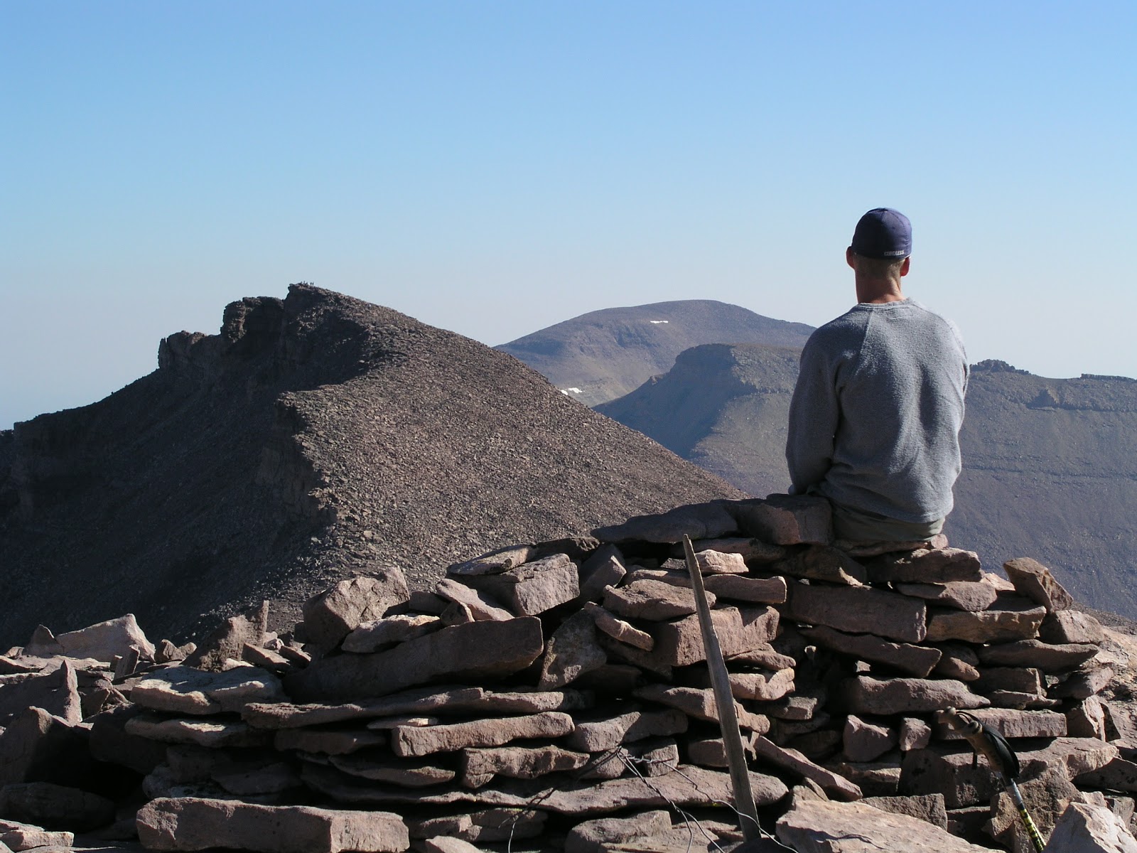
(The accompanying photograph by Ravell Call shows an unusual, "triple peak" view. The picture shows Craig A. Lloyd admiring the view from atop South Kings Peak and looking toward Kings Peak and further away, Gilbert Peak. So, Utah's 3 tallest summits are all highlighted in this picture.
The second photo shows Lynn Arave on the south side and just below Kings Peak, headed for South Kings Peak. The third photo below, also by Ravell Call, shows a bunch of hikers in Henry's Fork Basin, with Kings Peak rising up in the background, in between Gunsight Pass.
The fourth photo below shows the old Kings Peak metal plaque, circa 1990. It has been missing since about 1999.) 


-NOTE: The author, Lynn Arave, is available to speak to groups, clubs, classes or other organizations about Utah history at no charge. He can be contacted by email at: lynnarave@comcast.net  


Is It 'Wasatch' or "Wahsatch'; 'Uintah' or "Uinta'?

By Lynn Arave

Is it Wasatch or Wahsatch? How about Uinta or Uintah?
The answer is they are all correct depending on the usage, and have some interesting history behind them as well.
Though Wasatch is the accepted spelling for the mountain range and a county east of Salt Lake City, there once was a town named Wahsatch located along I-80 at east end of Echo Canyon about 24 miles southwest of Evanston, Wyo. It was named for Chief Wahsatch, a Shoshone Indian whose name was spelled that way, according to John W. Van Cott's book "Utah Place Names."
Wahsatch sprang up as a railroad town in 1868. Hundreds lived there in its frantic heyday, but eventually it became desolate when Evanston took over as the area's railroad hub. Now a ghost town, it is still listed as Wahsatch on the official Utah highway map.
But it is apparently one of few instances in Utah where Wasatch is still spelled with an 'h.'
Kent Powell, a Utah State Historical Society historian, said he's also wondered if Wasatch and Wahsatch weren't just two different spellings of the same word. Chief Wahsatch, he said, likely did not learn to spell his name in English and so someone else probably came up with the spelling.
Clarence King of the U.S. Geological Survey worked in Utah in 1869 and his photograph titled "Wahsatch limestone cliffs" supports the notion of that spelling once being applied to the mountain range.
Wasatch is a Ute Indian word meaning "mountain pass" or "low place in a high mountain," according to Van Cott.
Besides the lone place name using the Wahsatch spelling, a few current organizations and events have adopted it.
For example, there's the Wahsatch Shooters Association and two footraces — the Wahsatch Steeplechase and Wahsatch Rendezvous.
In addition to Wasatch/Wahsatch, there is another Utah place name spelled with and without an 'h' — Uintah and Uinta. There seems to be some question, even a little controversy, over the missing or added letter.
According to History to Go, an online historical resource by the Utah State Historical Society/Utah State History Department, early maps usually attached an 'h' to the end of Uintah. However, it was left off of Maj. John Wesley Powell's publications from his 1869 geographic expedition as being unnecessary for pronunciation of the word.
There's even a possible dark side to the Uintah spelling. Some descendants of the original Indians of the Uintah Valley Reservation suspect that in 1902 the federal government added the "h' to Uinta to distort the true identity of the Uinta Indians and to distance itself from an 1861 executive order that created the Uinta Valley River Reservation. At the same time, they wondered whether it was just mistake made by a government typist.
Uinta/Uintah also is a Ute Indian word and there is some disagreement on its meaning. It either refers to land at the edge of pines or streams of water or living high up where timber grows, according to "A History of Uintah County" by Doris Karren Burton.
Local historians see the spelling more as a matter of expediency.
"I have been told that for Uinta/Uintah that Uinta is applied to natural features- — Uinta Basin, Uinta Mountains, Uinta River — while Uintah is for political or names — Uintah County, Uintah Indian Reservation, Uintah Stake, etc.," Kent Powell said.
Burton essentially agrees. "The National Board of Geographic names applies the spelling Uintah to political subdivisions, such as counties, reservations, etc., and the spelling Uinta to mountains, streams, and other geographic features.
For example, there's Uintah County, Uintah town in Weber County and Uintah High School in Vernal. Meantime, there is the Uinta Mountains and the Uinta National Forest.
Floyd O'Neil, director emeritus of the American West Center at the University of Utah, said there's really no way to know for certain about how the spellings came to be, adding "This all creates a great spelling bog."

(Originally published in the Deseret News, July 27, 2009.)

-NOTE: The author, Lynn Arave, is available to speak to groups, clubs, classes or other organizations about Utah history at no charge. He can be contacted by email at: lynnarave@comcast.net  


The scoop on Ogden's 'Presidential' streets


By Lynn Arave


Some of the streets of Ogden City boast a "presidential flair" and have for almost 125 years now.
Seventeen of Ogden's main north-south streets are titled after U.S. presidents. Knowing them — and their order — may help you find your way around town. We're talking Washington Boulevard as the city's key thoroughfare.
 Going east, the full block streets advance in order to the 15th president, James Buchanan. Drop down to west of Washington Boulevard and there are two more, out-of-order presidential streets, Lincoln and Grant.
Ogden isn't unique in presidential street-naming, but for Utah it is unusual.
Other U.S. cities, including Kennewick, Wash., Hollywood, Fla., Trenton, N.J., Alcoa, Tenn., and more also have it in place.
 Missing from Ogden's streets is a Johnson Avenue, for the 17th President, Andrew Johnson. Why he's absent is not clear, but perhaps it was because Johnson was not elected president and/or because he was impeached.
In addition, no continuation of presidents after Grant have been added to Ogden's streets layout over the decades.
But Ogden's streets weren't always named after the top American leaders.
Originally Ogden received just a few street names. Locations in Ogden's early days were mostly identified by phrases like, "south of the Ogden River," or "north of the Ogden River."
Or, roads were referred to by ownership, like "Tithing Yard Street," "Blacksmith Shop" road; or the "First Street North of the Mayor's House."
It wasn't until 1870 that the Ogden City Council named its streets.
Then, some of Ogden's north-south streets were named after prominent leaders of The Church of Jesus Christ of Latter-day Saints. Mormon pioneers settled Ogden, and like Salt Lake City, LDS names soon dominated the street grid.
 For example, Washington Boulevard was first  titled Main Street. Lincoln was Franklin Street, for Franklin D. Richards; and Grant Avenue was Young Street, for Brigham Young. Also, Jefferson Avenue was Smith Street, for Joseph Smith, the founder of the LDS Church.
There were other streets too, like Pearl, Green, Spring and Wall. (But, only the latter of those has survived today.)
Why did the street name changes occur? It was an attempt to "Americanize" Ogden, according to "A History of Weber County," by Richard C. Roberts and Richard W. Sadler.
The first non-Mormon mayor in Ogden, Fred J. Kiesel (1889-91), lobbied the city council to rename Ogden's streets at a meeting April 5, 1889.
 This was likely part of the rivalry between the Mormons and non-Mormons in Ogden at the time.
The Standard-Examiner had cautioned in a March 27, 1889 story that even Liberals in the future might regret taking away the honored Utah names, like Young and Franklin, from its street grid, in favor of overused national titles, like Lincoln and Grant.
Still, an April 3, 1889 report in the Standard-Examiner said that Mayor Kiesel was graceful and sincere with his street-renaming proposal.
And, news reports in the Standard Examiner, even just days after the streets were renamed, seemed to have seamlessly made the name changes, as if they had always existed as such. 
The only north-south street name left untouched was Wall Avenue. It was named for the wall of an 1855 pioneer fort that existed there and went east to today's Madison Avenue and also extended from today's 21st to 28th streets.
 The wall was some 8 feet high and cost $40,000, to its end of being just half-complete. In the later years, the city added Pierce and Buchanan as the city's roads extended to the foothills.
Kiesel also convinced the City Council to re-number the east-west configuration at the same time.
Prior to 1889, First Street ran along the north side of the LDS Church's Tabernacle block and Second Avenue was on the south. These boundaries were extended and the original First Street became 21st Street.
 Kiesel cared about roads period -- their condition too -- and set up a poll tax that required all men aged 20-50, to work one day a year on the streets, or they had to pay a $3 fee.
 He also started Ogden's first uniform house numbering system and required all builders in town to have permits.
Kiesel was a supporter of the separation of church and state and got a law approved that made it illegal for any city residents to use a church meetinghouse as a school building, building too.
Grant Avenue and 24th Street were both essentially bogs in Ogden's early history. In the mid-1880s, loads of gravel were brought in to improve Ogden's streets. The city's first concrete sidewalks came in 1889.


 The first Ogden street paved was 25th Street, from Washington to Wall, in 1893 at the cost of about $100,000.

(Published in the Ogden Standard-Examiner, Feb. 14, 2014, by Lynn Arave.)


-NOTE: The author, Lynn Arave, is available to speak to groups, clubs, classes or other organizations about Utah history at no charge. He can be contacted by email at: lynnarave@comcast.net  


The Original 'This is the Place' Monument

By Lynn Arave

WHERE is the actual site where Brigham Young declared what is now Salt Lake Valley as "the place" in 1847?
It isn't where the well-known "This Is the Place" monument sits above the north side of Sunnyside Avenue.
The true spot is more likely where an obscure marker sits several hundred yards to the northeast of the famous concrete edifice, up a steep hill.
 Both monuments are in the southeast corner of This Is the Place Heritage Park.
A simple, 10-foot-tall white obelisk was installed by the Young Men's Mutual Improvement Association and dedicated by LDS Church President Heber J. Grant on July 25, 1921, before a crowd of about 2,000 people. It is located on a hillside loftier than the site of today's larger and much more visited monument.
Even in 1921, there was still much debate over the location of the actual site. Still, "this monument was located here as the definitive answer as to where the event occurred," the plaque near the original monument states.
W.W. Riter was 9 years old in 1847 when he and his parents followed Brigham Young into the Salt Lake Valley.
"In his early years, Wilford Woodruff had taken him to the spot and stated that this is exactly where Brigham Young had uttered those important words," the 1921 monument marker states.
Elder Brigham H. Roberts, a historian and member of the The Church of Jesus Christ of Latter-day Saints Quorum of Seventy from 1877 to 1933, also said the 1921 monument is very near to the actual place.
However, even the 1921 marker is not the original "This Is the Place" monument. There was an earlier marker in the area, too. In 1917, Elder Roberts and some Boy Scouts installed a wooden marker where Brigham Young entered the valley. It was replaced in 1921.
The 1921 monument eventually fell into disrepair and obscurity because of the much larger and more popular modern monument completed in 1947. It was dedicated on July 24, 1947, before a large crowd estimated to be 50,000 strong.
Due to This Is the Place Heritage Park development, the second marker was discovered in the 1990s. It was rededicated on July 21, 1997, by President Boyd K. Packer of the Quorum of the Twelve. The monument work was funded and directed by the Mills Chapter of the Sons of Utah Pioneers in partnership with Zachary Mahoney, grandson of one of the chapter members who made it his Eagle Scout project.

Brigham Young's actual historic words
What did Brigham Young actually say near the mouth of Emigration Canyon?
The second president of The Church of Jesus Christ of Latter-day Saints specifically said, "This is the right place. Drive on." The "This Is the Place" term is a modern, abbreviated usage.


                The original "This is the Place" marker, with the modern structure in the background.


(Story was originally published in the Deseret News, July 24, 2009, by Lynn Arave.)

-NOTE: The author, Lynn Arave, is available to speak to groups, clubs, classes or other organizations about Utah history at no charge. He can be contacted by email at: lynnarave@comcast.net  


The Tallest Man Made Structure in Utah ...


By Lynn Arave

What's the tallest artificial structure in Utah?
Hint: It is NOT in downtown Salt Lake City.

Kennecott Copper's Garfield Smelter smokestack, west of Salt Lake City,  may be dwarfed as it stands adjacent to the 9,000-plus-foot Oquirrh Mountains, which rise more than 4,000 feet above the Salt Lake Valley.
However, the reality is that the Kennecott smokestack is one of the loftiest, free-standing structures in the world and the tallest such thing west of the Mississippi.
Rising sharply about a dozen miles west of Salt Lake City and just south of I-80, this icon is by far the tallest man-made structure in the Beehive State at 1,215 feet.
It's almost the equivalent of having an Empire State Building high structure rising up, or equal to the height of three LDS Church Office Buildings (state's runner-up highest free-standing structure).
Built in 1974, the smokestack's hexagon-shaped base is 177 feet across.
You really don't want to stand right next to Kennecott Copper's Garfield smelter smokestack either. That's because you'll almost crack your neck, straining to look straight up and see the seemingly endless top of this mammoth structure.
A look inside its base reveals a surprising amount of open space, surrounded by concrete up to 12 feet thick.
The concrete itself towers to an even 1,200 feet, and then the fiberglass flue goes up another 15 feet.
"It's overkill for this (refinery) plant," said Jack Haymond, a consulting engineer for Kennecott who has worked there for 45 years. "But it was here. … It would cost a fortune to take it down."
He said when the federal Clean Air Act came along in 1970, Kennecott built the stack, which at the time was a good fit. It was just high enough to disperse waste gases, according to the new standards. However, with leaping advances in pollution controls, it is now taller than it needs to be.
Haymond said Kennecott, owned by Rio Tinto, is one of the two cleanest smelters in the world, capturing 99.9 percent of all the sulphur gas released.
The chimney replaced several predecessor Kennecott smokestacks, now demolished, the tallest of which was a height of 413 feet.
"They commandeered every cement truck in northern Utah" when they built it, Haymond said. Concrete flowed — more than 26,000 cubic yards — for 84 days, 24/7, minus one short break, to complete it. Some 900 tons of steel were also required.
Work on the stack began on Aug. 26, 1974, and was finished in less than three months. It is built according to Zone 3 seismic standards.
It cost $16.3 million at the time to build, the rough equivalent of almost $70 million in today's dollars.
Jana Kettering, Kennecott spokeswoman, said the stack is an icon, a landmark, for people traveling in and out of the Salt Lake Valley. She also said boaters she knows, who sail the Great Salt Lake, use it as a key geographical indicator.
Some airline pilots and frequent flyers also have been known to use it as a landmark. And it can be spotted from as far away as portions of Box Elder County, across the Great Salt Lake.
Strobe lights at two intensities — brighter in the day and not as bright at night — protect the stack from airplanes and helicopters.
What about lightning? Haymond said he's only aware of one instance when nature jolted the smokestack. He said in the mid-1980s, he came to work one day during a maintenance shutdown period and found pieces of concrete on the roadway below the stack. Lightning had chipped the top. It was soon repaired, but "no one saw the strike," he said.
Although there's a two-person cage-type elevator inside the smokestack that travels to the top, it is rarely used.
"It's a long, scary ride," Haymond said, and it takes about 20 minutes to reach the top. Today, a worker only needs to travel up to the 300-foot level each day to service an air-sampling station.
The top of the smokestack narrows to 40 feet in diameter and features 12-inch-thick concrete.
The smokestack is also part of Kennecott's efficient smelter process, which supplies about 60 percent of it owns electrical energy needs through steam generation.
A 1,765-foot-long piping system carries leftover gases into the smokestack and an interior pipe travels inside the concrete and up to the top of the stack.
Haymond said any discharge you see out of the smokestack isn't smoke, it is just steam. Only trace amounts of any waste gases escape.
According to a Wikipedia ranking of freestanding structures (those that lack guyed masts or support cables), the Kennecott Smokestack is the 31st tallest such structure (including skyscrapers) in the world. In the U.S., its is ranked fifth-highest, only behind the Willis Tower and John Hancock Center, both in Chicago; the Empire State Building in New York City; and a smokestack a mere two feet taller in Pennsylvania.
In comparison, the Las Vegas Stratosphere is 66 feet shorter at 1,149 feet high. Seattle's Space Needle is just 605 feet tall, less than half the smokestack's height.
The Kennecott smokestack, fourth tallest chimney in the world, is the only operating smelter chimney left in Utah and will turn 35 on Nov. 17. As a working facility, with many potential hazards about, public tours are not offered at the smokestack or refinery.
Kennecott's Bingham Canyon Mine, to the south, is where the copper extraction process begins, and it is the world's largest man-made excavation. Factor in this usually lesser-heralded smokestack, and Kennecott actually has two world-class man-made icons.
Smokestack facts:
Height: 1,215 feet.
Diameter: 177 feet across.
Year built: 1974
Cost: $16.3 million.
2nd highest smokestack in the U.S.
4th tallest chimney in the worldWorld's 5 tallest chimneys:
1. GRES-2 Power Station, Kazakhstan, 1,377 feet high
2. Inco Superstack, Sudbury, Ontario, Canada, 1,247 feet.
3. Homer City Generator, Pa., 1,217 feet
4. Kennecott smokestack, Magna, Utah, Utah, 1,215 feet.


(-Adapted from a Deseret News Story, by Lynn Arave, published on Nov. 16, 2009.


-NOTE: The author, Lynn Arave, is available to speak to groups, clubs, classes or other organizations about Utah history at no charge. He can be contacted by email at: lynnarave@comcast.net