Thursday, February 11, 2021

Recalling the old "Pioneer Spring" on Grant Avenue in Ogden


              The artesian well at the north end of Washington Boulevard.

MENTION water springs or wells in the Ogden area and you'll likely hear about the artesian well at the top of Washington Boulevard (still flowing today), or the artesian wells in Ogden Valley that were capped when Pineview Reservoir was constructed (and have been under water ever since).
However, there was a major water well -- "Pioneer Spring" --  in Ogden City and this existed from the time the city was settled and up until some 40 years later, in 1889, when it was capped.
"Reminscences of Dr. Condon: Recalling the old spring in front of the fire station" was a July 22, 1919 headline in the Ogden Daily Standard newspaper. The article's writer, Dr. A.S. Condon noted that this well and the old street names in Ogden disappeared at the same time, when the first "Gentile" (non-Mormon) mayor and city Council came into power in 1889.


           The old Hostess Bakery used to be approximately where the old Ogden Spring was.


This is a view of the vacant property where the old spring might have been on Grant Avenue.


                                    Another view of the old spring property.

This well was on Grant Avenue, in front of the City's first fire station and just across the street to the west. It was located between 25th and 26th Streets. The liberal leaders of Ogden believed the well to primarily be surface water and this a health hazard to residents.
Condon stated that the first attempt to cap the well with some sort of material failed and the water flowed back to the surface. The second time cement was used and this forced the well to flow into the Weber River (though that meant it had to travel over two blocks west, across Lincoln and Wall Avenue and the railroad yard to reach that river) Did Condon just assume the spring drained back into the aquifer? Perhaps). It's grave is neglected and unmarked, Condon stressed.
"So passed into the land of shadows a venerated friend loved by everybody, even its enemies for I have often heard them speak kindly of it," Condon wrote in his recollection.
Condon admitted that in the 19th Century impure water caused plenty of disease and sickness and even "empty cradles" in Ogden. The absence of sewers many many a shallow well was contaminated.
"The pure waters of Pioneer Spring offered a scanty supply for a large village, but did its best to fulfill the requirements. Crowds armed with pitcher and pail surrounded the faithful old spring in early morning and evening," Condon wrote.
Essentially, Condon stated that Ogden's new liberal leaders simply "ordained that the old order of things should give way to a new dispensation."
And, that reason was why the spring was capped and also why Ogden's streets were renamed after the U.S. Presidents, instead of local leaders and leaders of the dominant religion in town.

The mystery of Utah’s ‘Mountain of Christ’: Monte Cristo


                         Monte Cristo Peak, center, 9,148 feet above sea level.


MANY decades before a viable seasonal highway (U-39) traversed its heights, the Monte Cristo Mountains, about 40 miles northwest of Ogden, generated mystery and fascination.
Hundreds of miners had passed below, to the northwest when the La Plata mines were in their 1890s heyday, but even the height of Monte Cristo was unknown in the early 20th Century.
“A grand trip to ‘Old Monte,’ Near but unknown solitude and grandeur in the Monte Christo (sic) Mountains” was an August 26, 1908 headline in the Logan Republican newspaper.
“It is distinctly a region of scenery and scenery on a scale of grandeur obtainable in very few places,” the story stated, dubbing it Utah’s “Garden of the Gods.”
“You may drive all day and meet no one, see no signs of habitation, unless it be a lone sheep herder’s tent,” the story stated, saying sheep men call the area “Old Monte” and that its greatest charm is solitude and being cut off from the world of humanity.
The Ogden Standard-Examiner of Aug. 11, 1910 also reported on the mystery of Monte Cristo. It stated that a party of Ogdenites were going to travel there to ascertain the height of the tallest peak there, Monte Cristo. Rumors had for several decades since the La Plata mining boon below, believed the summit to be between 11,000 and 13,000 feet above sea level.


                           The Monte Cristo Mountains as seen from Snowbasin.


The Monte Cristo mountains are where four Utah counties – Weber, Rich, Cache and Morgan all intersect and where the nearest towns are Huntsville or Woodruff, both about 22 bird-flying miles in any straight direction.
The Salt Lake Tribune of Aug. 18, 1910 reported on the group’s findings: “The height of the mountain which many in the party had been led to believe was inaccessible and one of the highest in the state, was found to be 8,950 feet above sea level.”
(Modern measurements have upped that elevation to 9,148 feet above sea level.)


                                   Monte Cristo and Utah Highway 39 in late May.

-Who gave the mountains and tallest peak their religious name, Monte Cristo, is also a mystery for the ages. According to the book, “Utah Place Names,” by John W. Van Cott, there are three different claims for the name’s origin:
1. Miners returning from California though the range resembled the Monte Cristo Mountains of California; 2. The name could have been given by early French-Canadian trappers; and 3. One of the early road builders in the area carried a copy of the book, “The Count of Monte Cristo,” which he read to his co-workers at night around the campfire.
However, since the 1908 Logan Republican story spotlighted to remoteness of the area – and no road was mentioned, but the name Monte was there – that leaves only credence for the first two origins.
(Note: “Monte Cristo” also means “Mountain of Christ” in Spanish.)

MORE HISTORY ITEMS:

-The Salt Lake Herald of July 11, 1909 outlined the report of one of the first known automobile trip to visit the North Rim of the Grand Canyon. This Woolley Automobiling Party went from Salt Lake City to Kanab/Fredonia and required 39 hours and 20 minutes of driving the 430 total miles before looking down at Bright Angel Creek from the Rim.
-The Ogden Bay Waterfowl Management Area was the first federally funded waterfowl management area in the United States, according to the Davis County Clipper of Nov. 26, 1976.
This area is located west of Hooper and is located on the delta of the Weber River, near where it dumps into the Great Salt Lake. Development there began in 1937 and includes 16,700 acres. The Hoard Slough portion to the south was developed 21 years later in 1958.


Back when Davis County was temporarily ‘lost’ and Sandy was terrorized


DAVIS County was “lost” temporarily in May of 1892.
“County mark lost” was a May 13, 1892 headline in the Davis County Clipper. On May 6 of that year, “the stone that indicates the division line between Salt Lake and Davis counties was pulled up and moved into the middle of the wagon road,” the Clipper reported.
On May 9. Davis County road supervisor John Parkins heard about the vandalism and he headed south from Farmington to the border line, hoping to reset the block. However, he found that the block was no longer in sight.
“But after a three-hour search succeeded in finding it under some weeds on the inside of the stone wall on the lower side of the road, about four or five hundred yards north of where it stood,” the Clipper stated.
He surmised that the large stone had been taken on cart to that distant location. He also found two cigarettes at the scene and noticed that the wagon had done a U-turn to head back to Salt Lake County after dropping off the stone.
The stone was replaced and Davis County was back to normal.
-“Terrorizes citizens of Sandy” was a March 2, 1893 headline in the Clipper.
“A few days ago a crowd of Salt Lake toughs, thugs and jailbirds, headed by Hyrum Cassady, who had recently escaped from the city prison, descended upon the peaceful village of Sandy and began stealing right and left,” the Clipper stated.
Their thefts were quiet at first, but after they procured a keg of beer, they became reckless.
“Three of them went into the co-op. store and stole two pair of pants and it was decided to make a general raid on the town that night,” the newspaper reported.
One of the thugs’ own betrayed them and warned some citizens of their plans. That man was beaten and driven out of town.
“By this time it was rumored that the gang intended to set fire to buildings and the little town was wild with excitement. The citizens organized, and after quite a battle, succeeded in arresting five of the fellows, who were locked in a freight car,” the Clipper account stated.
The Sheriff was then sent for and he and his officers captured another three or four of the men. They were now holding the whole gang, but these thugs set fire to the railcar and cut a big hole in the side of it.
The eight criminals were finally contained and when brought to court, the leader was sentenced to six months in jail and a $15 fine. The other seven men received lesser sentences, ranging down to just two months in jail.
Some considered this the toughest gang ever arrested in one roundup in the area.
-“Tramps and grasshoppers” was an Aug. 10, 1893 Clipper editorial by Jed Brown of Bountiful. He maintained that the Bountiful area had never before had so many idle men or tramps walking around.
“They steal our vegetables and fruits and have feasts on our hard earnings,” Brown stated. “We should surely have an officer closer than we have to look after our interests.”

                                                      Buffalo on Antelope Island.

-The Clipper newspaper also had an item in its Aug. 3, 1892 edition on “How buffaloes were slaughtered.”
During an annual migration for food, buffalo herds were simply unstoppable and if an animal fell, it was trampled to death by the bison behind.
So, lazy hunters eventually realized that they didn’t have to always just shoot buffalo. All they had to do was frighten a herd in the direction of a ravine, “where if the front ranks halted they would be pushed over by the thousands.”
The article, taken from “Our Animal Friends” publication, concluded with “It was reckless, wholesale slaughter of noble animals and accounts partly for the scarcity of the buffalo in later years.”


Killing Old Ephraim didn't stop Logan Canyon sheep deaths in the 1920s


            The monument, near Old Eph's final stand, complete with a plaque.

THE killing of the legendary gigantic marauding grizzly bear known as "Old Ephraim" in Logan Canyon actually didn't stop the demise of sheep by bears for ranchers afterward.
For some time after Eph's demise, sheep were still being lost to bears.
Indeed, "Raid on grave of fallen monarch avenged by bears" was a Sept. 13, 1924 headline in the Deseret News.
(The story of Old Ephraim's death is well chronicled previously in this blog. See "Old Ephraim: Utah’s most legendary bear," July 16, 2015.)
This 1924 Deseret News story, just over a year after Old Ephraim was killed, stated that after Logan boy scouts had raided the gravesite of the famous bear, sheep killings got worse.
"The bears have been worse since the scouts were up here digging in Old Ephraim's grave than they have ever been before we came into this county with sheep." That was a quote from Frank Clark. who was the one who killed Old Eph on Aug. 21, 1923, talking about sheep deaths a year later in the summer of 1924.
"Contrary to bear habits and former history, the bears have been raiding the herds and killing heavily in the daytime, as well as at night," the Deseret News story reported.
Clark said that in just a week of the summer of 1924, he lost 10 sheep to bears in the same section where old Eph roamed.
"It seems that Old Ephraim's followers are still loyal," the 1924 Deseret News story concluded.
A Logan boy scout troop had visited the grave of Old Ephraim in the summer of 1924. They dug up the grave, took bones as souvenirs and the skull was sent to the Smithsonian. The skull has since been returned to Utah and is on exhibit at Utah State University.


Hill Field: From wind-swept flat to teeming city in 4 years; Plus, Francis Peak history


                                      A past HILL AFB air show.

"TEEMING City thrives on what was only wind-swept flat four years ago" was a headline in the Ogden Standard-Examiner of Feb. 7, 1943.
"Ogden air depot at Hill Field stands as a monument to the ingenuity, industry and determination of the people of Utah," the story stated. Counter to the former wind-swept land, there now exists there, "a city comprised of huge repair hangars and shops, humming with activity; great warehouses with hundreds of thousands of air corps supply items; administrative office buildings covering many acres; miles of track over which are shunted hundreds of freight cars every day."

                           Hill AFB from the southeast Layton bench.

The Standard's description continued: "Like any other modern city, Hill Field has many schools, theatres, a chapel, living quarters consisting of both civilian and military barracks, a fire station, cafeterias, utilities, including gas, water and electrical installations, a well-developed police organization, and its own transportation system. ... The physical growth of Hill Field has been prodigious..."
-Nine months later, another newspaper reported on the same transition of former open land in northern Utah: "One time farm area now industrialized," was a headline in the Salt Lake Tribune of Nov. 7, 1943.
The article continued, "Farmers who used to till the soil on a vast expanse of valley land in northern Davis County never thought more about industrial plants or anything which was a very far cry from agriculture."
"Today they gaze at the $22,000,000 rambling air service command headquarters called Hill Field," The Tribune stated.
The article said thousands of workers now work at the base.
(In fact, the area was at one time part of what was called "The Sandridge," a sandy area that was more for dry farming on pioneer times.)
"Hill Field existed as an idea as far back as 1935 ... Sheltered by high mountains, far enough inland to minimize chances of enemy attack, easily accessible by rail and not too far from the Pacific coast," the Tribune story said.
The stated Hill Field was then the nerve center for 12 sub depots in eight states, all of which are controlled and supplied by Hill Field.
"Only 12 miles from Ogden and 30 miles from Salt Lake City, Hill Field grew up in the midst of what was to become one of the most acute labor shortage areas in the war industrialized west," the story stated.


-MORE HISTORY: Another government installation in Northern Utah is the lofty radar station atop Francis Peak in Davis County. "Francis Peak radar unit to begin test basis May 31. Highest radar site in nation" was a May 28, 1959 headline in the Weekly Reflex newspaper. At a cost of $1.5 million, the facility at more than 9,500 feet above sea level is operated by the FAA. It originally included a Utah Air National Guard facility too.
The facility initially had the radar power to see aircraft 100 miles distant and was manned 24 hours a day.
Although a dirt road to Francis Peak was roughed in by 1938, through the efforts of the Civilian Conservation Corps, the Reflex newspaper of June 16, 1960 reported that the Utah National Guard was improving that 5-mile section of road that summer.

                                                Top, center, the Francis Peak radar station.

Changes in geographical feature names in Zion National Park; Plus, more history

                                                  A 1919 map of Zion Canyon.
HERE's a look at some of the natural feature names that have changed at Zion National Park, since its earliest days of the pioneers:

-RASPBERRY BEND: This was the original name for the "Big Bend" in Zion Canyon.


                                                Looking down on today's "Big Bend," from above.


-EL GOBERNADOR: This was the earliest of titles for the Great White Throne.

-WYLIE CAMP: This was the name of the first public camping place in Zion. This was essentially a tent camping resort and is approximately located where the Zion Lodge is today.

-THE THREE PATRIARCHS: This name has been modified over the decades and today the Court of the Patriarchs in the most common title for the area.

-THE STREAKED WALL and THE BROWN WALL: The "desert varnish of colors in the rock walls of Zion were originally labeled as this. The Streaked Wall was on the west side of the canyon and the Brown Wall was on the east. These were located between today's Zion Lodge on the north and the East and West Temples on the south.

(SOURCES: Comparing a 1919 Zion map from the Ephraim Enterprise newspaper of Nov. 22 that year, with modern maps.


-MORE HISTORY: The Zion Tunnel was constructed from 1927-1930. This 1.1-mile-long tunnel shortened the distance between Zion and Bryce national parks by some 70 miles. The tunnel was dedicated on July 4, 1930, but had to be closed just over two years later because of a significant rock fall. According to the Ogden Standard-Examiner of Sept. 28, 1932, the tunnel was closed for three days when 12,000 cubic feet of rock fell between the west portal and the first gallery. Engineers actually set off the blast that cause the rock fall while they were enlarging the size of the tunnel to make room for reinforcements.
Besides regular maintenance closures, a sandstone pillar in the tunnel unexpectedly collapsed in 1958 and caused a three-week closure. Since then, according to the National Park Service, the tunnel is now monitored 24 hours a day to look for such problems.

-BEFORE 1930, there was no good road from Utah to Flagstaff, Arizona. Taking the railroad there was still the easiest option. By the spring of 1930, Arizona had created a good road from Flagstaff to Cameron. The road from Fredonia/Kanab to Jacob's Lake was in the works and the road down from there to Cameron was also in the works. This was according to the Salt Lake Tribune of April 20, 1930.

-Eden Park was the a short-lived resort in Bountiful, created by Simon Bamberger, before he moved his Farmington resort, "Lakeside," eastward to become today's Lagoon. The Salt Lake Herald newspaper of June 15, 1894 reported that Fred W. Milverton and A.H. Stewart of Salt Lake City submitted the winning name for the new resort as "Eden." It opened on June 16 that year, with music, dancing and bowery. Passenger trains accessed the resort for 35 cents roundtrip for adults and 20 for children.
The Davis County Clipper of June 28, 1894 reported that the resort had 2,000 visitors the second weekend it was open and that it also had a "rustic bridge." 
On July 24, Pioneer Day, of 1894, the Salt Lake Herald stated that the resort hosted a baseball game and had prizes for the winners in a men's foot race, a boy's foot race, a fat men's race, a wheelbarrow race and a sack race. There were also prizes for the best recitations, both comic and serious. There was also a dance contest and fireworks.
The main reason that Eden Park only lasted about one year and was closed by the mid-summer of 1895, was listed in the Salt Lake Herald of May 8, 1910:
 Eden Park had no water or boating and so Bamberger looked further north for a desirable location and found what he wanted in Lagoon at Farmington.
This Herald article also stated that there had been plans to pump salt water from the Great Salt Lake to Lagoon for a special briny bathing feature, but that never happened.

-KILLING wolves was normal in 1894 Utah. The Davis County Clipper of June 28, 1894 reported that Harvey Sessions, 15, and a younger brother, plus Joseph Garrett, 8, were hunting in Birch Hollow of Mill Creek Canyon, east of Bountiful. They came up six young wolverines. They shot and killed three of them and wounded another.

-FROM Hooper to Kaysville, there was nothing in between from the 1850s until the start of the 20th Century. The Utah Mining Gazette newspaper of Salt Lake reported on Sept. 27, 1873, that a man tried to jump a train between Hooperville (early Hooper name) and Kaysville, but slipped and the train wheels crushed his foot.
The Salt Lake Evening Democrat newspaper of May 9, 1887 stated, "Your Ogden scribe took a pleasant and interesting trip to the salt works between Hooper and Kaysville on Sunday ..." Before the 20th Century, there was Ogden, Hooper and Kaysville, with no other towns in between. There was no Layton, Syracuse, West Point, Clinton, Clearfield, Sunset or Roy. They all came later.


Erosion problem of pioneer trail realized in the 1930s; Plus, a second Thurston Peak and Malan's Peak fires


                    This is the Place Monument at the mouth of Emigration Canyon.

THE early pioneer trails of the 19th Century were etched firmly in the soil as a semi-permanent historical marker for later generations. However, by the 1930s, it was apparent that the trails were also causing significant soil problems.
"Early pioneer trail forms soil problem" was a May 23, 1937 headline in the Ogden Standard-Examiner.
This Associated Press story outlined how the  original pioneer trail through the Wasatch Mountains was producing soil erosion that had to be dealt with.
"A winding mountain trail that almost a century ago led Mormon pioneers over the Wasatch mountains into Salt Lake Valley is just a soil erosion problem today," the story stated. "City, state and federal governments have joined forces to experiment with it."
The story stated that, "Each spring melting snows coursed down the rutted trail until it deepened and widened into a 20-foot gully."
Sheep grazing in the same area had made the erosion worse and equaled "a barren gash across the mountains" and "a flood hazard and menace."
As such, the Civilian Conservative Corps ("CCC") was being used to try and shore up the damage. The CCC built terraces, planted more foliage and a fenced trail for sheep to follow in the area around Little Mountain in Emigration Canyon.

                          The other "Thurston Peak" (Unofficial name), east of Centerville.

-MORE HISTORY: Thurston Peak is the not only the highest peak east of Layton city, but it is also the tallest peak in Davis and Morgan counties, straddling the county line.
At, 9,706 feet above sea level, this peak was not officially named until 1993. It had previously been labeled as a benchmark from Francis Peak.
However, the name "Thurston Peak" is not a unique title to Davis County.
When a United Airline Plane crashed in Davis County on Nov. 4, 1940, the crash site was identified as being on "Thurston Peak" or "Thurston Mountain." This peak was said to be on the south side of Ford's Canyon, east of Centerville.
A fleet of newspapers on Nov. 4, and Nov. 12-13 of 1940 all identified the crash site as being on "Thurston." These included the Salt Lake Tribune, the Salt Lake Telegram and the Davis County Clipper.
Although not named "Thurston" on official government maps, locals in the Centerville area had referred to the mountain as such for many years.
Yet, when the highest point in Davis County was officially named in 1993, the knowledge of this earlier "Thurston Peak" had apparently been forgotten. The name had been lost to history, some 50-plus years after the 1940 crash of the airplane, which killed all 10 passengers.


-THE annual hike by Weber State College students to Mount Ogden routinely lit a fire on Malan's Peak, left photo, (or in Malan's Basin), below the higher peak, to create a "Flaming W" symbol. However, this was NOT the only event to light Malan's Basin on fire. According to the Ogden Standard-Examiner of May 3, 1941, "Peak fire will roar if drive is successful" was the headline. A fire was to be lit if efforts to find local housing for thousands of high school students competing in the national regional high school music contest was successful.

                            Malan's Basin, with Mount Ogden in the far background.

Ogden's stockyards were 7th largest in U.S.; Plus, Ogden's first traffic jams and more

OGDEN'S Stockyards were a national powerhouse for decades.
Began in 1916 and located north of 24th Street by the Weber River, the facility soon moved to north of Wilson Lane on 70 acres.
"Ogden stockyards moves into seventh place in U.S." was the Feb. 4, 1936 headline in the Salt Lake Tribune. The yards handled more than 2.75 million head of animals in 1935. Chicago and St. Louis had the two largest stockyards in the country at the time. Omaha, Kansas City. Denver and St. Paul ranked ahead of Ogden.
However, the story stated that all of the six cities ranked ahead of Ogden in stockyard size had from five to 60 times the total population of the Weber County capital. 
The Ogden stockyards, 570 pens, were the largest in Utah and about triple the size of Salt Lake's stockyards. At one time, the Ogden yards was also the third largest shipper of sheep in the nation, ranking only behind Denver and Chicago.
Ogden's stockyards closed in 1971.
-MORE HISTORY: First Ogden traffic jams? World War II and its extensive military operations in northern Utah likely produced the first traffic jams in Weber County. "Army workers causing large traffic boost" was a May 3, 1941 headline in the Ogden Standard-Examiner.  The story noted how morning and afternoon road traffic in Ogden was now becoming so heavy that it was hazardous.
Between 4:30 p.m. and 5:15 p.m., a record 540 cars were counted in that 45 minutes at the "Death Curve" in Roy, where Riverdale Road ends.
Police in Ogden and Weber County also operated traffic blockades  to check on drivers. Six drivers in Ogden were arrested for not having licenses and 32 warnings here handed out for various traffic offenses. The most common traffic offense reported in the story was turning left from a lane other than the center lane.


                              This is likely the slowest speed sign in northern Utah today.

-"10 M.P.H. traffic sign thrice torn down" was an Oct. 13, 1939 headline in the Salt Lake Telegram newspaper. South Salt Lake City at the time had a slow down area near its Madison Elementary and Madison Junior High Schools.  But, on three occasions, the signs were torn down and thrown into nearby yards. This slow speed zone was believed to be the slowest in the state and only 10 mph zone too.


-"Davis County leads state in '47 traffic toll" was a Jan. 15, 1948 headline in the Weekly Reflex newspaper of Kaysville-Bountiful.  a total of 29 people died on roads in Davis County in 1947. Salt Lake County had more total deaths at 44, but on a per population basis, Davis' ranked worse.

'Moki' Dugway: The most unforgettable/scariest road in Utah, but a view to die for?


The heart of the Moki Dugway switchbacks.
                                                                                                   Photo by Ray Boren in 2018.

WHAT the upper Angels Landing Trail in Zion National Park is to hiking (scariest and most unforgettable), the "Moki" (sometimes also spelled "Moqui" or "Mokee") Dugway is the equivalent to highway driving in Utah.
Often known in San Juan County, Utah as "White knuckle hill," this three-mile-long graded dirt road with an 11 percent grade is unique in the State Highway system, it being a segment of Highway 261, from Mexican Hat to Highway 95 (south of Bear's Ears) or  a shortcut to Hite Crossing on Lake Powell.
This road climbs 1,200 feet up a sandstone cliff face and has no guard rails. The road is also so camouflaged into the cliffs, that you have to almost be on the switchbacks to see them.
The road drops 750 feet in just 440 yards.
"Going up or down is an experience not soon forgotten," is how the San Juan Record newspaper described driving the Moki Dugway on July 24, 1985. The Dugway has become one of the area's spectacular attractions -- and the nearby Muley Point Overlook doubles the eye candy.

Approaching the cliff the Moki Dugway climbs up is almost invisible until you're driving on it!
Photo by Ray Boren in 2018.


Supposedly, the future Moki Dugway slope is where Ute Chief Posey, though wounded, somehow came down the steep mountain and eluded law officers in the 1920s, intent on capturing the Chief for the final Ute uprising.
According to the San Juan Record of July 13, 2005, the Dugway's original name was "Isabelle Hill," though no one seems to know why, or when it switched to "Moki." Why some variations of the name spell it "Moqui" or "Mokee" is also unknown, but the shortest spelling is the norm now by common usage.

                            Even the sign at the top of the Dugway spells it as "Moki" these days.
                                                                                                                           Photo by Ray Boren.

The switchbacks begin at an elevation of 5,325 feet above sea level and top out at 6,525 feet.
The San Juan Record of July 1, 1998 proclaimed the road, "gives new thrills to the driving experiences of the southwest" ... and "provides access to an overlook on top that provides panoramic views of the area."
How did this Dugway come to be?
The Texas Zinc Corporation began to build the Dugway and a total  of 33 miles of road in 1955 from Utah Highway 95 south across Cedar Mesa to Mexican Hat, according to the San Juan Record of Jan. 7, 1965. Plagued by strikes, the road was finally complete in mid-1957 and it provided direct access from the high elevation mines down to a uranium mill at Mexican Hat.
The Dugway portion of the road alone cost $1 million (more than $9 million in 2020 dollar value).
The road was deeded over to the State of Utah in 1957 and officially opened as a state highway on Aug. 10, 1957. Yet, the other portions of U-261 were not paved until 1961-62.


     The Moki Dugway, a gravel segment, is that gap in the red color along Highway 316.


(Texas Zinc Corp. was bought by Atlas Corporation in 1963 and the uranium mill at Mexican Hat closed in 1965.)
San Juan County asked the UDOT to pave the road several times over the decades, including in 1971, according to the San Juan Record on Jan. 21, 1971. However, that never happened and the road remains gravel today.


(To bypass the Moki Dugway means drivers have to go along U-191 from Mexican Hat toward Blanding and then turn left onto U-95 toward Hite. The difference in distance is 30 extra miles without the Dugway, or about 37 minutes extra in travel time.)

The movie, "Chill Factor," (1999) filmed on the Moki Dugway.
Drivers going northwest out of Mexican Hat on U-261 see a high cliff in the distance and wonder where the road goes until the switchbacks come into view. It is likely motor home operators, big rig drivers and those afraid of heights who are unaware of the Dugway, surely question their sanity when they encounter the switchbacks going up or down.
Monument Valley High School  held the "Moki Dugway Hill Climb," a three-mile footrace on Dec. 14, 1991. Newspapers only contain that one single reference to the race being held.

One Google review of the Moki Dugway describes it as an "incredibly scary gravel road like going down the side of the Grand Canyon." Another recommends that only those unafraid of heights drive it, while some others thought it was over-rated.


Looking down a portion of the Moki Dugway to U-261 below is like looking out of an airplane.
                                                                                                             Photo by Ray Boren.

-"Skyway prospects delight San Juan" was a Dec. 29, 1968 headline in the Salt Lake Tribune. Reporter Carl E. Hayden stated that there was a plan to build a "sky railway" from the top of the Moki Dugway at Muley Point to Mexican Hat.
People would be shuttled from Mexican Hat and up the Dugway -- about 16 miles -- in buses and then be able to pay to ride a gravity powered cable car about 12 miles straight down as the bird flies to Mexican Hat.
This "would give tourists the breathtaking joy of ascending the Moki Dugway," according to the Tribune.
Of course, the skyway was never built and in today's era, with controversy over increased commercial access to the nearby Bear's Ears area, sacred to Native Americans, the development would probably never happen.

                      Near Bear's Ears, with Navajo Mountain looming in the background.
                                                                       -Photo by Ravell Call.

AT LEAST 5 ACCIDENTS ON THE MOKI DUGWAY:

Yes, people have died on the Moki Dugway. 
1. According to the San Juan Record of May 17, 1989, the first death happened about 1965. A man driving down the Dugway stopped and got out of his truck to urinate at the first turn from the stop. Lonnie Wilson, a passenger in the truck said he heard the driver say, "Oh My God!" from the rear of the vehicle and he was gone. His lifeless body was found on the next ridge below.

2. The newspaper said that scene was nearly repeated in 1989 when Howard Kinlicheeny, age 26, was in a pickup with friends and also stopped to relieve himself. He slipped off the road and fell 40 feet down. He suffered a severed spinal cord and a fracture on his femur.

3. The San Juan Record of May 11, 1994 carried the headline, "Mother dies in one-car accident." Jane Madison Navaho, 21, of Tonalea, Arizona, died when the car she was a passenger in went off the road near the top of the Dugway. She was thrown out of the vehicle after it plunged 60 feet and then rolled over her. Her husband, Dickie Navaho, was injured and had to extricated from the vehicle. The driver, Mary Stephens of Pasadena, Calif., was able to crawl out of the car. She was the only one wearing a seat belt. The Utah Highway Patrol said Stephens was driving too fast and lost control coming down the Dugway's first curve.

4. The San Juan Record of July 22, 1987, in a column by Doris Valle, recounted the tale of a driver who walked away from a fiery crash on the Dugway. Richard Nielson was starting to drive down the cliff's switchbacks in a uranium ore truck, probably in the early 1960s. The truck's brakes failed and then the steering, causing it to go over the first cliff coming down the Dugway. Flames erupted under the hood and Nielson's foot was caught by some crumpled metal inside the cab. The flames suddenly died down and started again, twice, with a few minutes in between. He finally got his foot unstuck and though shaken up, climbed back up the hill to the top of the Dugway. 
He "came up behind two other truckers who stood aghast, looking down at the smoldering wreckage below. They were ready to climb down to find Richard's body when he tapped one on the shoulder, 'What're waiting for?" he asked. "Let's get on down the road!"'

5. According to the San Juan Record of April 13, 2005, a family was almost to the bottom of the switchbacks that year when above them boulders the size of houses came loose and fell on the ledges above. They escaped injury, but a parked road grader higher up the Dugway was damaged by rock fall.


               Hikers to Angels Landing today hang on to chains, anchored to pipes.                                                                                                Photo by Roger Arave.
MORE HISTORY: The Washington County News of Dec. 24, 1925 stated that the first official trail from the end of the road in upper Zion Canyon to the Narrows had been constructed that year. There were 2 different trails, one for hoses and another for pedestrians, leading from the Temple of Sinawava to the Narrows to the Virgin River.
Also, the newspaper stated that the same year, 500 feet of pipe railing had been added "to render the climb to Angels' Landing safe for the timid person." That was something secure to hang on to during the climb up and down the steep path.

                                       Angels Landing with chains.
                                                                                                       Photo by Roger Arave.


Duchesne Tunnel: Utah’s longest water chute

                         View of the west end of the Duchesne Tunnel. in July, with low water levels.
                                                                                                          (Photo by Roger Arave.)


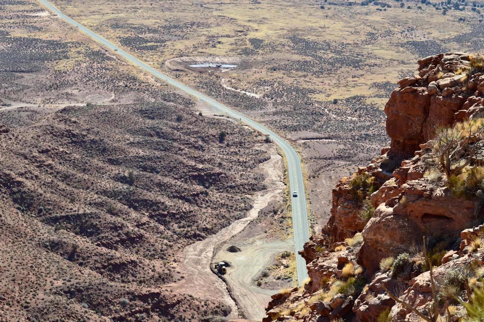
WHEN driving along the Mirror Lake Highway (U-150), it is hard not to look upward at the majestic Uinta Mountain Range. However, BELOW the highway level is a feature just off the highway that most travelers miss …
The Duchesne Tunnel is a six-mile long engineering marvel that is a key to providing water to Utah and Salt Lake counties. The tunnel takes water the south slope of the Uinta Mountains in the Duchesne River drainage and moves it over the mountains to the Provo River drainage and into Deer Creek Reservoir.
  This $9 million tunnel can be viewed at a stop along the Mirror Lake Highway in summer (U-150).
  The stop is signed on both the east and west ends of the highway. However, the west sign is so close to the paved turnout, that motorists may easily pass by and have to turn around and return.
  Watch for it 0.7 of a mile after milepost No. 17, right after the Shady Dell Campground, on the right (south) side of the road for eastbound travelers.
  Although some overgrown trees obscure a good view of it, a 100-foot-long path leads about 40 feet downward to a fenced viewpoint.
  There are also several historical plaques there.
This tunnel required 13 ½ years to build. From delays over a work strike, to World War II manpower and financial shortages, to a disastrous fire, to another strike, this one over safety issues, this project had a lot of obstacles.
One of the first references to the tunnel’s construction was in the Salt Lake Tribune of May 4, 1941. “Work on the Duchesne tunnel also is proceeding rapidly,” the story stated, explaining that 90 men working three different shifts had hollowed out 2,000 feet of tunnel during the approximate first year of work.
WW II temporarily halted work on the tunnel. Yet, a Salt Lake Telegram story of Dec. 30, 1941, stated that the project “is needed to supply additional water for defense developments in Salt Lake and Utah counties.”
Less than a year later, work on the project was at a standstill when a fire destroyed a $100,000 power plant. Machinery and generators were ruined and replacements had to come from San Francisco, according to the Telegram of Oct. 20, 1942.
Next there was a wartime hiatus on work.
The Provo Daily Herald of Jan. 7, 1946 stated that wartime restrictions had finally come to an end and tunnel work would resume soon.
The Daily Herald of June 12, 1946 stated there was a new project problem – a cement lining in the tunnel was now deemed as necessary, raising the total cost by at least $900,000.
Besides having another four miles to do, now the cement meant considerable additional work.
The Herald of May 4, 1947 stated that the Bureau of Reclamation was going to have to call for new bids to finish the remaining 3.7 miles of the tunnel.
The Herald followed on July 3, 1947 with this headline, “Duchesne Tunnel encounters year delay because of bid rejections, but water shortage is not an immediate danger.”
The lowest bid received -- $2.54 million -- was one-third higher than the engineer’s estimate.
After a suitable bid was reached and construction restarted and almost three years later in 1951, there was a major strike over job safety. The Salt Lake Telegram of March 21, 1951 stated that workers claimed “hazardous working conditions” and “unreasonable demands for speed.”
Work eventually restarted, but almost six months later in October of 1951, there were still some 3,000 feet to go in the tunnel boring. The tunnel was extensively inspected and it was estimated that it could be ready for use in 1952.
That estimate was wrong, because the Korean War in 1951 also halted construction.
The Daily Herald of Dec. 6, 1951 reported the tunnel was only 217 feet short of being “holed through.” However, the tunnel was still going to have to be lined with cement and so the completion date was being reset for early 1953.
Workers were getting anxious for completion of the project and they had all contributed $1 toward a pool to guess when the tunnel bore would be completed.
Tragedy also struck in the tunnel project on July 24, 1952, when a worker was killed on the job. Stanley M. Elder, 19, was killed when a slipped into a sand chute and was buried under four feet of earth. The Wasatch Wave newspaper of July 25 reported that workers saw a hand protruding from the sand and summoned help. He was removed within five minutes, but could not be revived.
The Ogden Standard-Examiner of Aug. 4, 1952 carried the headline, “Crews working 3 shifts a day to complete Duchesne tunnel.” Work on lining the tunnel walls with cement had begun June 23. “Workers are now about one-quarter of the way into the giant tunnel and will soon be moving at a 300-foot per day clip,” the newspaper stated.
The Salt Lake Tribune of Nov. 24, 1952 stated that cleanup work was all that remained on what was the longest tunnel ever bored in Utah. However, ample water supplies were likely to delay usage of the tunnel. The last concrete in the tunnel had been poured on Nov. 10, 1952.
The Standard-Examiner reported “6-mile Duchesne tunnel is done” on Oct. 14, 1953. Water that day was turned into the tunnel, erasing any concerns that the Salt Lake Valley would run out of water anytime soon.
This concrete-lined tunnel is 9.2-feet in diameter and goes right through a core of the Uinta Mountains, in a horseshoe-shaped rock tunnel.
 Engineers had used slide rules and non-electronic equipment to design it. One crew started on the west end and another on the east side -- to meet in the middle.
  When they met, they were only a few inches off each other -- an amazing feat of accuracy.
  Some claim the tunnel is so straight, you can look through it and see the other end!
  The Provo River Water Users Association manages the tunnel and its construction was part of the Provo River project.
  The tunnel carries the most water in the spring, the least in late summer and early fall.
A special dam, built in 1952, about 21 miles east of Kamas, supplies water for the tunnel. This tunnel slows or stops flows of the north fork of the Duchesne River at a special control gate.


The Mystery of the Granite Record Facility


THE Granite Mountain Records Facility in Little Cottonwood Canyon contains what is very likely the world's most extensive collection of family records.
Operated by The Church of Jesus Christ of Latter-day Saints, these vaults are encased in the mountain, located about 20 miles southeast of Salt Lake City.
When these vaults, about one mile up the canyon, first opened in 1963, the public was invited for tours. However, by the end of the 20th Century, they were off limits to all but vault workers. The media were also never invited there, likely after the 1970s.
“LDS buys quarry tract as records repository” was a Sept. 29, 1959 headline in the Salt Lake Tribune. The story stated that the Utah Granite Company and Temple Granite Quarries Corporation had sold the land needed for the records vault to the Church. Exact details of the transaction were never made public.
“Church cuts vaults in Granite quarry” was a Jan. 12, 1961 headline in the Salt Lake Tribune. The story reported that some 80 years after the Latter-day Saint Church first began chipping and hauling away granite blocks for its future Salt Lake Temple, the Church was back in the same canyon doing other work with the dominant stone there.
Work had started on the project in the summer of 1960.


The Centennial Development Company of Juab County had the contract to do the excavation in the canyon. The company first drilled a 700-foot exploration tunnel, to be followed by larger tunnels.
President Henry D. Moyle, Second Counselor in the Church’s First Presidency, told Malin Foster of the Tribune that the vaults are being built at the safest known place from disasters in the area for storing records. The rock vaults were also considered an ideal location for the storage of records based on temperatures and humidity.
“Drills deepen sanctuary for Church records” was a May 29, 1961 headline in the Tribune. Staff writer Don LeFevre reported that a crew of 14 men were cutting through granite to create large caverns.
“Their environment is a dark, damp and cool one as they labor on the construction of the vault which will one day house millions of dollars worth of valuable microfilm and documents,” LeFevre wrote.
To that date, the drilling was through some 1,800 linear feet of rock and completed channels measure 27 feet wide and 16 feet high. A total of six portals had been drilled into the mountain, on the north side of the canyon, above Utah Highway 210.
(The canyon road leads to Snowbird and Alta ski resorts. The Church has a historical trail just inside the mouth of the canyon and on the opposite, south side, that commemorates the granite quarry when the S.L. Temple blocks originated from.)
“Crews work in LDS ‘cave’ project” was a Jan. 27, 1962 Tribune headline. By early 1962, crews were done drilling and were pouring cement and deciding the best type of flooring, walls and ceiling for this “cave.” Trenches in the floor had also already been made for future plumbing and electrical lines.
This story also stated that the First Presidency itself chose the site for this granite vault records repository.
“Impregnable storage vaults safeguard LDS genealogical records” was an Oct. 6, 1963 headline in the Ogden Standard-Examiner. This Associated Press story stated that the vaults were originally called “The Little Cottonwood Project,” had cost more than $1.5 million, had been more than three years in the making and was slated for completion in about one year.
There were three 600-foot-long storage vaults, lined with 18 inches of cement and corrugated steel. Three large heavy bank-like vault doors covered the entrances. The three main passages were also intersected by three others, more than 400 feet long and all interconnected.


“LDS grants look-see of tunnels” was a Dec. 2, 1963 headline in the Salt Lake Tribune. Church leaders first toured the new granite vaults. Then selected civic and business leaders had their turn on day number two; and finally on the third day, the general public got to come and take a look on a guided tour. They were titled "Church Records Vault" when they opened. (Their current title is "Granite Mountain Records Facility.")
The Tribune story stated the inside of the vaults were painted in pastel colors and boasted self-contained power, water and ventilation.
The story also said that the vaults were “buried beneath 600 feet of solid granite.
There have been no public updates by the Church on these record vaults. Presumably, they have been updated and likely contain not only original microfilm records, but likely the cutting edge in records storage, including CDs and other high-tech equipment.

-Similarly, the U. S. Air Force had began work on its own Cheyenne Mountain Complex in 1957, inside a granite mountain in Colorado, near Colorado Springs. That much larger vault was not completed finished until 1967, cost more than $142 million and sits underneath an estimated 2,000 feet of granite.

-The Salt Lake Tribune of Aug. 23, 1967 reported that landowners in Little Cottonwood Canyon had dropped a plan to build a housing subdivision at the mouth of the canyon, in favor of constructing a private facility for microfilm and other storage inside the mountain itself. Located just up the canyon from the Church’s granite vaults, they were designed to be similar to those man-made caverns. Today, they are called Perpetual Storage, Inc., located at 6279 Little Cottonwood Road.

-The accompanying illustrations above are some of the images from a mid-1960s brochure, published by the LDS Church on the Vaults.